Download
Preview
Add to list
More
6.9 km
~1 hrs 23 min
0 m
Loop
“Drift through Haaksbergerveen’s big-sky bog and wet heath—flat, breezy, and sometimes squelchy underfoot.”
This easy, mostly level loop wanders through one of the Netherlands’ most distinctive landscapes: raised bog and wet heath on the Dutch–German border. Over roughly 7 km (4.3 mi) you’ll be on a mix of firm sandy tracks, narrow peatland paths, and occasional boardwalk-like sections, with essentially 0 m (0 ft) of climbing—though the ground can feel “lumpy” where old peat cuttings and tussocks remain.
Getting to the start (car + public transport)
Because “near” wasn’t fully specified, the most reliable way to pinpoint the start is to aim for the main access points to the Haaksbergerveen / Buurserveen nature area on the east side of Haaksbergen (Overijssel), close to the border with Germany. Common, well-known trail access is via signed nature parking areas on the edge of the reserve.
- By car: Navigate to Haaksbergerveen Nature Reserve (Natuurgebied Haaksbergerveen) near Haaksbergen and follow local signs for reserve parking (often marked “P” for natuurgebied). From Haaksbergen town center it’s typically a short drive to the reserve edge.
- By public transport: Take the train to Enschede or Hengelo, then a regional bus toward Haaksbergen. From Haaksbergen, you’ll usually need a short taxi ride or a longer walk to reach the reserve entrance, depending on the exact bus stop you choose.
- Navigation: Load the route in HiiKER before you go; in peatland reserves, small junctions can look similar, and some side paths may be seasonal or unsigned.
If you share the start coordinates (lon/lat), I can convert them to the nearest named place/parking area or landmark and tailor the directions precisely.
What the terrain is like and what to wear/pack - Footing: Expect flat but often damp ground. Even in dry spells, bog edges can stay wet. After rain, some sections can be soft or muddy. - Footwear: Waterproof hiking shoes or light boots are ideal; gaiters help if it’s been wet. - Wind exposure: Open bog can be breezy—bring a light shell even on mild days. - Bugs: In warmer months, mosquitoes and midges can be intense near standing water—repellent is worth it.
0.0–1.5 km (0.0–0.9 mi): Reserve edge and transition into bogland You’ll typically begin on a wide, well-compacted track at the reserve boundary, where farmland/wooded edges give way to open wetland. The first kilometer is usually the easiest for pacing and warming up—flat, straightforward, and a good place to confirm you’re on the correct loop direction in HiiKER.
Look for early signs of the bog environment: - Heath and sedges replacing drier grasses - Drainage ditches or old cut lines that hint at the area’s land-use past - Bird activity over open ground (raptors and corvids often patrol the edges)
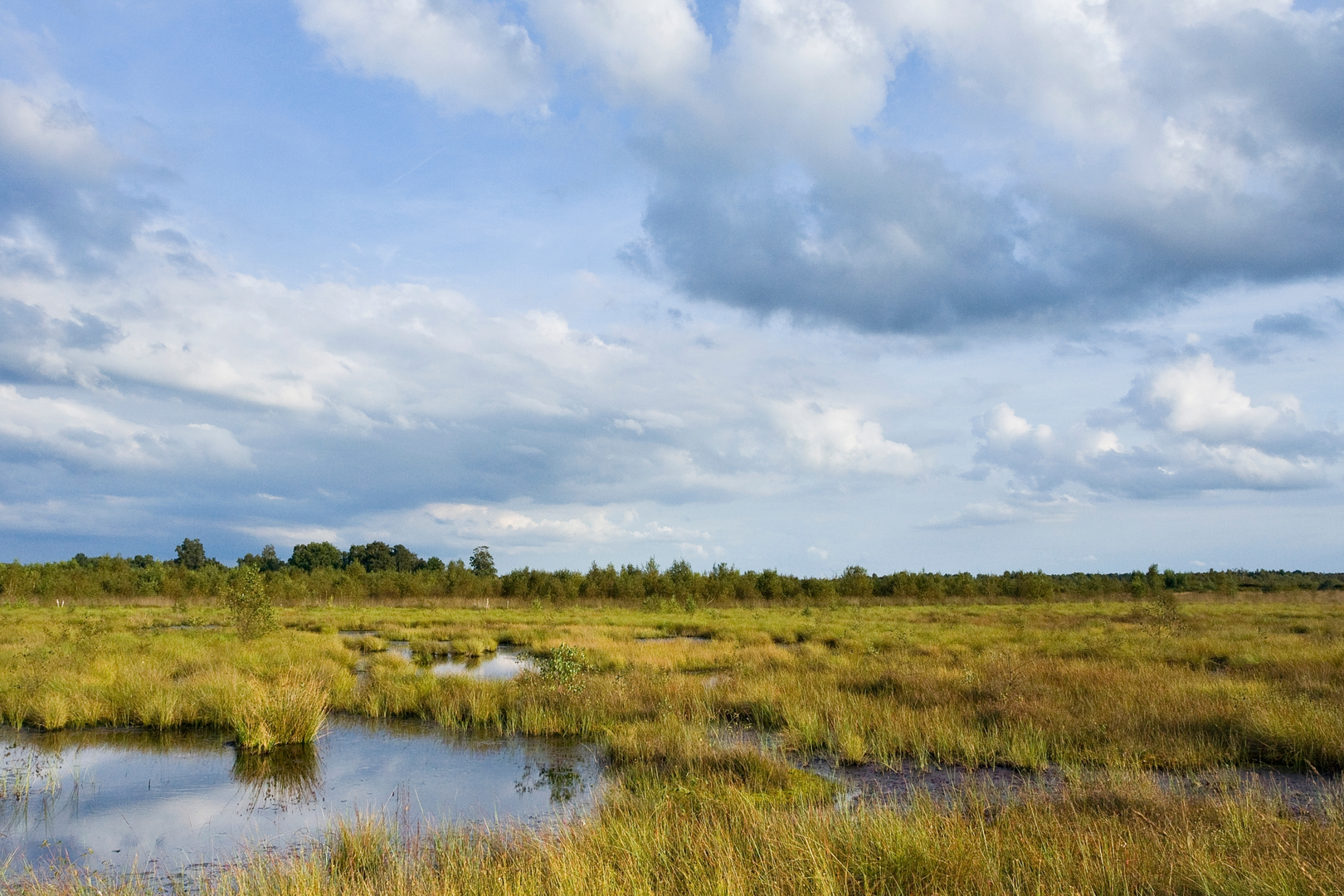
1.5–4.5 km (0.9–2.8 mi): The heart of Haaksbergerveen & Buurserveen
This middle portion is the signature stretch: open, quiet, and “big-sky” flat. Raised bogs like these are rare and protected because they formed over thousands of years as waterlogged plant material accumulated into peat. Historically, peat was cut and used as fuel across the region; many Dutch bog reserves preserve visible traces of that era—straight lines, old extraction zones, and re-wetted sections where restoration has been underway for decades.
Nature and wildlife to watch for (without disturbing it): - Bog vegetation: heather, cotton grass (seasonal), sphagnum moss carpets, and insect-eating plants in wetter pockets (often present in bog systems, though exact species vary by micro-area). - Birdlife: expect wetland and heathland birds; you may see marsh harriers or other raptors hunting low over the vegetation, and hear songbirds in scrubby edges. - Mammals: roe deer can appear at the margins, especially early/late in the day. - Amphibians/insects: wetter ditches and pools support frogs and dragonflies in season.
This is also where conditions can change fastest: - Soft shoulders: The “safe” line is often the center of the path; step off-track only where it’s clearly firm. - Seasonal closures/redirects: Sensitive bog restoration areas may be roped off—follow posted signs and keep to the designated route.
4.5–7.0 km (2.8–4.3 mi): Return leg along drier edges and back to the start As the loop bends back, you’ll usually transition onto slightly firmer tracks with more shrubs/trees and less open bog. The walking stays easy and level, but this is where people most often miss a turn because multiple straight tracks can look alike. Keep an eye on: - Junction posts and small waymarkers - Any subtle change from narrow path to broader track (or vice versa) - Your HiiKER position at intersections, especially if you’re trying to keep the loop exactly ~7 km (4.3 mi)
Landmarks and regional context This borderland area around Haaksbergen sits in the broader Twente region, where historic land use mixed small-scale agriculture, heath grazing, and peat cutting. The Haaksbergerveen/Buurserveen complex is valued today not for dramatic elevation or vistas, but for its rare peatland ecology and the long story of how people shaped

Surfaces
Unknown
Asphalt
Grass
Sand
Comments and Reviews
User comments, reviews and discussions about the Haaksbergerveen and Buurserveen Loop, Netherlands.
average rating out of 5
0 rating(s)