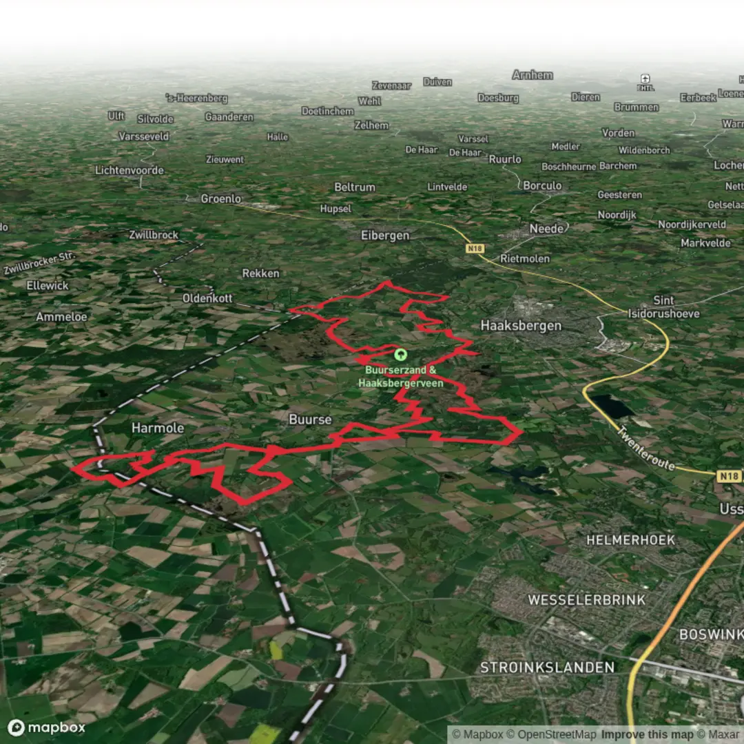
Buurserzand, Witte Veen and Haaksbergerveen via Aamweg and Turfweg
Download
Preview
Add to list
More
53.1 km
~2 days
84 m
Multi-Day
“An all-day wander through Dutch borderlands—purple heaths, drifting sands, and whispering fens under changeable skies.”
This is a long, low-relief day through some of the Netherlands’ most distinctive “borderland” landscapes: dry heath and drifting sands, wet heaths and boggy fens, and a patchwork of pine plantations, small farms, and peat-cutting remnants. At around 53 km (33 mi) with roughly 100 m (330 ft) of total ascent, it’s physically “easy” in terms of climbing, but it’s still a big endurance walk—expect a full day on your feet, and plan for variable underfoot conditions (sand, forest track, and potentially soggy boardwalk/peaty ground).
For planning, load the route in HiiKER and download offline maps; the terrain is flat and can feel repetitive, and in open heath/fen areas it’s easy to drift onto parallel tracks.
Getting to the start (car + public transport)
Because the start point is listed only as “near,” the most practical access hub for this loop is the Buurse / Haaksbergen area in Overijssel, right by the Buurserzand nature reserve. A common, easy-to-navigate landmark to aim for is:
- Buurse, Netherlands (near the Buurserzand reserve entrances and trail parking areas)
If you’re driving, look for signed parking for Buurserzand around the village of Buurse (just southeast of Haaksbergen). These lots are typically on the edge of the heath/forest where the network of sandy tracks begins.
Public transport tends to funnel through Haaksbergen:
- Train + bus: Travel by rail to Enschede or Hengelo, then connect by bus toward Haaksbergen, and from there local buses/taxis or a short bike ride can get you to Buurse/Buurserzand trailheads.
- Car: From the Enschede/Hengelo region, it’s a straightforward drive to Haaksbergen and then south to Buurse. Plan to arrive early—53 km (33 mi) is a long day even on flat ground.
If you share the exact coordinates you have for the start, I can convert them to the nearest specific street address or named trailhead/parking area.
What to pack for this route: - Footwear: trail shoes are fine in dry spells; after rain, consider something with better water resistance because fen edges can stay wet. - Wind layer + sun protection: open heaths and fens are exposed. - Food/water: treat it like an all-day hike; resupply options exist near villages, but the nature reserves themselves are quiet. - Gaiters (optional): helpful in sandy stretches and in heather.
What the terrain feels like (and why it matters)
You’ll move through three main nature areas—Buurserzand, Witte Veen, and Haaksbergerveen—linked by rural lanes and old access tracks such as Aamweg and Turfweg. The names are a clue to the landscape history: - “Veen” indicates peatland/fen—wet, acidic ground where peat accumulated over centuries. - “Turf” refers to peat cut for fuel; many paths and straight ditches in these regions trace that extraction history.
Even with only ~100 m (330 ft) of ascent total, the hike has constant micro-variation: soft sand vs. firm forest road vs. springy peat edges. That’s what will determine your pace more than elevation.
Buurserzand: heath, sand, and pine forest mosaics (first long block)
Early on, expect a classic Buurserzand feel: heathland openings stitched together by sandy tracks and conifer stands. The “zand” component often means patches of dry, nutrient-poor ground where heather thrives and where wind can move sand around in small drifts.
Landmarks and nature to watch for: - Heather and heath grasses: late summer can be purple with bloom; outside bloom season it’s still a textured, open landscape. - Scots pine and mixed woodland edges: these provide shelter from wind and can make navigation trickier because many tracks look similar. - Wildlife: roe deer are common in these mosaics; you may also see fox, hare, and a lot of birdlife along the open/wood boundary. In open heath, keep an eye out for raptors cruising low.
Underfoot and pacing: - Sandy stretches can slow you down more than you’d expect on a “flat” hike. If you’re targeting an all-day completion, budget time for slower kilometers here.
Linking lanes: Aamweg and Turfweg (middle connector sections)
As you transition onto rural connectors like Aamweg and Turfweg, the feel changes: straighter lines, drainage ditches, and a more agricultural edge. These connectors are useful for making distance efficiently, but they can be exposed to wind.
What to look out for: - Ditch crossings and soft verges: after rain, the edges of lanes/tracks can be muddy; stay on the firmest line to avoid ankle-twisting ruts. - Cyclists and local traffic: even quiet roads can have fast-moving bikes; walk predictably and keep groups tight on narrow sections. - Navigation: this is where HiiKER is most helpful—multiple farm tracks and parallel lanes can create “almost right” turns.
Historical context: - The peatland districts around here were shaped by centuries of drainage and peat cutting. Straight ditches, rectilinear parcels, and long access tracks are often the footprint of that

Surfaces
Unknown
Ground
Asphalt
Dirt
Unpaved
Sand
Wood
Gravel
Grass
Comments and Reviews
User comments, reviews and discussions about the Buurserzand, Witte Veen and Haaksbergerveen via Aamweg and Turfweg, Netherlands.
average rating out of 5
0 rating(s)