Download
3D Flyover
Add to list
More
10.9 km
~2 hrs 11 min
0 m
Loop
“Drift through Buurserzand’s heather and pale sands, past old earthworks and a quiet bridge—unhurried.”
This easy loop is a flat, sandy wander through one of the Netherlands’ most distinctive inland landscapes: heath, wind-shaped pines, and broad “zand” (drift-sand) clearings that feel surprisingly open for such a low-elevation route. At around 11 km / 6.8 miles with roughly 0 m / 0 ft of climbing, it’s ideal for a relaxed half-day outing—more about texture, light, and wildlife than about elevation.
You’ll be moving through the Buurserzand area (a well-known nature reserve near the village of Buurse, close to Haaksbergen in the eastern Netherlands, near the German border). The names in the route—Harrvelderschans and Koekoeksbrug—hint at two classic Dutch features you’ll encounter: a historic defensive earthwork (“schans”) and a small bridge (“brug”) crossing one of the local streams or drainage channels that stitch these sandy/heath landscapes together.
Getting to the start (car + public transport)
By car: Aim for the main Buurserzand access points near Buurse (Overijssel)—the most practical “nearest known landmark” to use for navigation is Buurse village center and the common trailhead parking areas on the edge of the reserve. If you’re using HiiKER, open the route and use its start-point navigation to the closest signed Buurserzand parking area; these are typically small forest car parks right where the heath and sand begin, with information boards and waymarked posts.
By public transport: The nearest larger town for transit connections is Haaksbergen. From there, local buses and/or a short taxi ride can get you toward Buurse. Expect the final leg to be the limiting factor—this is a rural reserve, so service frequency can be modest and the last kilometre or two may require walking from the nearest stop. Plan your return time around the bus timetable and keep a buffer.
What the walk feels like, kilometre by kilometre
0–2 km / 0–1.2 mi: You’ll ease in on wide, forgiving paths—often compacted sand or sandy forest track. The landscape quickly alternates between open heath and scattered woodland. Because the route is essentially flat, the “effort” here is more about surface than slope: dry sand can feel slower underfoot than you’d expect for an easy-rated hike.
2–5 km / 1.2–3.1 mi: This is where Buurserzand’s character shows up: heather fields, pale sandy patches, and low vegetation shaped by wind and land management. In late summer, heather can color the scene; in cooler months, the openness makes the area feel bigger and breezier. Keep an eye out for subtle path junctions—many tracks look similar, and in open heath it’s easy to drift onto a parallel trail. HiiKER is the best way to confirm you’re staying on the intended loop when multiple sandy lanes braid together.
5–8 km / 3.1–5.0 mi: Approaching the Harrvelderschans portion, you may notice slight rises and dips—still essentially 0 m / 0 ft of meaningful elevation gain overall, but with gentle undulations typical of sandy soils and old earthworks. A “schans” is historically a defensive field fortification, usually an earthen structure built to control routes and borders. This region, close to historic boundary lines and trade routes, has long been strategically relevant; remnants like a schans are a reminder that today’s quiet forest and heath once sat in a landscape where movement and access mattered.
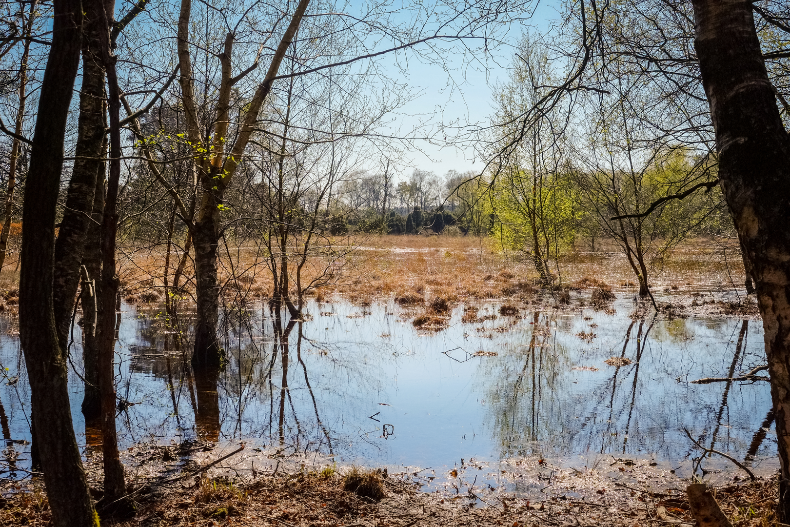
8–11 km / 5.0–6.8 mi: The loop swings you toward Koekoeksbrug (“Cuckoo Bridge”), a small but memorable landmark because it signals water in an otherwise sandy setting. Expect a modest bridge over a stream, ditch, or wet channel—these crossings can be slick with algae or wet leaves in damp weather. After the bridge, the route typically returns through mixed woodland and heath-edge paths back toward the starting access area.
Terrain, footing, and what to watch for
- Surface: Predominantly sand, sandy forest track, and heath paths. After dry spells, sand can be loose; after rain, it can firm up but puddles may form in low spots.
- Flat doesn’t mean effortless: With no real climbing, the main fatigue factor is soft ground. If you’re used to gravel or pavement, budget a little extra time.
- Wayfinding: The reserve has many intersecting tracks. Use HiiKER to confirm junction choices, especially where open heath creates multiple faint lines.
- Seasonal conditions:
- Wind exposure is higher in open heath and drift-sand clearings—bring a layer even on mild days.
- In wetter periods, expect muddy edges near channels and around bridge approaches.
- Wind exposure is higher in open heath and drift-sand clearings—bring a layer even on mild days.
Nature, wildlife, and landscape highlights
Buurserzand is known for its heathland ecology and sandy soils. You’ll likely see: - Heather and acid-soil plants along open stretches, with pine and birch at the margins. - Birdlife typical of heath and woodland edges—listen for calls from the scrub and treeline, especially early in the day. - Deer are possible in quieter hours, often near woodland transitions. - Insects: In warm months, bring protection for mosquitoes and biting flies, especially near wetter pockets and around the bridge area.

Surfaces
Unknown
Sand
Dirt
Asphalt
Grass
Unpaved
Ground
Comments and Reviews
User comments, reviews and discussions about the Buurserzand, Harrvelderschans and Koekoeksbrug Loop, Netherlands.
average rating out of 5
0 rating(s)