Download
3D Flyover
Add to list
More
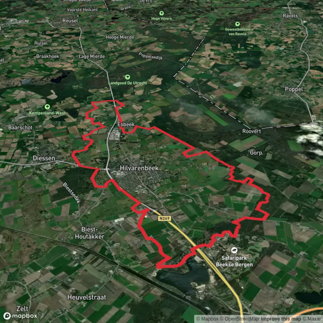
31.3 km
~6 hrs 16 min
15 m
Loop
“Wander shimmering white dunes, tranquil ponds, and storied woodlands on this enchanting North Brabant loop.”
Starting from the outskirts of De Witte Duinen, this 31 km (about 19.3 miles) loop trail offers a flat, easy-going journey through the unique landscapes of North Brabant, Netherlands. With virtually no elevation gain, it’s accessible for most walkers and ideal for those looking to cover a longer distance without strenuous climbs. The trailhead is conveniently located near the village of De Moer, close to the entrance of the Loonse en Drunense Duinen National Park, making it easy to find by car or public transport. If arriving by train, Tilburg is the nearest major station; from there, local buses connect to De Moer, and parking is available near the park entrance for those driving.
Trail Overview and Navigation
The route follows a mix of sandy paths, forest tracks, and rural lanes, weaving through the white dunes (“Witte Duinen”) and past the Leemsputten ponds. Navigation is straightforward, but the sandy terrain can be disorienting in places, so using HiiKER for offline maps and waypoints is highly recommended. The trail is well-marked at major junctions, but some sections through the dunes and heathland are less distinct, especially after windy weather.
Natural Highlights and Wildlife
The first section leads you into the heart of the Loonse en Drunense Duinen, one of Western Europe’s largest drifting sand areas. Expect sweeping vistas of white sand, interspersed with patches of heath and pine forest. The shifting sands create a semi-desert landscape, rare for the region, and support unique flora such as juniper, heather, and rare mosses. Birdwatchers should keep an eye out for woodlarks, nightjars, and the occasional kestrel hovering above the open dunes.
After about 10 km (6.2 miles), the trail transitions into denser woodland, where you’ll encounter the Leemsputten—old clay pits now filled with water and surrounded by lush vegetation. These ponds attract frogs, dragonflies, and a variety of waterfowl. The area is especially tranquil in the early morning, with mist rising from the water and deer sometimes visible at the forest edge.
Cultural and Historical Points
The region’s history is closely tied to sand mining and clay extraction, which shaped the landscape and created the Leemsputten ponds. Along Koekovense Weg and Beekse Weg, you’ll pass remnants of old farmsteads and traditional Dutch windbreaks—rows of poplars planted to shield fields from the wind. The nearby village of De Moer has roots dating back to the Middle Ages, and its small church and historic farmhouses are worth a short detour.
Facilities and Practical Tips
There are several picnic spots along the route, particularly near the Leemsputten and at forest clearings. Water and food are not available on the trail itself, so bring enough supplies for the full distance. Toilets can be found at the main entrances to the national park and in De Moer. The sandy sections can be tough on ankles, so supportive footwear is recommended, and sun protection is essential due to the open, exposed dunes.
For those planning to use public transport, check local bus schedules in advance, as services to De Moer are infrequent, especially on weekends. The trail is open year-round, but spring and autumn offer the most comfortable temperatures and vibrant colors in the heath and woodland.

Surfaces
Unknown
Sand
Asphalt
Concrete
Grass
Dirt
Ground
Comments and Reviews
User comments, reviews and discussions about the De Witte Duinen, Leemsputten via Koekovense Weg and Beekse Weg, Netherlands.
average rating out of 5
0 rating(s)