Download
3D Flyover
Add to list
More
14.1 km
~2 hrs 49 min
0 m
Point-to-Point
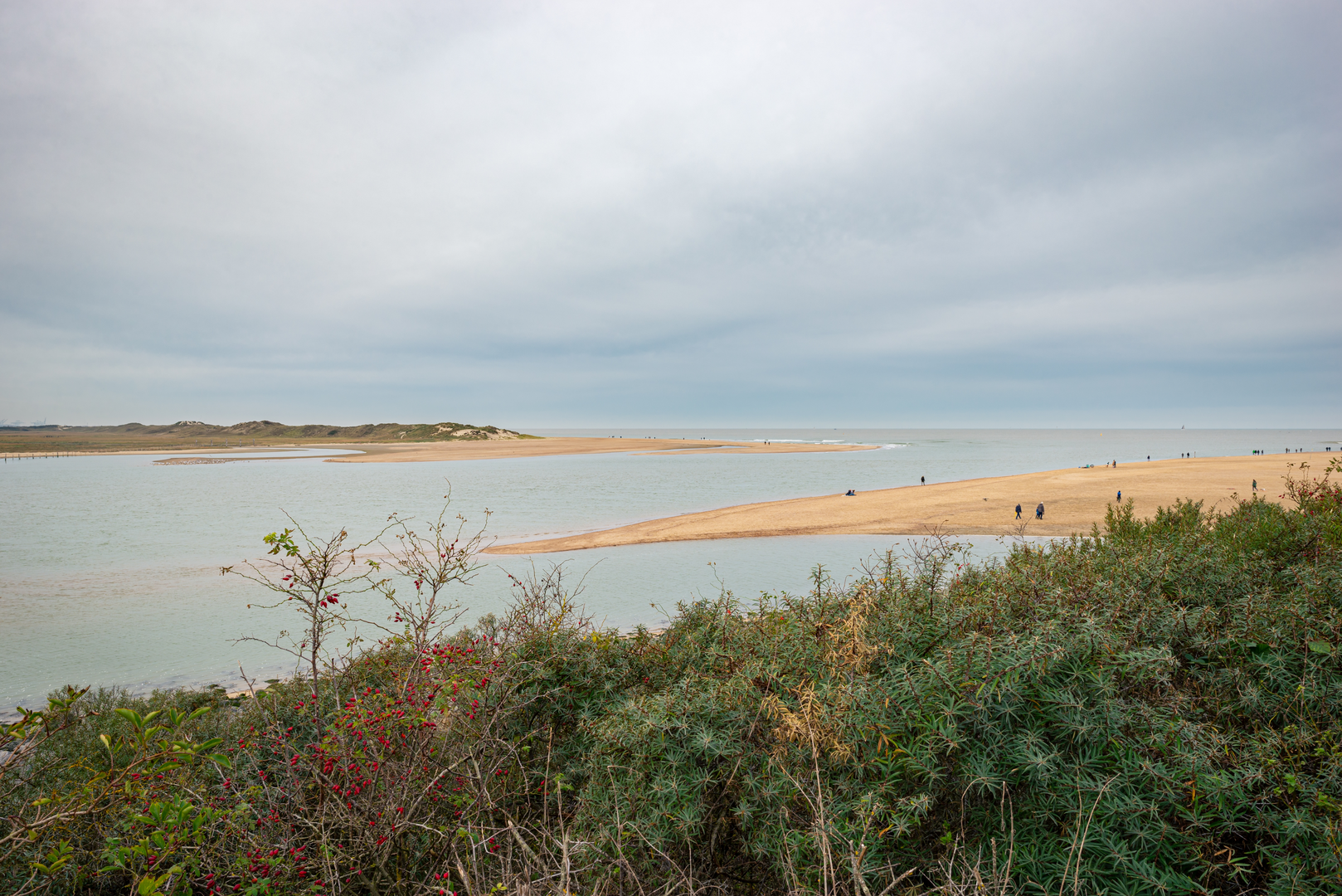
“Big skies and canal ribbons guide a breezy borderland stroll past quiet forts and polder wildlife.”
This is a low-lying, canal-and-polder walk on the Dutch–Belgian borderlands: expect dead-flat terrain (about 14 km / 8.7 mi, roughly 0 m / 0 ft of climbing), big skies, long sightlines, and a steady rhythm of dikes, towpaths, and quiet lanes linking small fortifications and historic waterways. Underfoot is typically firm—paved cycle path, compacted gravel, and short stretches of field-edge track—so it’s well-suited to beginners, families, and anyone wanting an easy-distance day with lots of cultural detail.
Getting to the start (De Brabander area)
Because “De Brabander” can refer to a local hospitality/business name in the Zeeuws-Vlaanderen region, the most reliable way to pinpoint the exact start is to search the hike name in HiiKER and use the route’s start pin. Once you have that pin, these are the usual access patterns for this area:
- By car: Aim for parking in or near Sluis (Zeeland, Netherlands) or one of the nearby hamlets along the border (common options are public car parks on the edge of Sluis’ old town). From there, it’s easy to link onto the dike paths and quiet roads that the route uses. Parking is generally straightforward outside peak summer weekends.
- By public transport: The closest major rail hubs are typically Bruges (Brugge), Belgium and Knokke-Heist, Belgium, with onward buses toward the border towns (often via Dam(m)e or Maldegem depending on the line). On the Dutch side, buses serve Zeeuws-Vlaanderen towns with connections toward Sluis. Use HiiKER’s start point to choose the nearest bus stop; in this region, stops can be spaced out, so plan for a short walk-in.
If you share the route’s start coordinates (or a HiiKER link), I can translate them to the nearest specific street/landmark and tighten the transport directions.
You’ll want light layers and wind protection even on mild days—open polders can feel cooler than the forecast. After rain, the unpaved edges can be slick, but there’s rarely anything technical.
What the route feels like underfoot
The first kilometres tend to settle you into the landscape: straight, level lines along canals and drainage ditches, with occasional gates or bridges. You’ll likely pass: - Dike-top paths with short grass verges and wide views. - Canal-side towpaths (often smooth and fast walking). - Quiet farm lanes where you may share space with cyclists and local traffic.
Because elevation is essentially negligible, the “effort” comes from distance and exposure rather than hills. A comfortable pace for most hikers is 3.5–5 km/h (2.2–3.1 mph), putting the walk at roughly 3–4.5 hours of moving time, plus stops.
Fort Nassau: borderland military history
Around the mid-walk (often somewhere near the 5–8 km / 3–5 mi mark depending on the exact start), the route swings by Fort Nassau, one of the small defensive works tied to the long history of fortification in Zeeland/Flanders. This region was strategically vital for controlling approaches to ports and waterways, and many forts here were designed to work with inundation—deliberately flooding low fields to slow armies—rather than relying on high ground.
What to look for: - Earthwork shapes: low ramparts, angular outlines, and moats that can be easy to miss because they blend into the flat landscape. - Water control features: sluices, culverts, and straightened channels—these are as much “military architecture” as the fort itself.
Even if the fort is partially overgrown or repurposed, the geometry of the land often tells the story: straight lines where you’d expect curves, and raised banks that don’t match natural drainage.
Rozenoord and the canal-country ecology
As you continue toward Rozenoord (often another 2–4 km / 1.2–2.5 mi after Fort Nassau), the walk leans into classic polder nature: reedbeds, wet ditches, and field margins that act like wildlife corridors.
Common wildlife in this landscape (season-dependent): - Waterbirds: mallard, coot, moorhen, grey heron; in migration periods you may see larger flocks of geese and waders using flooded fields. - Raptors over open farmland: kestrel and buzzard are frequent sights, hovering or circling. - Amphibians in spring around ditches and ponds; listen for frogs on warmer, damp days.
Practical notes: - Wind is the main “difficulty multiplier.” A headwind on exposed dikes can make the last third feel longer than the distance suggests. - Sun exposure can be significant with little shade—bring sunscreen and water even on cooler days. - Farm operations: stay on the marked path, close gates, and give space to machinery.
Approaching Sluis: walls, waterways, and a fortified townscape
The final stretch trends toward Sluis, a town known for its historic role as a fortified settlement and trading point near the border. As you near town (typically the last 3–5 km / 2–3 mi), you’ll notice the landscape shifting from open fields to more structured waterways, tree lines, and built edges.
In Sluis, keep an eye out for: - Remnants of fortifications: traces of defensive lines and waterworks

Surfaces
Unknown
Asphalt
Gravel
Dirt
Concrete
Cobblestone
Wood
Comments and Reviews
User comments, reviews and discussions about the De Brabander to Sluis via Fort Nassau and Rozenoord, Netherlands.
average rating out of 5
0 rating(s)