Download
3D Flyover
Add to list
More
14.6 km
~2 hrs 55 min
0 m
Loop
“Wander through wildflower meadows, riverside history, and bird-filled skies in Overijssel’s enchanting heart.”
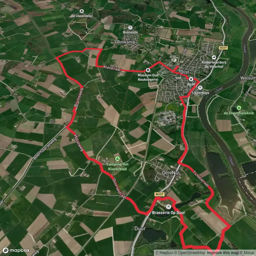
Starting from the charming riverside hamlet of Fortmond, this 15 km (about 9.3 miles) loop offers a gentle, flat walk through the heart of Overijssel’s river landscape, with virtually no elevation gain. The trail weaves together sections of the Hanzestedenpad and the Sallandse Zandloper, immersing you in the natural and historical richness of the IJssel river valley.
Getting There
Fortmond is easily accessible by car, with parking available near the Fortmond ferry landing, close to the address Fortmonderweg 1, 8121 SB Olst, Netherlands. For those using public transport, take the train to Olst station, then connect by local bus (line 161) toward Wijhe, alighting at the stop “Fortmond, Veer.” From there, it’s a short walk to the trailhead.
Riverside Landscapes and Historical Echoes
The route begins along the IJssel, one of the Netherlands’ most scenic rivers. Early on, you’ll pass the old brickworks of Fortmond, a striking industrial relic with its tall chimney and kiln structures—reminders of the area’s 19th-century brickmaking industry. Interpretive signs explain the site’s history and its transformation into a nature reserve.
Nature and Wildlife
The trail meanders through the Fortmond nature reserve, a mosaic of willow groves, reed beds, and open water. This area is a haven for birdlife: expect to see herons, kingfishers, and, in spring and autumn, migratory geese and waders. The floodplains are grazed by Konik horses and Galloway cattle, which help maintain the open landscape. Keep an eye out for beaver lodges along the water’s edge.
Sallandse Zandloper and Hanseatic Heritage
After about 5 km (3.1 miles), the route joins the Sallandse Zandloper, a path that traces the ancient sand ridge between the IJssel and the Salland region. This section offers wide views over meadows and fields, with the spires of nearby Hanseatic towns like Wijhe and Olst visible on the horizon. The Hanzestedenpad, or Hanseatic Cities Path, connects historic trading towns that flourished in the Middle Ages as part of the Hanseatic League. Along the way, you’ll encounter dikes, old towpaths, and remnants of river engineering that shaped the landscape for centuries.
Trail Navigation and Facilities
Waymarking is clear, but for precise navigation and to explore alternative routes or nearby points of interest, use HiiKER’s detailed trail maps. There are benches and picnic spots at intervals, especially near the river and in the Fortmond reserve. Public toilets and a small café can be found in Olst, about 3 km (1.9 miles) from the loop’s eastern edge.
Seasonal Highlights and Practical Tips
The trail is accessible year-round, but spring and early summer bring wildflowers and the most active birdlife. In winter, parts of the floodplain may be wet or muddy—waterproof footwear is recommended. The entire route is exposed, so bring sun protection in summer and windproof layers in cooler months. Dogs are allowed but must be leashed in nature reserve sections due to grazing livestock and wildlife.
This easy, scenic loop is ideal for walkers seeking a blend of riverine nature, Dutch rural charm, and echoes of the region’s Hanseatic past.

Surfaces
Asphalt
Unknown
Grass
Concrete
Sand
Wood
Comments and Reviews
User comments, reviews and discussions about the Hanzestedenpad and Sallandse Zandloper Route Fortmond Loop, Netherlands.
average rating out of 5
0 rating(s)