Download
3D Flyover
Add to list
More
39.7 km
~2 days
0 m
Multi-Day
“Wander a sprawling Kempen loop of pinewoods, purple-tinged heath, and whispering wetlands—sometimes soggy.”
This is a long, low-lying Kempen (Campine) loop of roughly 40 km / 25 miles with essentially 0 m / 0 ft of climbing, linking holiday-park woodland and lakes around Het Vennenbos, open heath on Cartierheide, and a chain of small streams, wet meadows, and ponds around De Goorloop and Kromvenne. Expect a mix of wide sandy forest tracks, compacted gravel cycle paths, heathland singletrack, and occasional boardwalky/wet sections where the ground holds water.
Where the hike starts (nearest landmark / address)
“Het Vennenbos” is best anchored to the well-known holiday park in Hapert (North Brabant, NL): Center Parcs De Kempervennen / Het Vennenbos area is commonly approached via Hapert / Bladel. A practical, easy-to-find start landmark for planning is the Het Vennenbos holiday park entrance area in Hapert (near Bladel), North Brabant—use that as your meeting point and then follow the loop outward toward Cartierheide and the stream/ven complexes.
If you share the exact longitude/latitude for “Hike head: near …”, I can pin it to the nearest street address or named trailhead precisely.
Getting to the start
By car - Aim for Hapert / Bladel (North Brabant) and follow signs for Het Vennenbos / holiday park parking. Parking is typically straightforward around holiday parks and recreation areas, but on weekends and school holidays it can fill early—arrive with buffer time.
By public transport
- The Kempen region is bus-connected rather than rail-at-the-door. The usual pattern is:
1) Train to a larger hub such as Eindhoven (common regional gateway), then
2) Bus toward Bladel / Hapert, and
3) A short walk from the nearest stop to the holiday-park entrance/trail access.
Because bus routes and stop names can vary by season and operator, check the day-of schedule before you commit.
What the terrain feels like over 40 km / 25 miles
Even with negligible elevation gain, this is still a full-day outing because the surface changes and the landscape is “busy” with junctions: - 0–10 km (0–6 mi): easy warm-up on broad tracks through mixed woodland and around recreational waters near Het Vennenbos. You’ll likely pass small lakes/vennen and drainage channels early on. - 10–22 km (6–14 mi): the character opens up as you approach Cartierheide—more sky, more wind exposure, and longer sightlines across heath and sandy clearings. - 22–33 km (14–20.5 mi): wetter ground becomes more common around De Goorloop and associated lowland meadows/ditches; expect occasional muddy pinch points after rain. - 33–40 km (20.5–25 mi): a return through forest and ven edges around Kromvenne, often calmer and more sheltered, with long straight tracks that can feel deceptively “samey” late in the day.
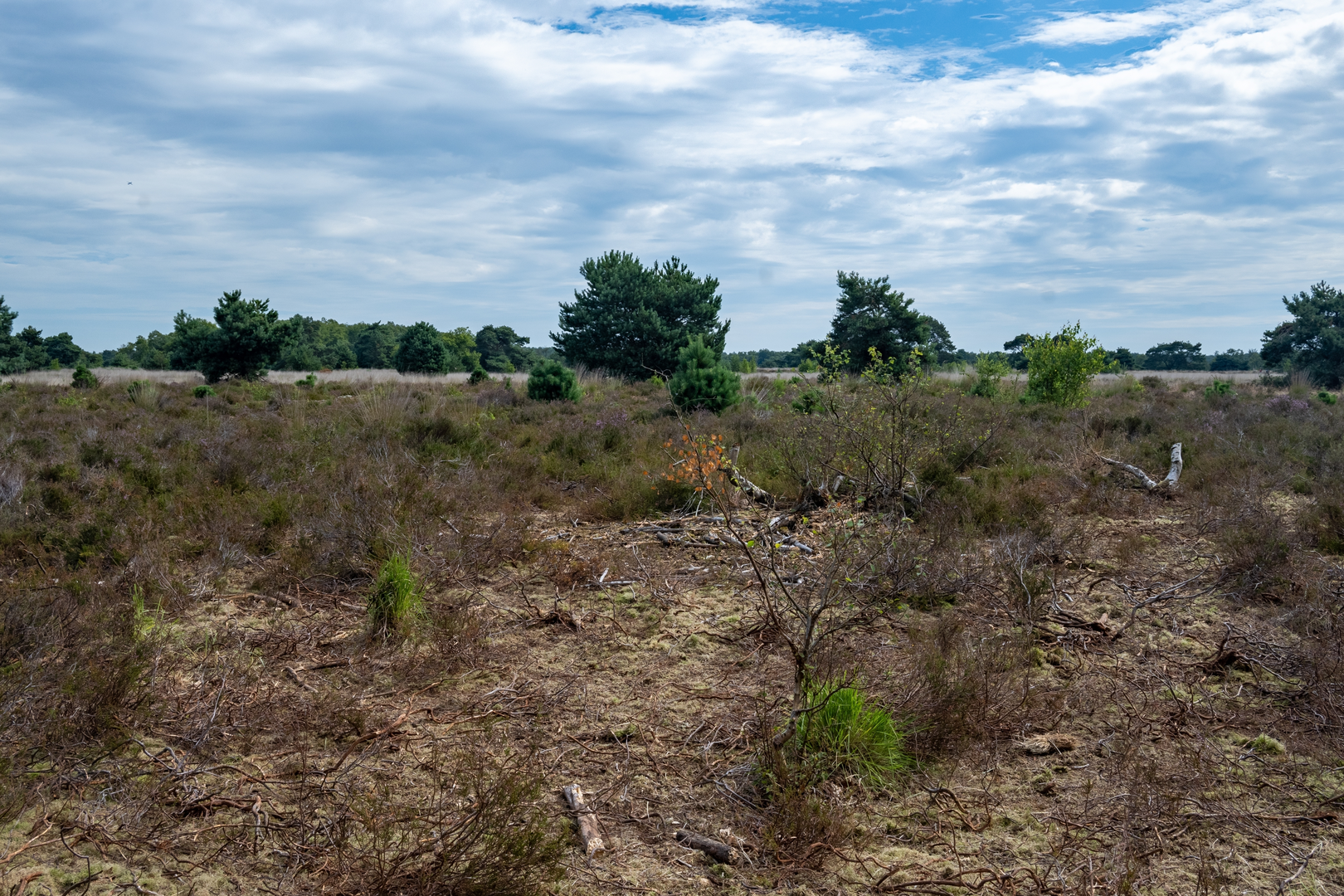
Cartierheide: heathland, sand, and big horizons
Cartierheide is one of the highlights because it breaks up the forest walking with classic Brabant heath: - Underfoot: sandy paths can be energy-sapping in dry spells; after wet weather, the sand firms up but puddles collect in low spots. - Vegetation: heather, grasses, scattered pines/birch, and patches of open sand. Late summer can bring purple heather blooms; in winter it’s more muted but still expansive. - What to look for: heathland birds (often heard before seen), butterflies in warm months, and the sharp transition zones where heath meets pine plantation—these edges are wildlife corridors.
De Goorloop & Kromvenne: water, wetlands, and “ven” country
This part of the loop leans into the Kempen’s defining feature: shallow, nutrient-poor ponds (vennen) and managed lowland watercourses. - De Goorloop is a small stream/ditch-like watercourse typical of the region’s drainage and land management. Trails near it can be soft, rutted, or slick where bikes and walkers share narrow margins. - Kromvenne (literally “crooked fen/pond” in name) signals more of the same ven landscape—still water, reed edges, and damp woodland pockets. - Wildlife: expect waterfowl, frogs/toads in warmer seasons, dragonflies in summer, and plenty of songbirds in the scrubby margins. Deer are possible in quieter forest stretches, especially early/late in the day.
Navigation and wayfinding (keep it simple, avoid wrong turns)
This is flat country with lots of intersecting tracks—easy walking, but it’s also easy to drift onto the wrong parallel path. - Use HiiKER to keep an eye on junction density, confirm you’re on the correct track after every major crossing, and to spot “shortcuts” that are actually private drives or dead-end service roads. - Pay extra attention where forest grids meet heath edges—paths can braid and rejoin, and signage may prioritize cyclists.
Landmarks and regional context (a bit of history without slowing you down)
You’re walking through the Brabantse Kempen, a landscape shaped by: - Heathland grazing and sod-cutting historically, which helped maintain open heaths like Cartierheide.

Surfaces
Unknown
Dirt
Ground
Sand
Asphalt
Concrete
Unpaved
Paved
Grass
Comments and Reviews
User comments, reviews and discussions about the Het Vennenbos, Cartierheide, De Goorloop and Kromvenne Loop, Netherlands.
average rating out of 5
0 rating(s)