Download
Preview
Add to list
More
39.2 km
~2 days
346 m
Multi-Day
“A long, unhurried wander from Arnhem’s beech-oak hush to Doorwerth’s storied estates—pace wisely.”
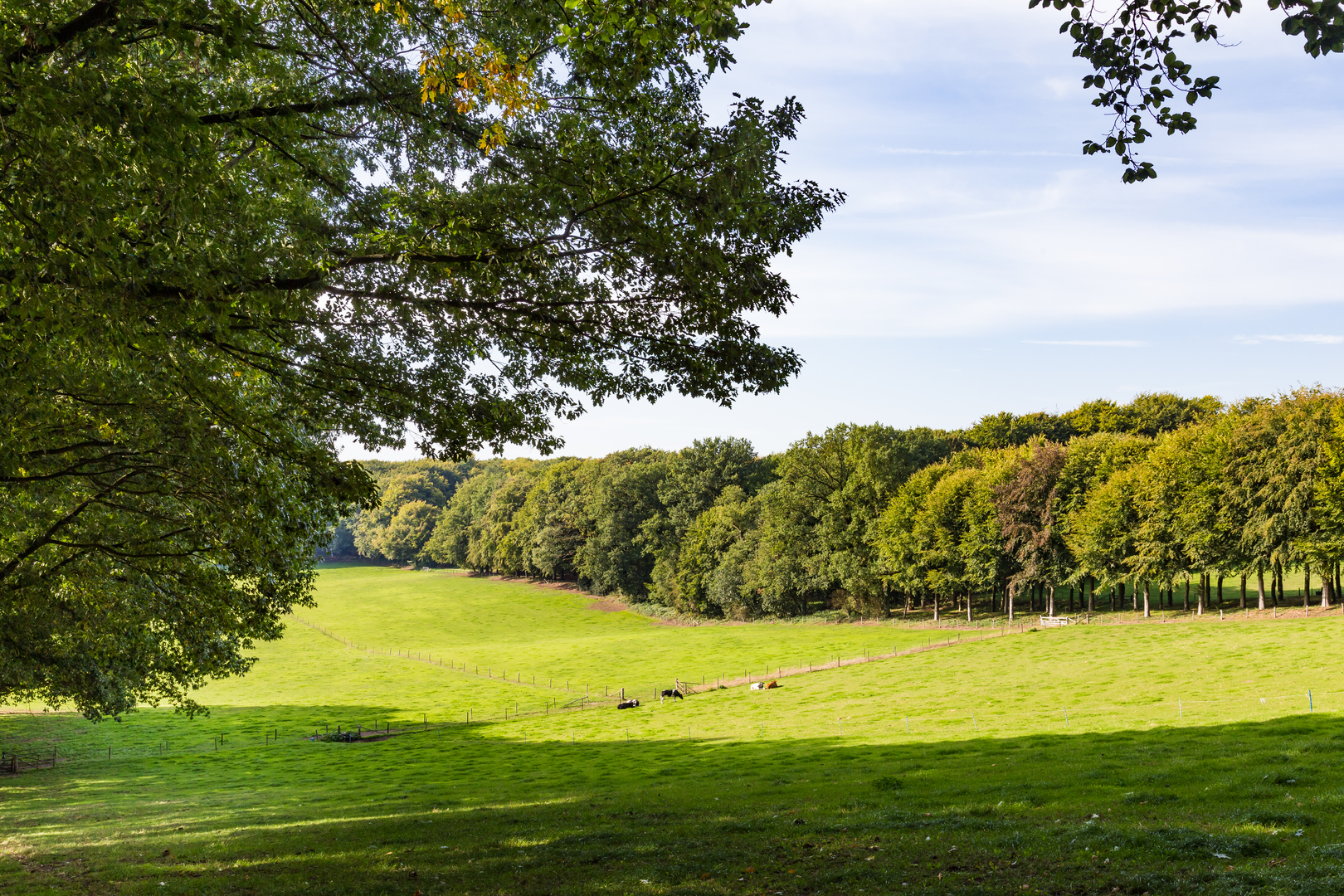
This is a long, low-stress day out through some of the Netherlands’ most classic “Veluwezoom-edge” landscapes: mixed beech and oak woodland, pockets of heath and sandy soils, and the river-influenced forests and estates around Doorwerth. At ~39 km (about 24.2 miles) with ~300 m (about 985 ft) of total ascent, it’s more about steady time on your feet than steep climbing. Even with an “Easy” technical rating, plan it like an all-day hike.
Getting to the start (car + public transport)
Because the start point is listed only as “near,” the most practical approach is to aim for the Mariëndaal / Maasbergse Bos access on the west side of Arnhem—these areas are commonly entered from the Mariëndaal estate trailheads near Arnhem (look for signed estate entrances and parking areas around the Mariëndaal/ Schaarsbergen edge). If you share a lon/lat for the exact trailhead, I can pin it to the nearest address or landmark precisely.
By public transport - Train to Arnhem Centraal (major hub). - From Arnhem Centraal, use local buses toward Schaarsbergen / Doorwerth / Oosterbeek depending on which side you’re starting from, then walk a short connector to the forest edge. In practice, many hikers start from the Arnhem-side woodland entrances because they’re easiest to reach without a car. - Build in extra time: bus frequency can thin out outside peak commuting hours, and the last return bus can be earlier than you expect.
By car - Drive to the Arnhem woodland edge (Mariëndaal / Schaarsbergen side) or to Doorwerth if you prefer to start nearer the castle/estate section. - Use official forest/estate parking areas (signed “P”); avoid blocking farm gates and narrow residential lanes—enforcement is common near popular estate entrances.
What the route feels like underfoot
Expect a mix of: - Wide forest tracks (fast, forgiving, good for steady pacing), - Narrower singletrack weaving through beech stands and mixed woodland, - Occasional sandy patches (especially in drier stretches—shoes can fill with grit), - Short paved or hard-packed connectors near villages/estate edges.
The elevation gain (~300 m / ~985 ft) is typically delivered in small, rolling rises rather than one big climb. You’ll notice it most as repeated gentle ups and downs along old moraine-like ridges and river terrace edges rather than any sustained ascent.
Landmarks, landscapes, and the “why here” history
You’re walking through a region shaped by a combination of ice-age geology, river dynamics, and centuries of estate forestry and land management.
- Mariëndaal is known as an estate landscape: managed woodland, long straight lanes, and older boundary features that hint at historic land division and hunting/forestry use. The “orderly” feel of some sections—straight rides, uniform stands—often reflects planned forestry and estate management rather than wild forest.
- Doorwerth is strongly associated with landed estates and castle history. The area around Kasteel Doorwerth (Doorwerth Castle) is one of the most significant cultural landmarks you’re likely to pass near: a medieval-origin castle with later rebuilds, set in a landscape of estate woods and fields. Even if the loop doesn’t go directly through the courtyard, the surrounding estate forests carry that “old land” atmosphere—avenues, ditches, and long-established woodland boundaries.
- The broader Arnhem–Oosterbeek–Doorwerth corridor also sits within a landscape that saw intense activity during World War II (Operation Market Garden, 1944). Depending on your exact line, you may encounter memorials, information boards, or place names tied to that period—particularly closer to Oosterbeek/Arnhem edges. If you want, share your exact GPX and I’ll point out which memorial sites you pass closest to.
Nature and wildlife to look out for
This is prime habitat for classic Dutch woodland wildlife. Sightings depend on time of day and how quietly you move.
- Deer: Roe deer are common; red deer are possible in broader Veluwe-connected habitats, especially at dawn/dusk.
- Wild boar: Present in many Veluwe-adjacent forests. You’re more likely to see rooting signs (turned soil, disturbed leaf litter) than the animals themselves.
- Birdlife: Great spotted woodpeckers, nuthatches, jays, and buzzards are typical. In mature beech stands, listen for drumming and sharp contact calls.
- Seasonal highlights:
- Spring: fresh beech leaf-out and woodland flowers in lighter patches.
- Summer: dense canopy shade—cooler walking but more insects.
- Autumn: excellent color in beech/oak and a strong chance of mushrooms (don’t forage unless you’re confident and it’s permitted).
- Winter: leaf-off views through the woods and muddier low sections.
Pacing, distance markers, and a practical breakdown
For planning, it helps to think in thirds:
- 0–13 km (0–8 miles): Settling into the rhythm on forest tracks and estate lanes. This is where you’ll want to keep your pace conservative—39 km punishes early over-speeding more than it rewards it.
- 13–26 km (8–16 miles): The “middle miles” where the route’s rolling nature becomes apparent. Expect repeated small rises (nothing dramatic, but cumulative). This is a good window for a longer break.
- **26–39 km (

Surfaces
Unknown
Asphalt
Unpaved
Ground
Dirt
Sand
Concrete
Gravel
Paved
Comments and Reviews
User comments, reviews and discussions about the Maasbergse Bos, Mariendaal and Doorwerthsche Loop, Netherlands.
average rating out of 5
0 rating(s)