Download
3D Flyover
Add to list
More
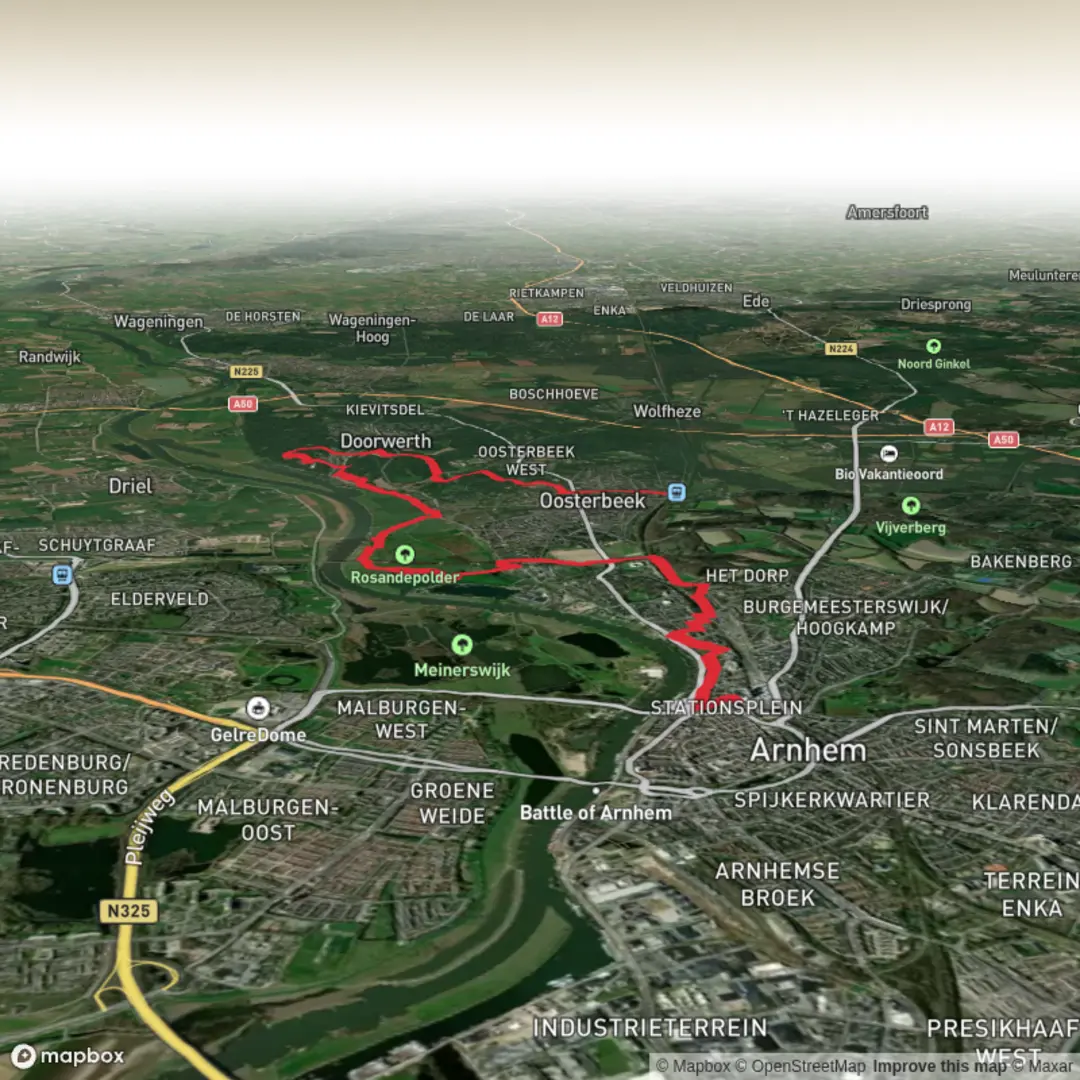
15.1 km
~3 hrs 13 min
118 m
Point-to-Point
“From city buzz to blooming heath, this route weaves history, riverscapes, and tranquil forests together.”
Starting from Arnhem Centraal, one of the Netherlands’ busiest railway stations, this 15 km (about 9.3 miles) route heads west toward Oosterbeek, following the scenic Rosandepad. The trail is mostly flat, with a gentle elevation gain of around 100 metres (328 feet), making it accessible for most hikers and ideal for those seeking a relaxed day out.
Getting There
Arnhem Centraal is easily accessible by train from major Dutch cities such as Amsterdam, Utrecht, and Nijmegen. If arriving by car, parking is available at the station or in nearby garages. The trailhead is just outside the main entrance of Arnhem Centraal, making logistics straightforward for both public transport users and drivers.
Urban Start and Transition to Nature
Leaving the bustle of Arnhem behind, the route quickly transitions from city streets to the leafy outskirts. Within the first 2 km (1.2 miles), you’ll pass through Sonsbeek Park, a sprawling urban green space known for its landscaped gardens, waterfalls, and the historic white villa, Huis Sonsbeek. This park is a highlight in itself, with opportunities to spot waterfowl and enjoy panoramic views over Arnhem from the higher points.
Rosandepad and the Lower Rhine Valley
After Sonsbeek, the trail picks up the Rosandepad, a well-marked regional path. The route meanders through the Rosandepolder, a low-lying area along the northern banks of the Lower Rhine (Nederrijn). Here, you’ll walk along grassy dikes and through open meadows, with frequent sightings of grazing cattle and, in spring and summer, a variety of wildflowers. The river views are expansive, and birdwatchers may spot herons, storks, and sometimes even kingfishers along the water’s edge.
Historical Significance and Landmarks
Approaching the halfway point, you’ll pass near the Airborne Museum ‘Hartenstein’ in Oosterbeek, a site dedicated to the Battle of Arnhem during World War II. The area is steeped in history, with memorials and information panels detailing the events of Operation Market Garden in 1944. The trail also skirts the edge of the Oosterbeek War Cemetery, a poignant reminder of the region’s past.
Woodlands and Heath
The final stretch leads through the wooded slopes and heathlands of the Veluwezoom National Park’s southern edge. The terrain here is slightly undulating, with sandy paths winding through oak and beech forests. In late summer, the heath blooms purple, creating a striking landscape. Wildlife is abundant—roe deer, foxes, and a variety of woodland birds are commonly seen.
Finishing in Oosterbeek
The hike concludes in the charming village of Oosterbeek, near the Oosterbeek railway station, which offers direct train connections back to Arnhem and other cities. Cafés and bakeries in the village provide a welcome spot to rest and refuel.
Navigation and Preparation
The route is well-signposted, but for detailed navigation and real-time updates, HiiKER is recommended. Wear sturdy walking shoes, as some sections can be muddy after rain. Bring water and snacks, as facilities are limited between Arnhem and Oosterbeek. The trail is suitable year-round, though spring and autumn offer especially beautiful scenery.

Surfaces
Unknown
Asphalt
Sand
Unpaved
Gravel
Dirt
Concrete
Ground
Cobblestone
Wood
Paved
Comments and Reviews
User comments, reviews and discussions about the Arnhem Centraal to Oosterbeek via Rosandepad, Netherlands.
average rating out of 5
0 rating(s)