Download
Preview
Add to list
More
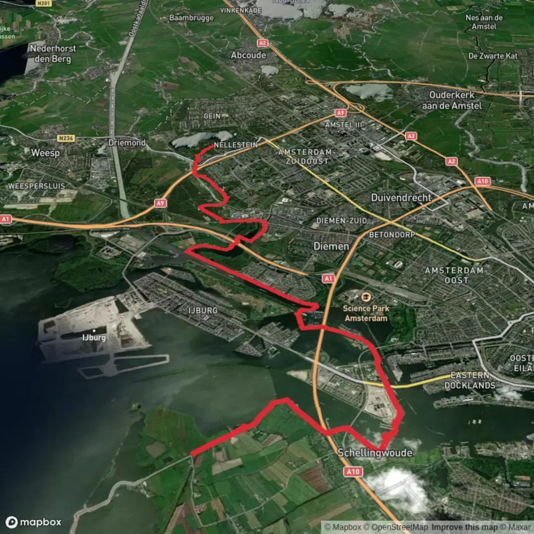
18.3 km
~3 hrs 39 min
0 m
Point-to-Point
“A flat ribbon of water and sky—from Durgerdam’s dike hush to Gaasperplas’s lake calm—wind permitting.”
This is a mostly flat, waterside walk that strings together three very different Amsterdam landscapes: the quiet dike village feel of Durgerdam on the IJmeer/Markermeer edge, the big-engineered crossing at the Amsterdamse Brug, and the open, park-and-lake setting of Gaasperplas. At ~18 km (≈11.2 mi) with ~0 m (0 ft) of climbing, it’s ideal when you want distance without hills—wind and exposed paths are the main “effort” factor.
Getting to the start (public transport + car)
Because “Hike head: near” is incomplete, the most practical start point for this route is a well-known landmark at the Durgerdam end:
- Suggested start landmark: Durgerdam village / Durgerdammerdijk (the dike road running through Durgerdam, Amsterdam-Noord). A common, easy-to-find reference point is near the small village core along Durgerdammerdijk (look for the waterside dike and the cluster of traditional houses).
- Public transport: From central Amsterdam, you’ll typically use metro/train to Amsterdam Centraal and then bus connections toward Amsterdam-Noord / Durgerdam area. Exact lines can change, so check the current GVB/9292 journey planner for “Durgerdam” as your destination and aim to get off near the village/dike.
- By car: Navigate to Durgerdammerdijk, Amsterdam and park considerately—Durgerdam is small, with narrow dike roads and limited space. Use designated parking where available and avoid blocking driveways or dike access.
If you’d rather finish where transit is simplest, plan to end near Gaasperplas (Amsterdam Zuidoost), which is well-served by metro and buses.
What the route feels like underfoot
Expect a mix of:
- Dike-top asphalt and narrow paved lanes (especially around Durgerdam)
- Multi-use cycle paths (common around Amsterdam—stay alert and keep right)
- Park paths and compacted gravel around Gaasperplas
Even though the elevation gain is essentially 0 m (0 ft), the route can feel harder in headwinds and on fully exposed dikes.
Durgerdam to the city edge: dikes, water, and big skies (approx. 0–6 km / 0–3.7 mi)
The opening kilometers are all about the waterline. Durgerdam sits on a slender ribbon of land, and the dike environment gives you long views across the IJmeer/Markermeer waters. You’ll pass classic dike houses and small waterside inlets—this area has a long relationship with land reclamation, flood protection, and the constant negotiation between settlement and sea-lake conditions.
What to look for - Birdlife: This is prime territory for waterbirds—expect to see combinations of gulls, terns, coots, grebes, geese, and ducks depending on season. In colder months, numbers can swell with wintering birds. - Wind exposure: There’s little shelter. A calm forecast can still feel brisk on the dike. - Narrow shoulders: Some stretches are tight; be ready to step aside for cyclists.
Distance + effort - Roughly 6 km (3.7 mi) to transition from the village/dike feel toward more urban infrastructure. - Elevation remains effectively flat: ~0–5 m (0–16 ft) of tiny undulations at most.
Amsterdamse Brug area: engineered crossing and navigation cues (approx. 6–11 km / 3.7–6.8 mi)
As you approach the Amsterdamse Brug, the scenery shifts from pastoral dike to large-scale infrastructure—bridges, ramps, and broad waterways. This is where you’ll want to pay the most attention to route-finding, because paths can braid together (cycleways, footpaths, service roads).
Navigation - Use HiiKER to confirm which side of the waterway you should be on before and after the bridge approaches, and to avoid accidentally following a fast cycle corridor in the wrong direction. - Watch for underpasses and split-level crossings—it’s easy to drift onto a parallel path that looks correct but leads to a different junction.
Safety + comfort notes - Cyclist traffic can be heavy near bridge approaches and commuter corridors. - Noise and wind funneling: bridges and open spans can amplify wind; keep a layer accessible even on mild days. - Crossings: where you meet roads, assume bikes have priority unless signage indicates otherwise; make eye contact and cross decisively.
Toward Gaasperplas: parkland, lake loops, and a softer finish (approx. 11–18 km / 6.8–11.2 mi)
The final third trends greener and more recreational as you near Gaasperplas, a large lake set within parkland in Amsterdam Zuidoost. Paths here are generally easier to walk, with more places to pause, and the lake edges often provide a calmer atmosphere than the exposed dikes.
Landmarks and nature - Gaasperplas lake views: broad water, reed edges, and open lawns. - Wooded pockets and shelter: you’ll notice the wind drop compared with the dike sections. - Wildlife: more park birds (songbirds, woodpeckers in treed areas) alongside waterfowl on the lake. Early mornings and evenings are best for quieter wildlife watching.
Surface + pacing - Mostly smooth park paths;

Surfaces
Asphalt
Unknown
Grass
Concrete
Wood
Paved
Unpaved
Comments and Reviews
User comments, reviews and discussions about the Durgerdam, Amsterdamse brug and Gaasperplas, Netherlands.
average rating out of 5
0 rating(s)