Download
3D Flyover
Add to list
More
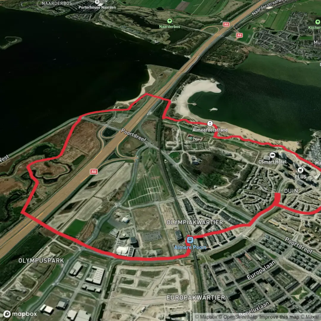
7.1 km
~1 hrs 24 min
0 m
Loop
“Stroll through Almere Poort’s lush parks and bold architecture, where reclaimed land blooms with Dutch ingenuity.”
Starting from the easily accessible Almere Poort train station, this loop trail covers approximately 7 km (about 4.3 miles) with virtually no elevation gain, making it an ideal choice for beginners, families, or anyone seeking a leisurely walk. The route is well-marked and flat, winding through the modern, green suburb of Almere Poort, which is part of the larger city of Almere in Flevoland, the Netherlands.
Getting There and Trailhead Access
Almere Poort train station serves as the main gateway to the trail. Frequent trains from Amsterdam Central Station reach Almere Poort in about 20 minutes, and local buses also connect the station to other parts of Almere. For those arriving by car, parking is available at the station and nearby shopping areas.
Trail Experience and Landmarks
The loop begins just outside the train station, quickly leading you into the lush expanses of Cascadepark, a central green space known for its modern landscaping and water features. At around 1.5 km (0.9 miles), you’ll pass the Homeruskwartier, a unique neighborhood famous for its experimental architecture and self-built homes. This area is a highlight for those interested in urban design and the innovative spirit of Almere, a city built on reclaimed land from the IJsselmeer in the late 20th century.
Continuing west, the trail skirts the edge of Pampushout, a young forest planted as part of Almere’s ambitious green city planning. Here, you may spot rabbits, songbirds, and—if you’re lucky—roe deer. The forest is especially vibrant in spring and early summer, with wildflowers and fresh foliage.
Nature and Wildlife
The route offers a blend of urban parkland and semi-wild green corridors. Waterways and ponds attract waterfowl such as coots, swans, and herons. The flat, open landscape is typical of Flevoland, with expansive skies and distant views, especially striking at sunrise or sunset.
Historical Context
Almere Poort and its surroundings are part of the world’s largest land reclamation project, the Flevopolder, completed in the 1960s and 1970s. The area was once the floor of the Zuiderzee, a shallow bay of the North Sea, before being transformed into fertile land. The city’s design reflects modern Dutch urban planning, emphasizing sustainability, green spaces, and innovative architecture.
Navigation and Facilities
The entire loop is easy to follow, with paved paths and clear signage. For navigation, HiiKER provides up-to-date maps and route details. Restrooms and cafes can be found near the train station and in the Homeruskwartier area. Benches and picnic spots are scattered throughout Cascadepark and Pampushout, making it easy to take breaks.
This accessible, flat loop is perfect for a relaxed outing, offering a unique glimpse into the Netherlands’ ongoing relationship with water, land, and urban innovation.

Surfaces
Asphalt
Unknown
Concrete
Grass
Comments and Reviews
User comments, reviews and discussions about the Almere Poort Loop, Netherlands.
average rating out of 5
0 rating(s)