Download
3D Flyover
Add to list
More
8.6 km
~1 hrs 43 min
0 m
Loop
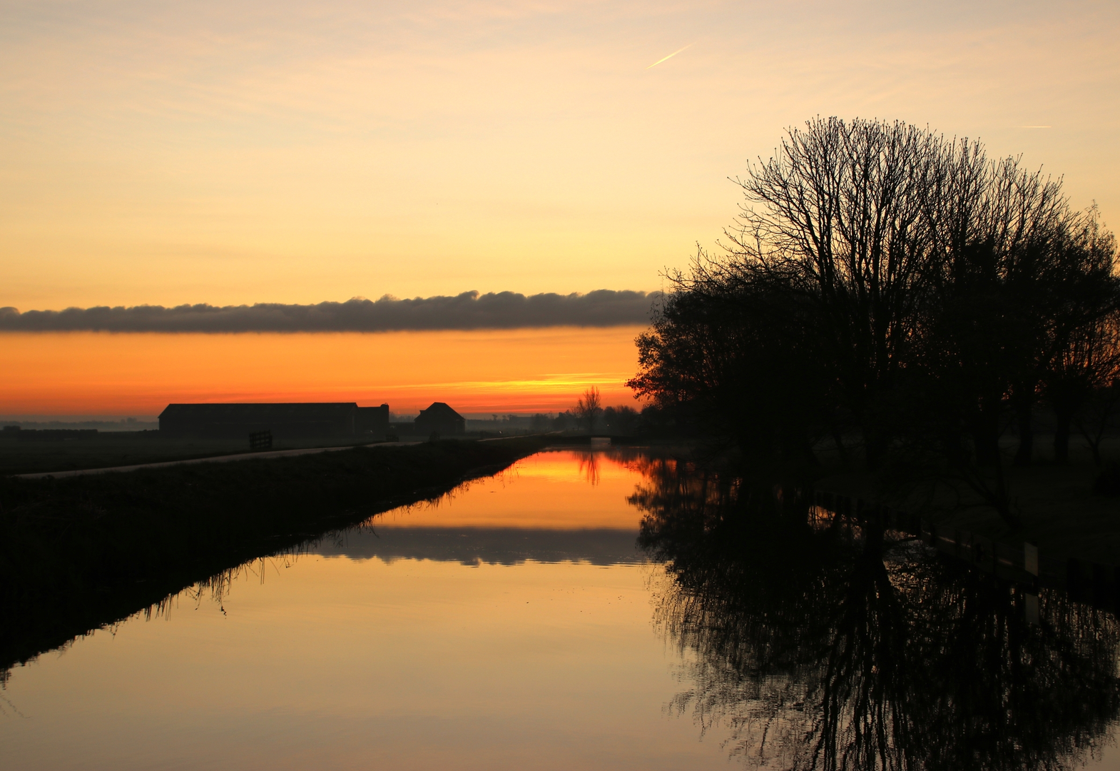
“An easy-going polder loop of big skies, straight canals, birdsong, and weather sweeping in.”
A flat, easy-going loop through classic Dutch polder country—wide skies, ruler-straight drainage canals, grazing pasture, and long sightlines where you can watch weather roll in from miles away. Expect roughly 9 km (5.6 mi) with about 0 m (0 ft) of elevation gain, mostly on firm farm tracks, paved cycle paths, and short grassy or compacted-dirt sections along ditches.
Getting to the start (public transport + car)
Because the start is listed only as “near” (no coordinates or town provided), the most reliable way to pinpoint the exact trailhead is to open the route in HiiKER and use its start-point pin to identify the nearest road name and transit stop. If you share the start longitude/latitude (or a HiiKER link), I can convert it to the nearest known address or landmark and tailor the directions precisely.
In general for Westzijde/Noordeinderpolder-area loops in the Netherlands: - By public transport: You’ll typically take a train to the nearest larger station (often a regional hub), then a local bus toward the polder-edge villages, finishing with a 10–25 minute walk (0.8–2 km / 0.5–1.2 mi) to the start. In polder regions, bus stops are often on the main dike road or village ring road, with smaller farm lanes leading into the open fields. - By car: Aim for parking near a dike road, small village edge, or a signed cycling junction (knooppunt) where there’s usually a safe verge or small pull-in. Avoid blocking farm gates and narrow one-lane access roads—agricultural traffic can be frequent even on quiet-looking lanes.
What the route feels like underfoot
This loop is best thought of as a lowland landscape walk rather than a “trail” in the mountainous sense. Surfaces are usually: - Paved cycle path / quiet lane: smooth and fast, good for steady pacing. - Farm track: compacted gravel or hard-packed dirt; can be dusty in dry spells. - Grassy verge / canal-side path: can be soft, uneven, and slick after rain.
With essentially no climbing, the main “effort” comes from distance, wind exposure, and footing changes rather than elevation.
Navigation and wayfinding (use HiiKER)
Polder terrain can look deceptively uniform—long straight lines, repeating bridges, and multiple similar junctions. Use HiiKER to: - Confirm you’re taking the correct bridge crossing over canals (a wrong bridge can add a long detour). - Track progress along parallel drainage ditches where paths run side-by-side. - Identify access restrictions if a farm track is temporarily closed or signed as private.
Landscape, landmarks, and what to look for
You’ll be walking through a working water-managed landscape shaped by centuries of drainage, diking, and land reclamation. Key features you’re likely to notice: - Drainage canals and ditches: the backbone of the polder system, keeping fields workable and settlements dry. - Dikes and raised roads: subtle but important—often the “high ground” in an otherwise level world. - Bridges, culverts, and pumping infrastructure: small but telling signs of continuous water control. - Farmsteads and long field parcels: many polder fields are laid out in long, narrow strips, reflecting historical land division and drainage patterns.
If the loop passes any historic windmill or pumping station, that’s a major landmark worth a pause—these structures represent the transition from wind-powered drainage to mechanized pumping that made many polders more reliable and productive.
Nature and wildlife (quiet highlights)
Even in heavily managed farmland, polders can be surprisingly rich in birdlife, especially along water edges: - Waterfowl and waders: look along canal margins for ducks, geese, herons, and seasonal waders probing the shallows. - Raptors: open fields make it easier to spot kestrels and other birds of prey hovering or scanning from posts. - Meadow birds (seasonal): in spring and early summer, listen for calls over the grasslands; some areas may have protected nesting zones with requests to keep to the path.
You’ll also see typical canal-bank vegetation—reeds, grasses, and low shrubs—plus occasional lines of trees acting as windbreaks near farms.
Conditions and hazards to plan for
- Wind exposure: With few trees or buildings, wind can be the biggest factor. A calm forecast can still feel brisk out in the open.
- Rain and mud: Even “easy” flat routes can become messy—grassy canal edges get slick, and farm tracks can puddle.
- Narrow roads and cyclists: Many polder routes share space with bikes. Stay predictable, keep right, and be extra cautious at blind corners near bridges.
- Livestock and electric fencing: Cows and sheep are common. Keep distance, don’t feed animals, and watch for low electric strands near gates.
- Sun exposure: On bright days there’s little shade—bring sun protection even for a short 9 km (5.6 mi) outing.
Practical kit and timing
- Time on feet: Most hikers will take about 2–2.5 hours for 9 km (5.6 mi) at an easy pace, plus stops.
- Footwear: Light hiking shoes are usually enough; after rain, consider something with better grip and water resistance.
- Water/snacks: Bring at least 500 ml–1 L depending on

Surfaces
Unknown
Grass
Concrete
Unpaved
Gravel
Asphalt
Paved
Comments and Reviews
User comments, reviews and discussions about the Westzijde and Noordeinderpolder Loop, Netherlands.
average rating out of 5
0 rating(s)