Download
3D Flyover
Add to list
More
13.7 km
~4 hrs 22 min
979 m
Loop
“A tapestry of wild lore, misty heights, and shimmering lakes awaits on Mangerton’s dramatic circuit.”
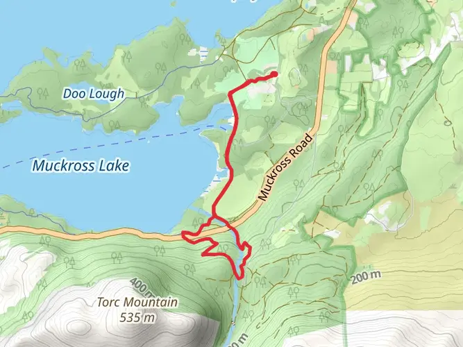
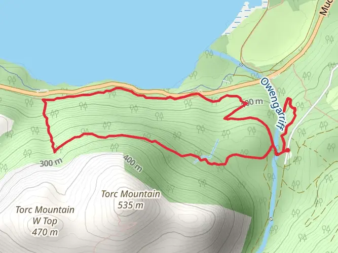
Starting from the car park at the base of Mangerton Mountain, just a short drive from Killarney town in County Kerry, the Mangerton Circular Trail offers a challenging loop of approximately 14 km (8.7 miles) with a total elevation gain of about 1000 metres (3280 feet). The trailhead is easily accessible by car, with parking available at the Mangerton Mountain car park, located off Mangerton Road, about 6 km (3.7 miles) southeast of Killarney. For those using public transport, buses run regularly to Killarney from major Irish cities, and local taxis can bring you directly to the trailhead.
Initial Ascent and Forest Section
The route begins with a steady climb through lush woodland, typical of Killarney National Park’s lower slopes. Early on, hikers are surrounded by native oak, birch, and holly, with the chance to spot red deer grazing in the clearings. The path is well-trodden but can be muddy after rain, so waterproof boots are recommended. After about 2 km (1.2 miles), the forest thins, revealing panoramic views over the park’s lakes and the distant MacGillycuddy’s Reeks.
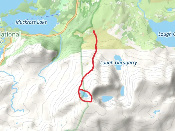
Open Mountain and Devil’s Punchbowl
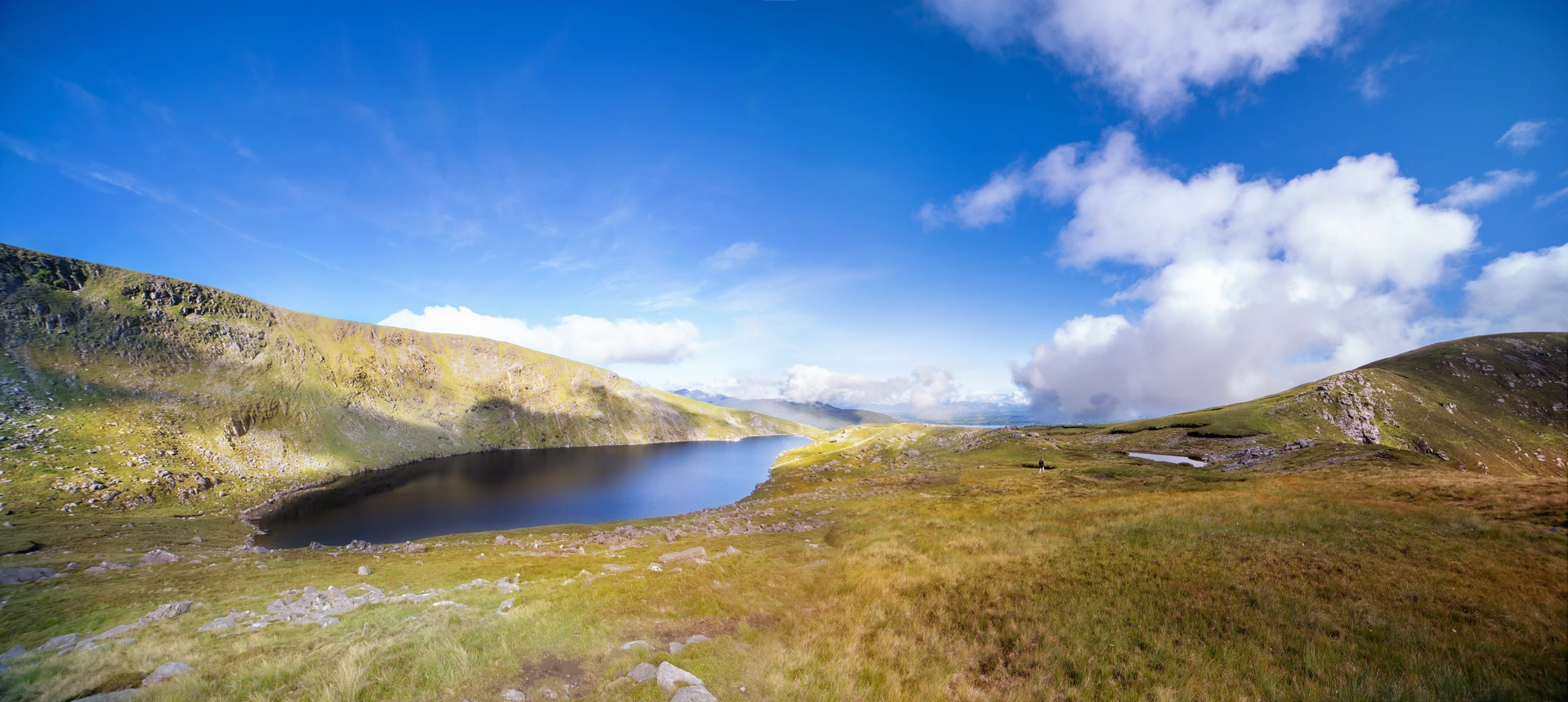
Emerging above the treeline, the trail continues to rise across open moorland. The landscape here is dominated by heather, bog cotton, and rocky outcrops. At roughly 5 km (3.1 miles) in, hikers reach the Devil’s Punchbowl, a dramatic corrie lake nestled beneath Mangerton’s summit cliffs. This glacial lake is a highlight of the route, offering a perfect spot for a rest and photo opportunities. The area is often frequented by ravens and kestrels, and the water’s edge is home to rare alpine plants.
Summit Ridge and Panoramic Views
From the Devil’s Punchbowl, the trail climbs steeply to Mangerton’s summit plateau, reaching the highest point at 839 metres (2752 feet). The ascent is demanding, with loose stones and exposed sections, so caution is advised, especially in poor weather. On clear days, the summit rewards with sweeping views across Killarney’s lakes, the Black Valley, and the rugged peaks of the Reeks. The wind can be strong and temperatures drop quickly, so extra layers are essential.
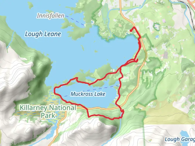
Descent and Return Loop
The descent follows the ridge before looping back towards the starting point. The path can be indistinct in places, especially in fog, so navigation skills are important—using HiiKER’s detailed trail maps is highly recommended. The return leg passes through more boggy ground and scattered boulders, eventually rejoining the lower woodland. Watch for sika deer and listen for the calls of woodland birds as you make your way back to the car park.
Historical and Natural Significance
Mangerton Mountain and its surroundings are steeped in history. The area was once a stronghold of the O’Donoghue clan, and local legends speak of ancient battles and mythical figures. The Devil’s Punchbowl itself is said to have been formed by a giant’s hand, according to folklore. The trail traverses part of Killarney National Park, Ireland’s oldest national park and a UNESCO Biosphere Reserve, renowned for its biodiversity and conservation efforts.
Preparation is key for this demanding loop: bring sufficient water, food, and weather-appropriate gear, and always check the forecast before setting out. The Mangerton Circular Trail is a rewarding challenge for experienced hikers, offering a blend of natural beauty, wildlife, and a sense of wild Irish history.

What to expect?
Activity types
Comments and Reviews
User comments, reviews and discussions about the Mangerton Circular Trail, Ireland.
4.6
average rating out of 5
35 rating(s)