Download
3D Flyover
Add to list
More
9.5 km
~3 hrs 1 min
669 m
Loop
“Mist-shrouded cliffs, wild deer, and sweeping vistas await on this dramatic journey through Killarney’s storied heights.”
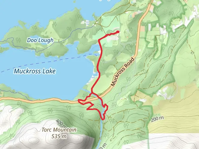
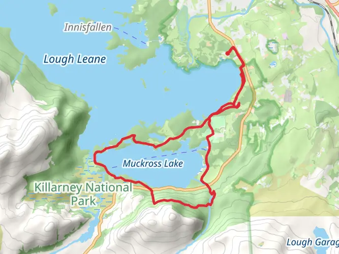
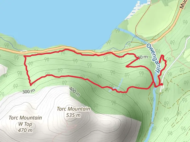
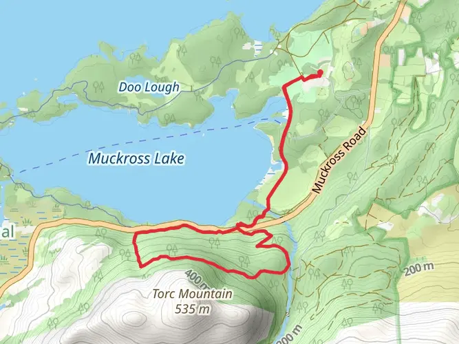
Starting from the trailhead near the Upper Lake car park in Killarney National Park, County Kerry, the Devil’s Punchbowl Loop covers roughly 10 km (6.2 miles) with an elevation gain of about 700 metres (2,300 feet). The route is a challenging loop, best suited for experienced hikers due to its steep ascents, rugged terrain, and exposure to rapidly changing weather conditions.
Getting There
To reach the starting point, travelers can take a bus or train to Killarney town, which is well-served by public transport from major Irish cities. From Killarney, local buses or taxis can bring you to the Upper Lake car park, a well-known access point for the park’s southern trails. Drivers will find ample parking at the Upper Lake car park, located just off the N71 road, about 16 km (10 miles) southwest of Killarney town center.
Trail Overview and Navigation
The loop begins with a gentle approach along the lakeshore, quickly transitioning into a steep ascent as the path climbs toward the Devil’s Punchbowl, a glacial corrie lake nestled beneath the summit of Mangerton Mountain. The initial 2 km (1.2 miles) are relatively moderate, but the gradient increases sharply as you approach the 4 km (2.5 mile) mark, where the landscape opens up to sweeping views of the Killarney lakes and the MacGillycuddy’s Reeks. Navigation can be tricky in fog or low cloud, so it’s essential to use a reliable mapping tool like HiiKER to stay on course, especially as the trail becomes less defined near the summit.
Landmarks and Natural Features
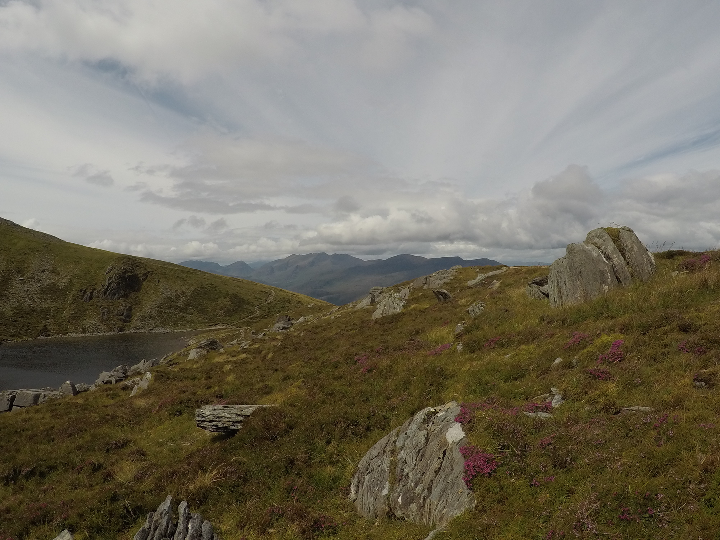
The Devil’s Punchbowl itself is a striking glacial lake, often shrouded in mist, with sheer cliffs rising on three sides. This area is a highlight of the loop, offering a dramatic setting for a rest stop. From here, the trail skirts the rim of the Punchbowl before ascending to Mangerton’s summit at 838 metres (2,749 feet), the highest point of the hike. On clear days, panoramic views stretch across the entire Killarney National Park, with Lough Leane, Muckross Lake, and the distant peaks of Carrauntoohil visible.
Descending from the summit, the path follows a rugged ridge before dropping steeply back toward the valley. The descent can be slippery, especially after rain, so sturdy footwear and trekking poles are recommended. The final section of the loop winds through heath and bogland, with the last 2 km (1.2 miles) returning to the lakeshore and the car park.
Wildlife and Flora
Killarney National Park is renowned for its biodiversity. Along the route, hikers may encounter red deer, Ireland’s only native deer species, as well as sika deer and mountain hares. The upland areas are home to rare plants such as the Killarney fern and alpine saxifrage, while the lower slopes are covered in heather, gorse, and native oak woodland. Birdlife is abundant, with peregrine falcons, ravens, and occasionally white-tailed sea eagles soaring overhead.
Historical and Cultural Significance
The region surrounding the Devil’s Punchbowl is steeped in history. Mangerton Mountain and its glacial features were shaped during the last Ice Age, and the area has long been associated with local folklore. The Punchbowl itself is said to have been formed by the hoof of the devil, according to legend, and the surrounding lands were once part of the estate of the Earls of Kenmare, whose influence shaped much of Killarney’s landscape and heritage.
Hikers should be prepared for rapidly changing weather, carry sufficient water and food, and ensure they have appropriate clothing for exposed mountain conditions. The Devil’s Punchbowl Loop offers a rewarding challenge with some of the most dramatic scenery in southwest Ireland.

What to expect?
Comments and Reviews
User comments, reviews and discussions about the Devil's Punchbowl Loop, Ireland.
4.88
average rating out of 5
16 rating(s)