Download
3D Flyover
Add to list
More
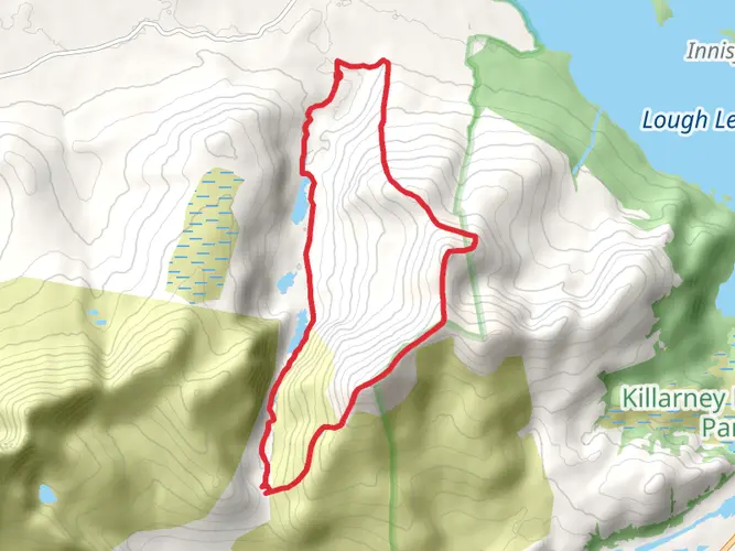
13.1 km
~4 hrs 14 min
974 m
Loop
“Rising through misty valleys and wild ridges, this dramatic loop unveils the heart of Kerry’s rugged beauty.”
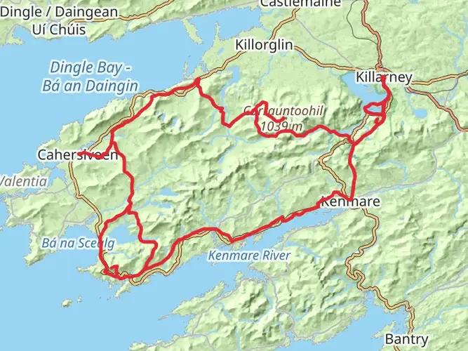
Starting from the car park at Cronin’s Yard, just outside the village of Beaufort in County Kerry, this loop trail covers approximately 13 km (8 miles) with a challenging elevation gain of about 1000 metres (3280 feet). Cronin’s Yard is a well-known base for Carrauntoohil hikes, easily accessible by car from Killarney (about 30 minutes’ drive). For those using public transport, buses run from Killarney to Beaufort village, from where local taxis can be arranged to reach Cronin’s Yard.
Approach and Early Stages
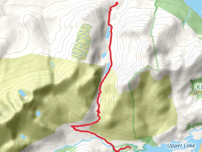
The route begins on a well-marked path through lush farmland and follows the Gaddagh River, with the MacGillycuddy’s Reeks rising dramatically ahead. Early on, hikers pass through a glaciated valley, with the imposing Hag’s Tooth Ridge visible to the left. The trail is rocky and can be boggy after rain, so waterproof boots are recommended. After about 3 km (1.9 miles), the path narrows and the landscape becomes more rugged, with sheep grazing on the slopes and ravens circling overhead.
O’Shea’s Gully Ascent
At the base of the Devil’s Ladder, the route veers right to enter O’Shea’s Gully, a steep and narrow ascent that is less eroded than the Ladder but still requires careful footing. The gully is filled with loose scree and boulders, and hands are often needed for balance. This section is the most physically demanding, gaining over 500 metres (1640 feet) in less than 2 km (1.2 miles). Weather can change rapidly, with mist and wind common even in summer. Hikers should use HiiKER for navigation, as visibility can drop quickly and the path is not always obvious.
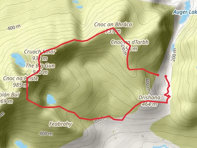
Summit and Panoramic Views
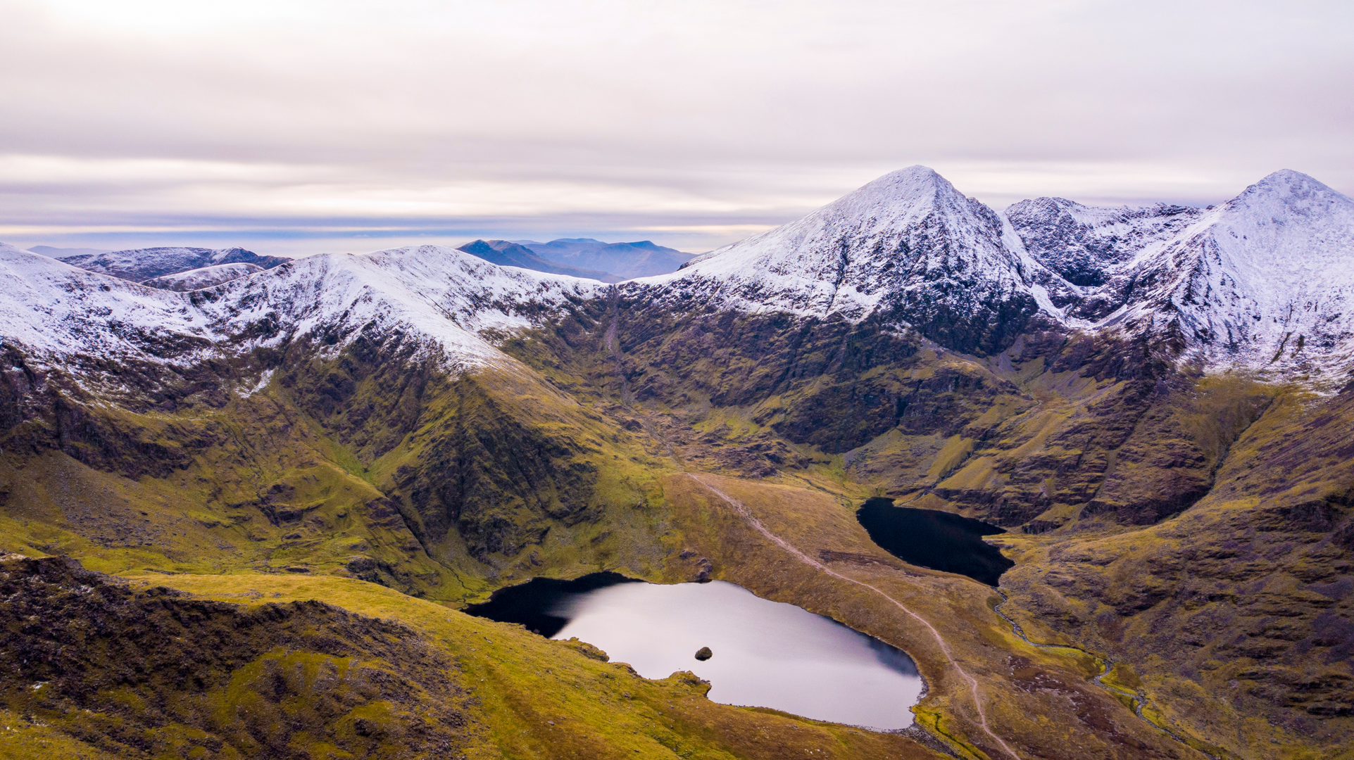
Emerging from the gully, the trail joins the main ridge leading to the summit of Carrauntoohil, Ireland’s highest peak at 1039 metres (3409 feet). The summit is marked by a large iron cross and offers sweeping views across the Reeks, Lough Leane, and the Dingle Peninsula on clear days. The area is rich in alpine flora, including heather and saxifrage, and sightings of mountain goats are possible.
Descent and Return Loop
The descent follows the Devil’s Ladder, a steep gully that is heavily eroded and can be slippery, especially after rain. Trekking poles are helpful for stability. After descending the Ladder, the route rejoins the valley path for a gentle walk back to Cronin’s Yard. The return leg passes several glacial lakes, including Lough Gouragh and Lough Callee, which are popular spots for a rest and photos.
Historical and Natural Significance
Carrauntoohil and the MacGillycuddy’s Reeks have a storied history, with the area once forming part of the O’Sullivan Beare clan’s territory. The landscape is shaped by glacial activity, and the region is designated as a Special Area of Conservation for its rare habitats and wildlife. The iron cross at the summit was erected in 1976 and has become a symbol for climbers across Ireland.
Hikers should be prepared for rapidly changing weather, bring sufficient food and water, and ensure they have a map and compass or use HiiKER for reliable navigation. The trail is best suited for experienced hikers due to its steep, rocky sections and exposure to the elements.

What to expect?
Comments and Reviews
User comments, reviews and discussions about the Carrauntoohil via O'Sheas Gully, Ireland.
4.78
average rating out of 5
73 rating(s)