Download
3D Flyover
Add to list
More
15.2 km
~5 hrs 8 min
1270 m
Multi-Day
“The Glencorbet Horseshoe Loop sweeps through wild peaks and valleys, rewarding expert hikers with breathtaking, untamed beauty.”
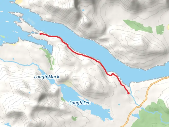
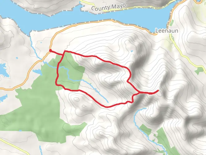
Starting from the small car park near Letterfrack village, just outside the entrance to Connemara National Park in County Galway, the Glencorbet Horseshoe Loop is a formidable challenge for experienced hikers. The trail covers approximately 15 km (9.3 miles) with a demanding elevation gain of about 1,300 metres (4,265 feet), making it one of the most strenuous routes in the region. Letterfrack is accessible by bus from Galway city, with regular services operated by Bus Éireann, or by car via the N59, which winds through the scenic Connemara landscape.
Route Overview and Navigation
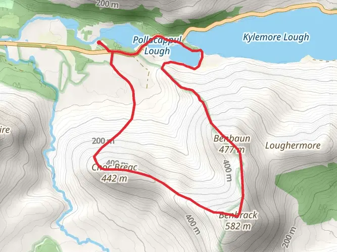
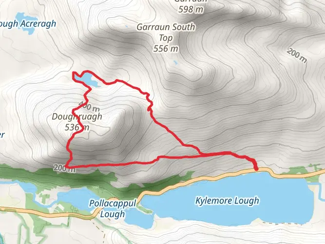
The loop begins by following a minor road from Letterfrack, quickly transitioning to open hillside as you ascend towards the first major summit, Benbaun, the highest peak in County Galway at 729 metres (2,392 feet). The initial climb is steep and sustained, with rough, boggy ground underfoot—waterproof boots and gaiters are essential. The route is unmarked and requires confident navigation skills; HiiKER is highly recommended for accurate GPS tracking and route-finding, as visibility can deteriorate rapidly in mist.
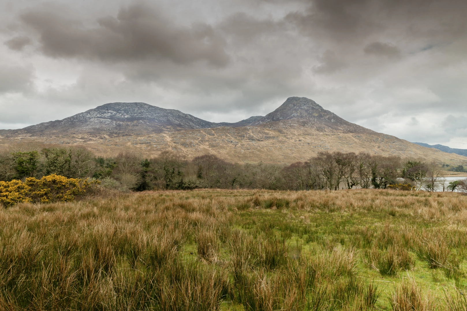
After Benbaun, the trail continues along a dramatic horseshoe ridge, taking in several other notable summits including Bencullagh and Benbrack. The ridgeline offers sweeping views over the Twelve Bens, Kylemore Abbey, and the Atlantic coastline, but the terrain remains rugged, with rocky outcrops and occasional scrambling sections. Expect exposed sections where wind and weather can be severe—layered clothing and windproof gear are vital.
Landmarks, Nature, and Wildlife
The route traverses the heart of Connemara National Park, an area renowned for its wild, unspoiled beauty. The landscape is dominated by quartzite peaks, deep glacial valleys, and peat bogs. In spring and summer, the hillsides are dotted with wildflowers such as bog cotton and heather. Red deer, mountain hares, and peregrine falcons are sometimes spotted along the higher slopes, while the lower valleys are home to Connemara ponies and a variety of songbirds.
At approximately the halfway point, the descent into the Glencorbet valley provides a brief respite, with lush grassland and the sound of tumbling streams. The valley itself is steeped in history, with remnants of old stone walls and abandoned cottages hinting at the region’s past as a site of small-scale farming and sheep grazing. The area was also affected by the Great Famine in the 19th century, and the landscape bears silent witness to the hardships endured by local communities.
Final Stages and Return
The final section of the loop involves a steady climb back onto the ridge before descending towards the starting point near Letterfrack. The descent can be slippery, especially after rain, and care should be taken on the steep, grassy slopes. The loop finishes back at the car park, where the nearby Connemara National Park Visitor Centre offers facilities and information about the region.
Given the extra difficult rating, this trail is best suited to experienced hikers with strong fitness, advanced navigation skills, and a good understanding of mountain safety. Weather conditions can change rapidly, and there is little shelter along the route. Always check the forecast, carry a map, compass, and HiiKER for navigation, and let someone know your plans before setting out.

What to expect?
Activity types
Comments and Reviews
User comments, reviews and discussions about the Glencorbet Horseshoe Loop, Ireland.
4.73
average rating out of 5
45 rating(s)