Download
Preview
Add to list
More
13.7 km
~4 hrs 21 min
971 m
Loop
“Traverse wild ridges and sweeping vistas where Connemara’s rugged spirit and ancient stories come alive.”
Starting from the trailhead near the village of Letterfrack in County Galway, this 14 km (about 8.7 miles) loop with an elevation gain of approximately 1,000 metres (3,280 feet) is a challenging journey through the heart of Connemara National Park. The route is renowned for its rugged beauty, sweeping vistas, and the sense of wild remoteness that defines this part of western Ireland.
Getting There
Letterfrack is the gateway to Connemara National Park and is accessible by car via the N59 from Galway City, a drive of about 1.5 hours. For those using public transport, Bus Éireann operates services from Galway to Letterfrack, with the bus stop located near the park entrance. The trailhead is a short walk from the main visitor centre, which is well signposted.
Trail Overview and Navigation
The loop begins with a gentle ascent through native woodland, quickly giving way to open moorland as you climb towards the first major landmark, An Bhinn Bhán (The White Peak). The initial 3 km (1.9 miles) involve a steady climb, with the terrain underfoot shifting from gravel paths to rough, boggy ground. Waterproof boots are essential, especially after rain. Navigation can be tricky in poor visibility, so carrying a map and compass is recommended, and HiiKER provides reliable GPS mapping for this route.
Connemara’s Peaks and Panoramas
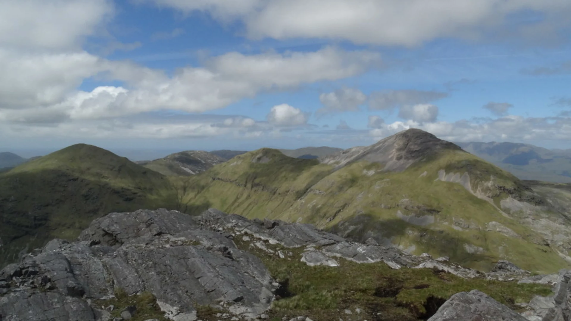
After reaching An Bhinn Bhán, the trail continues along a high ridge, offering panoramic views over the Twelve Bens mountain range and the Atlantic coastline. At around 6 km (3.7 miles), you’ll encounter the ascent to Mucanacht, the second major summit. This section is steep and rocky, with loose scree in places, demanding careful footing. The reward is a breathtaking vantage point over the patchwork of lakes, bogs, and distant islands.
Wildlife and Flora
Connemara National Park is a haven for wildlife. Keep an eye out for Connemara ponies grazing on the lower slopes, as well as red deer, mountain hares, and a variety of birdlife including skylarks, kestrels, and peregrine falcons. The boggy uplands are rich in heather, bog cotton, and rare orchids, especially in late spring and summer.
Historical and Cultural Significance
The region is steeped in history, with evidence of ancient human settlement visible in the form of megalithic tombs and old field systems. The land was shaped by centuries of farming and peat cutting, and the Irish language is still spoken in nearby communities. The park itself was established in 1980, preserving a landscape that has inspired poets and artists for generations.
Descent and Return
The descent from Mucanacht is gradual, following a ridge that curves back towards Letterfrack. The final 5 km (3.1 miles) pass through open heath and scattered woodland, with occasional boardwalks to protect sensitive bog habitats. The loop closes near the visitor centre, where facilities include toilets, a café, and interpretive displays about the park’s natural and cultural heritage.
This loop is best suited to experienced hikers with good fitness and navigation skills, as weather conditions can change rapidly and the terrain is often rough and exposed. Always check the forecast, bring adequate layers, and ensure your phone or GPS device is fully charged before setting out.

Comments and Reviews
User comments, reviews and discussions about the An Bhinn Bhán and Mucanacht Loop, Ireland.
4.35
average rating out of 5
26 rating(s)