Download
Preview
Add to list
More
9.3 km
~2 hrs 20 min
284 m
Loop
“Explore the scenic, historical, and wildlife-rich Zitronenkraemerkreuz Loop near Trier-Saarburg, Germany, on this 9 km trail.”
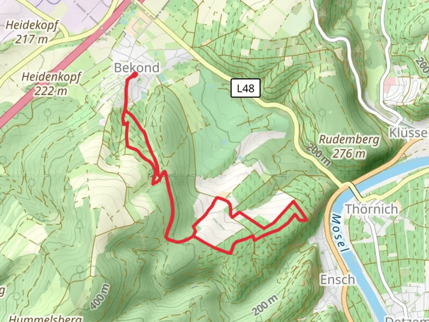
Starting your adventure near Trier-Saarburg, Germany, the Zitronenkraemerkreuz Loop is a captivating 9 km (5.6 miles) loop trail with an elevation gain of approximately 200 meters (656 feet). This medium-difficulty trail offers a delightful mix of natural beauty, historical landmarks, and opportunities for wildlife spotting.
Getting There
To reach the trailhead, you can either drive or use public transport. If you're driving, set your GPS to the nearest known address: Trier-Saarburg, Germany. For those opting for public transport, take a train or bus to Trier-Saarburg station. From there, it's a short walk to the trailhead.
Trail Overview
The trail begins with a gentle ascent through lush forests, offering a serene start to your hike. As you progress, the path becomes more varied, featuring both wooded areas and open meadows. The initial 2 km (1.2 miles) will see you gaining about 50 meters (164 feet) in elevation, making it a manageable start for most hikers.
Historical Significance
One of the highlights of this trail is its historical significance. The region around Trier-Saarburg is rich in history, dating back to Roman times. As you hike, you'll come across remnants of ancient Roman roads and possibly even some old fortifications. These landmarks serve as a fascinating reminder of the area's storied past.
Mid-Trail Highlights
Around the 4 km (2.5 miles) mark, you'll reach the Zitronenkraemerkreuz, a historical cross that gives the trail its name. This spot is perfect for a short break and some photos. The cross itself is a significant landmark, often associated with local legends and folklore. From here, the trail offers panoramic views of the surrounding countryside, making it a great spot to take in the scenery.
Flora and Fauna
The trail is a haven for nature lovers. Depending on the season, you might encounter a variety of wildlife, including deer, foxes, and numerous bird species. The flora is equally diverse, with wildflowers blooming in the spring and summer, and vibrant foliage in the fall. Keep your eyes peeled for rare plant species that are native to this region.
Navigation
For navigation, it's highly recommended to use HiiKER. The app provides detailed maps and real-time updates, ensuring you stay on the right path. The trail is well-marked, but having a reliable navigation tool can enhance your hiking experience.
Final Stretch
The last 3 km (1.9 miles) of the trail are mostly downhill, making for a pleasant and easy finish. You'll descend back into the forested area, eventually looping back to your starting point. This section offers a peaceful end to your hike, with the sounds of nature accompanying you as you make your way back.
Practical Tips
- Wear sturdy hiking boots, as some sections can be rocky and uneven.
- Bring plenty of water and snacks, especially if you plan to take breaks and enjoy the scenery.
- Check the weather forecast before you go, as the trail can be slippery after rain.
- If you're hiking in the summer, consider starting early to avoid the midday heat.
This trail offers a perfect blend of natural beauty, historical intrigue, and moderate physical challenge, making it a rewarding experience for hikers of all levels.

What to expect?
Activity types
Comments and Reviews
User comments, reviews and discussions about the Zitronenkraemerkreuz Loop, Germany.
4.0
average rating out of 5
1 rating(s)