Download
Preview
Add to list
More
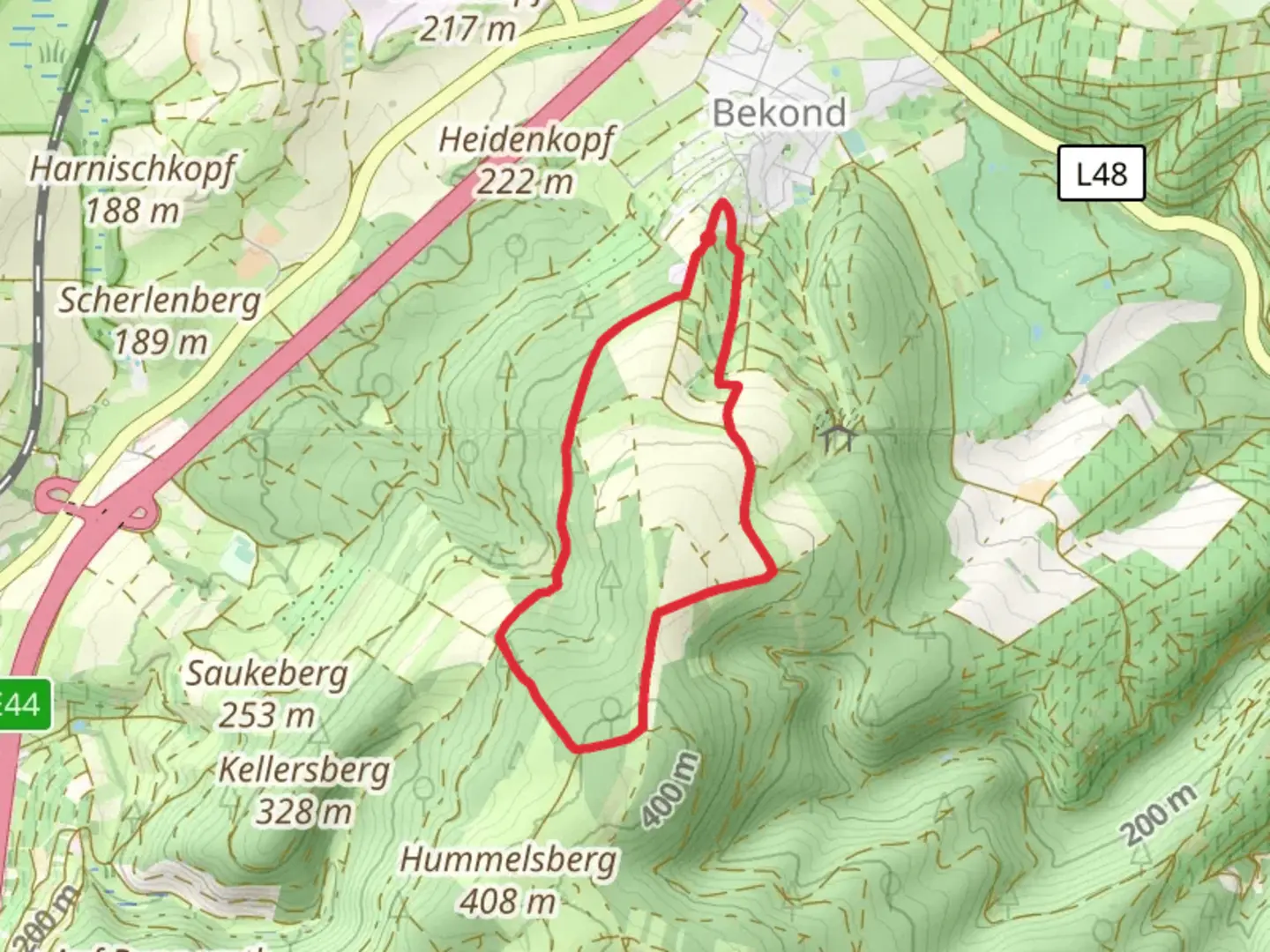
5.5 km
~1 hrs 22 min
165 m
Loop
“The Enscher Wald-Bekond trail offers a 6 km loop of natural beauty, history, and wildlife spotting.”
Starting near Trier-Saarburg, Germany, the Enscher Wald-Bekond trail is a delightful 6 km (approximately 3.7 miles) loop with an elevation gain of around 100 meters (328 feet). This medium-difficulty trail offers a mix of natural beauty, historical landmarks, and opportunities for wildlife spotting.
Getting There
To reach the trailhead, you can drive or use public transport. If driving, set your GPS to the nearest significant landmark, which is the town of Bekond. For those using public transport, take a train to Trier-Saarburg and then a local bus to Bekond. The trailhead is easily accessible from the town center.
Trail Overview
The trail begins in a lush forested area, offering a serene start with well-marked paths. As you proceed, you'll encounter a gentle ascent, gaining about 50 meters (164 feet) in the first 1.5 km (0.93 miles). This section is shaded and cool, making it a pleasant walk even on warmer days.
Historical Significance
Around the 2 km (1.24 miles) mark, you'll come across remnants of ancient Roman settlements. Trier, known as the oldest city in Germany, was a significant Roman hub, and the influence extends to this trail. Look out for old stone foundations and informational plaques that provide context about the area's historical importance.
Nature and Wildlife
As you continue, the trail opens up to a more diverse landscape. The forest gives way to open meadows around the 3 km (1.86 miles) point. Here, you might spot local wildlife such as deer, foxes, and a variety of bird species. The meadows are also home to a range of wildflowers, especially vibrant in the spring and summer months.
Midpoint and Scenic Views
At approximately 4 km (2.48 miles), you'll reach the highest point of the trail, offering panoramic views of the surrounding countryside. This is a great spot to take a break, enjoy a snack, and soak in the scenery. The elevation gain here is about 100 meters (328 feet) from the starting point, providing a moderate challenge without being too strenuous.
Descending Back
The descent begins gradually, leading you back into the forest. The path here is well-maintained but can be slippery after rain, so watch your footing. Around the 5 km (3.1 miles) mark, you'll pass a small, picturesque stream. This area is particularly beautiful in the autumn when the leaves change color.
Final Stretch
The last kilometer (0.62 miles) of the trail loops back towards Bekond. This section is relatively flat and easy, allowing you to cool down as you finish your hike. You'll emerge back near the town center, where you can find local cafes and restaurants to relax and refuel.
Navigation
For navigation, it's highly recommended to use the HiiKER app, which provides detailed maps and real-time updates to ensure you stay on track. The trail is well-marked, but having a reliable navigation tool can enhance your hiking experience.
This trail offers a perfect blend of natural beauty, historical intrigue, and moderate physical challenge, making it a rewarding hike for those looking to explore the scenic and historical landscapes near Trier-Saarburg.

What to expect?
Activity types
Comments and Reviews
User comments, reviews and discussions about the Enscher Wald- Bekond, Germany.
5.0
average rating out of 5
1 rating(s)