Download
Preview
Add to list
More
13.8 km
~3 hrs 27 min
423 m
Loop
“This 14 km loop trail in Germany's Black Forest blends natural beauty, historical sites, and moderate challenges.”
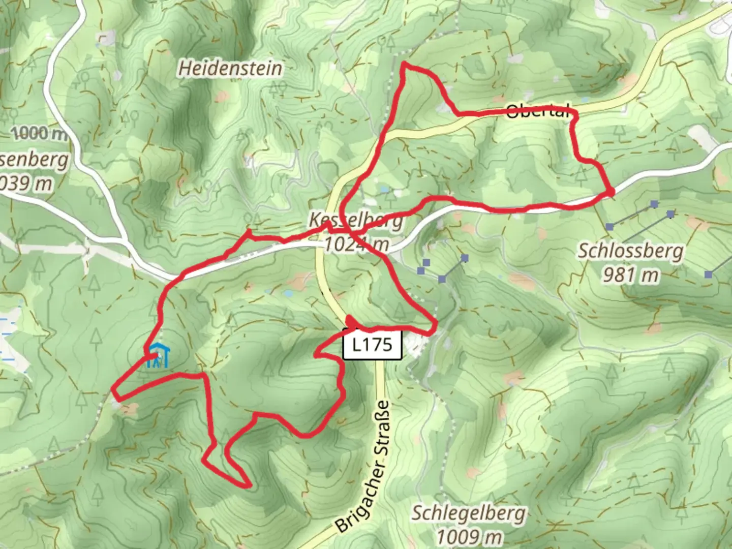
Starting near Schwarzwald-Baar-Kreis in Germany, this 14 km (approximately 8.7 miles) loop trail offers a moderate challenge with an elevation gain of around 400 meters (about 1,312 feet). The trailhead is conveniently accessible by both car and public transport. If you're driving, you can park near the village of Dauchingen, which is the closest significant landmark. For those using public transport, take a train to Villingen-Schwenningen and then a local bus to Dauchingen.### Initial Ascent and Forested PathwaysThe trail begins with a gentle ascent through the lush, dense forests of the Black Forest region. As you start your hike, you'll notice the rich biodiversity, including various species of birds and small mammals. The first 3 km (1.9 miles) will take you through a mix of deciduous and coniferous trees, providing ample shade and a serene atmosphere. The elevation gain in this section is gradual, making it a good warm-up for the more challenging parts ahead.### Reaching Lange LochenAround the 5 km (3.1 miles) mark, you'll reach Lange Lochen, a notable high point on the trail. This area offers panoramic views of the surrounding Black Forest landscape. It's a great spot to take a break, have a snack, and enjoy the scenery. The elevation gain to this point is about 200 meters (656 feet), so you'll feel a sense of accomplishment as you take in the vistas.### Historical SignificanceAs you continue, you'll come across several historical markers and ruins that date back to medieval times. The Black Forest region has a rich history, and these remnants offer a glimpse into the past. Keep an eye out for old boundary stones and remnants of ancient fortifications. These landmarks are often accompanied by informational plaques, providing context and historical background.### Wildlife and FloraThe trail is home to a variety of wildlife, including deer, foxes, and a plethora of bird species. The flora is equally diverse, with wildflowers blooming in the spring and summer months. If you're hiking during these seasons, you'll be treated to a colorful display of nature's beauty. The trail also passes through several meadows, which are perfect for bird-watching and photography.### Navigational TipsFor navigation, it's highly recommended to use the HiiKER app, which provides detailed maps and real-time updates. The trail is well-marked, but having a reliable navigation tool will ensure you stay on track, especially in the more remote sections.### Mittelweg and Return LoopAround the 10 km (6.2 miles) mark, you'll intersect with the Mittelweg, another well-known trail in the Black Forest. This section involves a descent through more forested areas and open meadows. The final 4 km (2.5 miles) of the trail loop back towards Dauchingen, with a mix of gentle descents and flat sections, making for a pleasant end to your hike.### Final StretchAs you approach the end of the trail, you'll pass through a picturesque valley with a small stream. This area is particularly beautiful in the autumn when the leaves change color. The last kilometer (0.6 miles) is relatively flat, allowing you to cool down and reflect on the diverse landscapes and historical sites you've encountered.This loop trail offers a well-rounded hiking experience, combining natural beauty, historical significance, and moderate physical challenge. Whether you're a seasoned hiker or a casual walker, this trail provides a rewarding journey through one of Germany's most iconic regions.

What to expect?
Activity types
Comments and Reviews
User comments, reviews and discussions about the Unterer Hirzwald Lange Lochen and Mittelweg Loop, Germany.
4.5
average rating out of 5
2 rating(s)