Download
Preview
Add to list
More
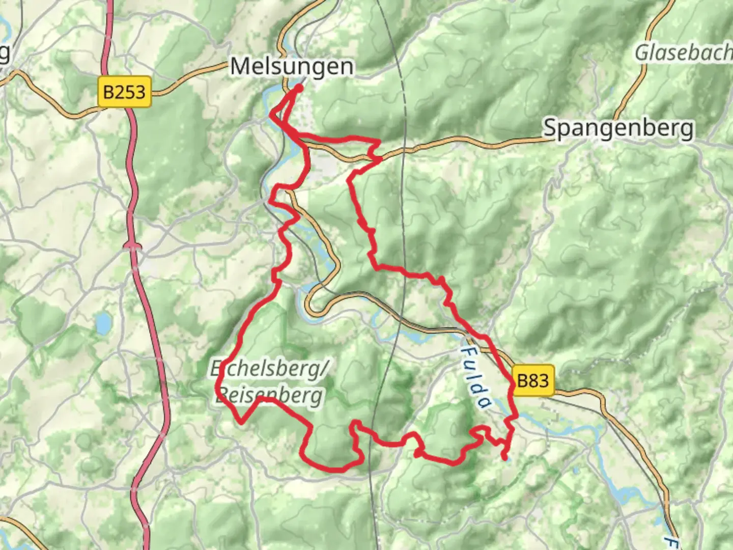
44.9 km
~2 day
1078 m
Loop
“Explore lush landscapes, historical ruins, and charming villages on this enchanting German hiking loop.”
Nestled in the picturesque region of Schwalm-Eder-Kreis, Germany, the Karl Wolfram Weg and Freiher von Seebachweg Loop offers a captivating journey through lush landscapes and historical landmarks. This 45 km (approximately 28 miles) loop trail, with an elevation gain of around 1000 meters (3280 feet), is rated as medium difficulty, making it suitable for hikers with some experience.### Getting ThereThe trailhead is conveniently located near Schwalm-Eder-Kreis. If you're traveling by car, you can reach the starting point by heading towards the town of Homberg (Efze), which is well-connected by regional roads. For those relying on public transport, the nearest major train station is in Kassel. From Kassel, you can take a regional train to Wabern, followed by a local bus to Homberg (Efze). From there, it's a short taxi ride or a local bus to the trailhead.### Trail HighlightsScenic Landscapes and Natural BeautyAs you embark on this loop, you'll traverse a variety of landscapes, from dense forests to open meadows. The trail offers panoramic views of the surrounding countryside, especially as you ascend to higher elevations. Keep an eye out for the diverse flora and fauna that inhabit the area, including deer, foxes, and a variety of bird species. The trail is particularly stunning in spring and autumn when the foliage is vibrant and colorful.Historical SignificanceThe region is steeped in history, and the trail passes by several sites of historical interest. One notable landmark is the ruins of the medieval castle, Burg Homberg, which offers a glimpse into the area's past. The castle, perched on a hill, provides a perfect spot for a rest and a chance to soak in the views of the surrounding landscape.Cultural LandmarksAs you continue along the trail, you'll encounter charming villages that reflect the traditional architecture of the region. These villages offer a chance to experience local culture and hospitality. Be sure to visit the local churches and historical buildings, which often have fascinating stories to tell.### Trail Navigation and SafetyThe trail is well-marked, but it's always wise to have a reliable navigation tool. HiiKER is an excellent resource for detailed maps and real-time navigation assistance. Given the trail's length and elevation gain, it's important to be prepared with adequate water, snacks, and appropriate clothing for changing weather conditions.### Wildlife and NatureThe trail is a haven for nature enthusiasts. The forests are home to a variety of wildlife, and the meadows are often dotted with wildflowers. Birdwatchers will find plenty to admire, with species such as woodpeckers and hawks frequently spotted along the route.### Practical TipsPlan for a multi-day hike if you wish to fully enjoy the trail's offerings. There are several campsites and guesthouses along the way, providing convenient options for overnight stays. Always check the weather forecast before setting out, and inform someone of your plans for added safety.This loop trail offers a perfect blend of natural beauty, historical intrigue, and cultural richness, making it a rewarding experience for those who venture into this enchanting part of Germany.

What to expect?
Activity types
Comments and Reviews
User comments, reviews and discussions about the Karl Wolfram Weg and Freiher von Seebachweg Loop, Germany.
average rating out of 5
0 rating(s)