Download
Preview
Add to list
More
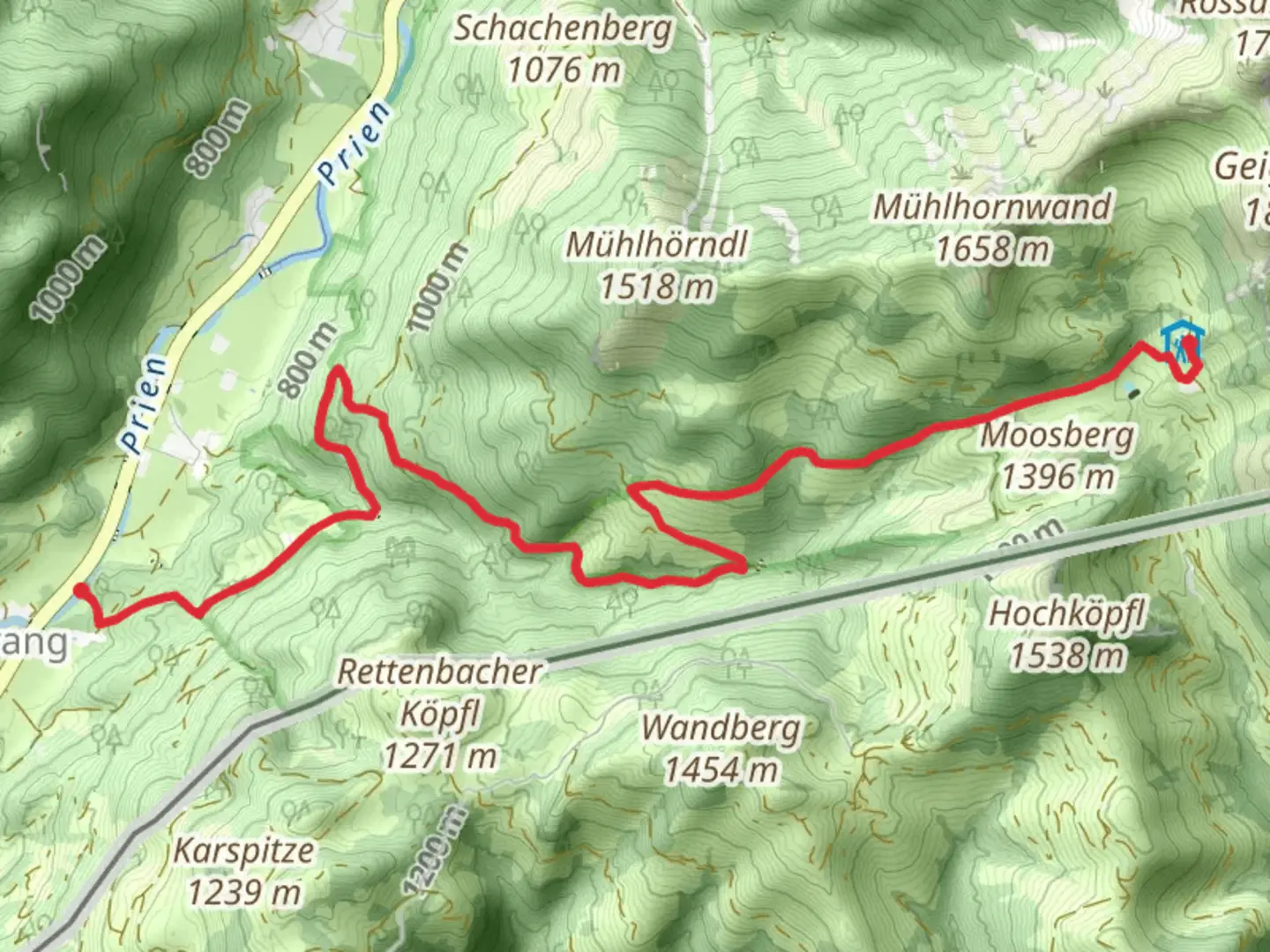
7.9 km
~2 hrs 49 min
747 m
Point-to-Point
“Explore the breathtaking Bavarian Alps on the scenic and invigorating Sachrang to Priener Huette trail.”
Starting near the picturesque town of Rosenheim, Germany, the Sachrang to Priener Huette Via Alpina Purple trail offers an invigorating hike through the Bavarian Alps. This point-to-point trail spans approximately 8 kilometers (5 miles) with an elevation gain of around 700 meters (2,300 feet), making it a moderately challenging route suitable for hikers with a reasonable level of fitness.
Getting There To reach the trailhead, you can either drive or use public transportation. If driving, head towards Sachrang, a charming village near Rosenheim. For those relying on public transport, take a train to Rosenheim and then a bus to Sachrang. The trailhead is conveniently located near the village center, making it easily accessible.
Trail Overview The hike begins in Sachrang, a quaint village known for its traditional Bavarian architecture and serene landscapes. As you set off, the trail gradually ascends through lush meadows and dense forests, offering a peaceful start to your journey. The initial 2 kilometers (1.2 miles) are relatively gentle, allowing you to warm up and enjoy the surrounding nature.
Key Landmarks and Nature Around the 3-kilometer (1.8-mile) mark, you'll encounter the first significant landmark: the Sachranger Alm, a traditional alpine hut where you can take a short break and enjoy some local refreshments. This spot also provides stunning views of the surrounding peaks and valleys.
Continuing on, the trail becomes steeper as you approach the halfway point. The forest gives way to more open terrain, revealing panoramic vistas of the Bavarian Alps. Keep an eye out for local wildlife, including deer, marmots, and a variety of bird species that inhabit this region.
Historical Significance The area around Sachrang and Priener Huette is steeped in history. The trail itself follows part of the Via Alpina, a network of long-distance hiking trails that traverse the eight Alpine countries. Historically, these routes were used by traders, pilgrims, and even armies, making them rich in cultural and historical significance.
Final Ascent and Arrival As you approach the final 2 kilometers (1.2 miles), the trail becomes more rugged and challenging. The elevation gain is more pronounced here, so take your time and pace yourself. The effort is well worth it as you near the Priener Huette, a welcoming alpine hut situated at an elevation of approximately 1,410 meters (4,626 feet). The hut offers not only a place to rest and refuel but also breathtaking views of the surrounding peaks.
Navigation and Safety For navigation, it's highly recommended to use the HiiKER app, which provides detailed maps and real-time updates to ensure you stay on track. The trail is well-marked, but having a reliable navigation tool can enhance your hiking experience and provide peace of mind.
Wildlife and Flora Throughout the hike, you'll encounter a diverse range of flora, from alpine flowers to ancient trees. The changing landscapes offer a unique opportunity to observe the natural beauty of the Bavarian Alps up close. Be mindful of the local wildlife and maintain a respectful distance to avoid disturbing their natural habitat.
This trail offers a perfect blend of natural beauty, historical significance, and moderate physical challenge, making it a rewarding experience for any hiker.

What to expect?
Activity types
Comments and Reviews
User comments, reviews and discussions about the Sachrang to Priener Huette Via Alpina Purple, Germany.
5.0
average rating out of 5
2 rating(s)