Download
Preview
Add to list
More
5.6 km
~2 hrs 19 min
716 m
Point-to-Point
“Embark on a captivating 6km journey through Bavarian Alps' lush forests, historic sites, and stunning alpine meadows.”
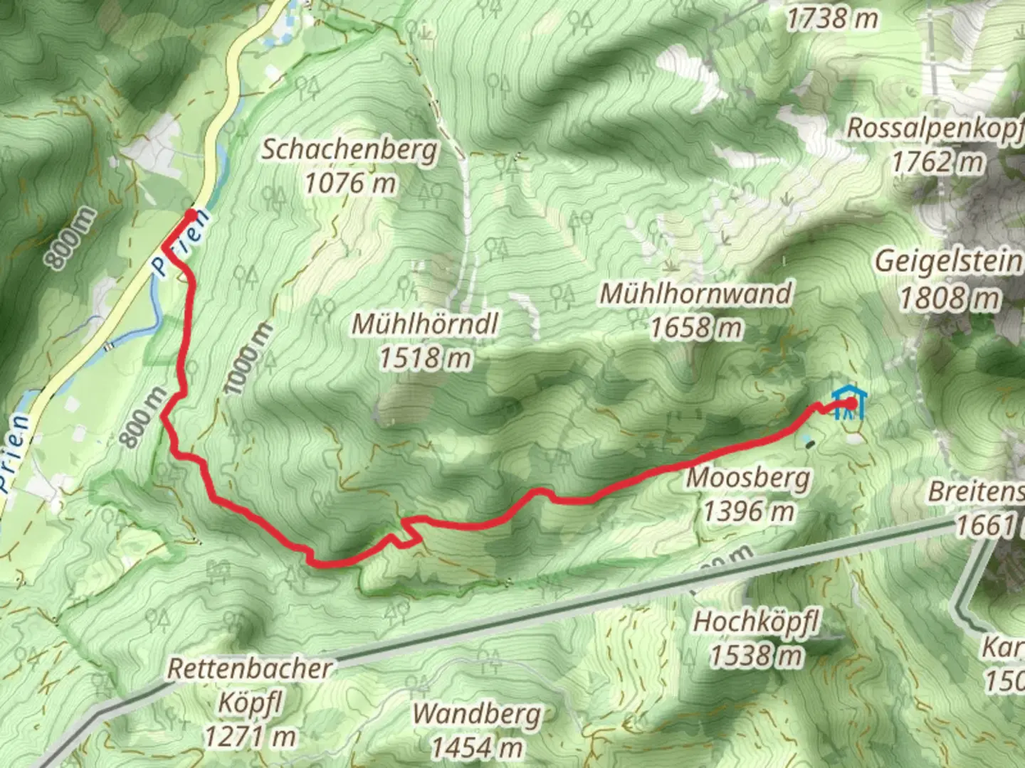
Starting near Rosenheim, Germany, the Innerwald to Priener Huette Via Alpina Purple trail offers a captivating journey through the Bavarian Alps. This point-to-point trail stretches approximately 6 kilometers (3.7 miles) with an elevation gain of around 700 meters (2,297 feet), making it a moderately challenging hike suitable for those with a reasonable level of fitness.### Getting There To reach the trailhead, you can either drive or use public transport. If you’re driving, head towards the town of Rosenheim and follow signs to Innerwald. For those using public transport, take a train to Rosenheim and then a local bus towards Innerwald. The nearest significant landmark to the trailhead is the picturesque village of Sachrang, which is well-signposted and easy to find.### Trail Overview The trail begins in the serene village of Innerwald, nestled in the Chiemgau Alps. As you start your ascent, you’ll be greeted by lush forests and the soothing sounds of mountain streams. The initial part of the trail is relatively gentle, allowing you to warm up before the steeper sections begin.### Key Landmarks and Nature About 2 kilometers (1.2 miles) into the hike, you’ll come across the idyllic Sachranger Bach, a small stream that offers a perfect spot for a short break. The trail then begins to climb more steeply, and you’ll notice the change in vegetation as you ascend. Keep an eye out for local wildlife such as deer and various bird species that inhabit this region.### Historical Significance The area around Rosenheim and the Chiemgau Alps is steeped in history. During your hike, you might come across remnants of old shepherd huts and alpine pastures that have been used for centuries. The Priener Huette itself, your destination, has a rich history dating back to the early 20th century. It was originally built to provide shelter for hikers and mountaineers exploring the region.### Navigation and Safety Given the elevation gain and the sometimes rugged terrain, it’s advisable to use a reliable navigation tool like HiiKER to stay on track. The trail is well-marked, but weather conditions can change rapidly in the mountains, so always be prepared with appropriate gear, including a map, compass, and sufficient food and water.### Final Stretch As you approach the final 1.5 kilometers (0.9 miles), the trail opens up to stunning alpine meadows, offering panoramic views of the surrounding peaks. The last push to Priener Huette is steep but rewarding, with the hut providing a welcoming sight after your climb. Here, you can rest, enjoy a meal, and take in the breathtaking scenery before planning your descent or onward journey.This trail offers a perfect blend of natural beauty, historical intrigue, and physical challenge, making it a must-do for any hiking enthusiast exploring the Bavarian Alps.

What to expect?
Activity types
Comments and Reviews
User comments, reviews and discussions about the Innerwald to Priener Huette Via Alpina Purple, Germany.
4.75
average rating out of 5
4 rating(s)