Download
Preview
Add to list
More
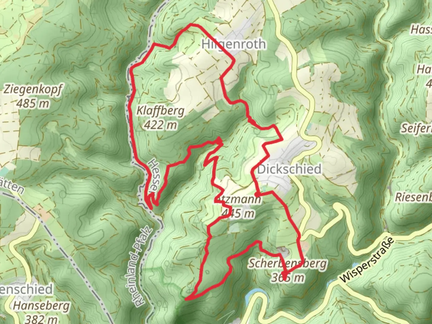
13.9 km
~3 hrs 32 min
461 m
Loop
“The Scherbensberg Loop via Dickschieder Wildwechsel offers a rewarding 14 km hike with stunning views, historical landmarks, and diverse wildlife.”
Starting near Rheingau-Taunus-Kreis, Germany, the Scherbensberg Loop via Dickschieder Wildwechsel is a captivating 14 km (approximately 8.7 miles) loop trail with an elevation gain of around 400 meters (about 1,312 feet). This medium-difficulty trail offers a blend of natural beauty, historical landmarks, and diverse wildlife, making it a rewarding experience for hikers.
Getting There
To reach the trailhead, you can drive or use public transport. If driving, set your GPS to the nearest known address: Dickschied, 65391 Lorch, Germany. There is parking available near the trailhead. For those using public transport, take a train to Lorchhausen station and then a local bus to Dickschied. The trailhead is a short walk from the bus stop.
Trail Overview
The trail begins with a gentle ascent through dense forests, where you will be surrounded by towering trees and the sounds of local wildlife. Early in the hike, you will encounter a variety of bird species, so keep your binoculars handy if you're a birdwatching enthusiast.
Significant Landmarks
At around the 3 km (1.9 miles) mark, you will come across the ruins of an old watchtower, a remnant from the medieval period. This site offers a glimpse into the region's historical significance, as these towers were once part of a network used for communication and defense.
Continuing on, the trail opens up to a series of meadows around the 6 km (3.7 miles) point. These meadows are particularly beautiful in spring and summer, filled with wildflowers and offering panoramic views of the surrounding hills. This is a great spot to take a break and enjoy a picnic.
Wildlife and Nature
As you progress, the trail takes you through the Dickschieder Wildwechsel, a wildlife corridor known for its diverse fauna. Deer, foxes, and various bird species are commonly spotted here. The trail is well-marked, but it's advisable to use the HiiKER app for navigation to ensure you stay on track.
Elevation and Terrain
The most challenging part of the hike comes around the 9 km (5.6 miles) mark, where the trail ascends steeply for about 1 km (0.6 miles). This section will test your endurance, but the effort is rewarded with stunning views from the Scherbensberg summit. At the top, you can see for miles, with vistas that include the Rhine River and the surrounding valleys.
Final Stretch
The descent begins after the summit, leading you back through mixed forests and eventually reconnecting with the initial part of the loop. The final 2 km (1.2 miles) are relatively flat and easy, allowing you to cool down as you make your way back to the trailhead.
Practical Tips
- Wear sturdy hiking boots, as the terrain can be uneven and rocky in places.
- Bring plenty of water and snacks, especially if you plan to picnic in the meadows.
- Check the weather forecast before you go; the trail can be slippery after rain.
- Use the HiiKER app for real-time navigation and updates on trail conditions.
This trail offers a perfect blend of natural beauty, historical intrigue, and physical challenge, making it a must-visit for any hiking enthusiast exploring the Rheingau-Taunus-Kreis region.

What to expect?
Activity types
Comments and Reviews
User comments, reviews and discussions about the Scherbensberg Loop via Dickschieder Wildwechsel, Germany.
4.0
average rating out of 5
3 rating(s)