Download
Preview
Add to list
More
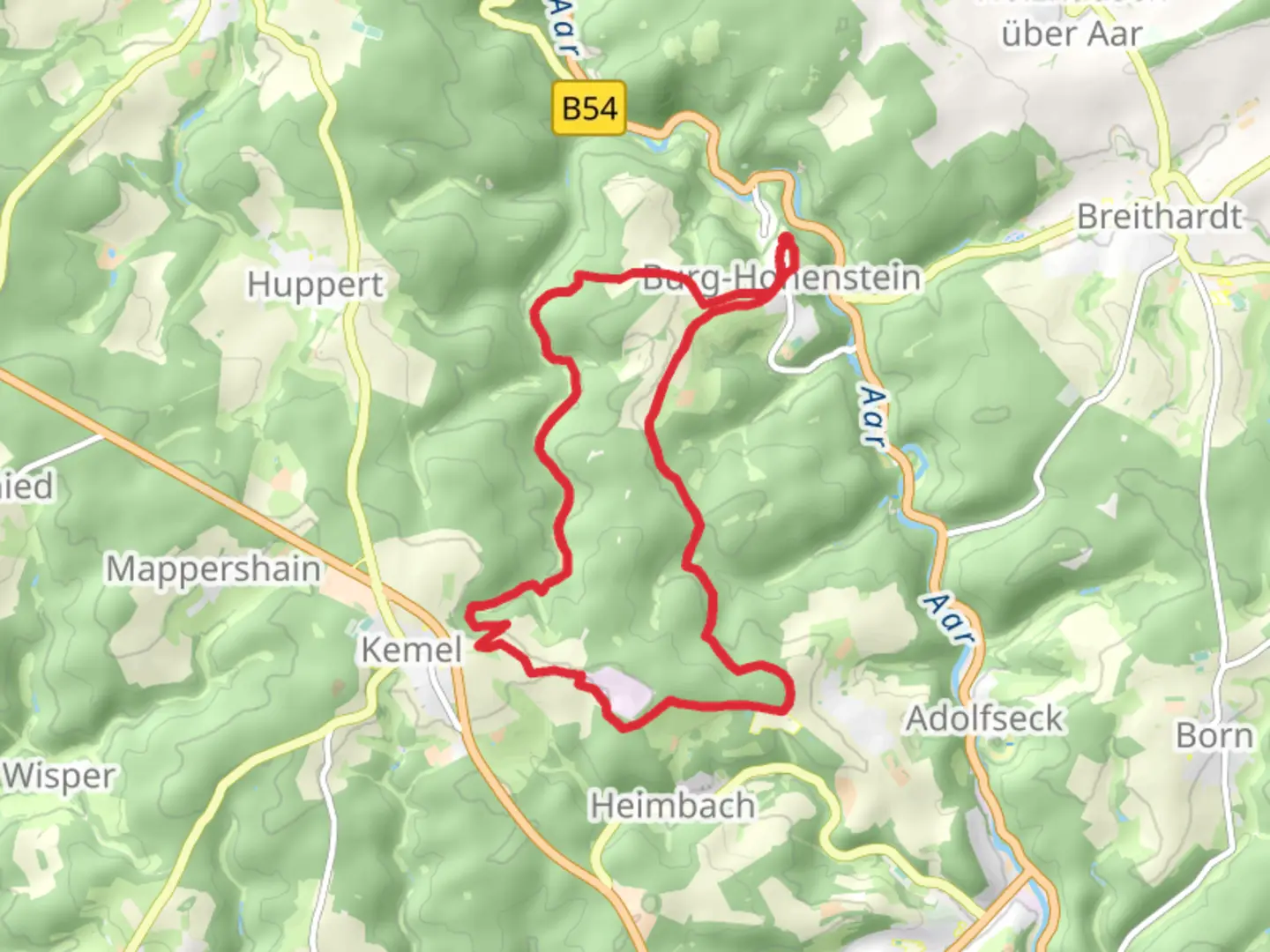
14.7 km
~3 hrs 30 min
338 m
Loop
“Explore lush forests, historic sites, and panoramic views on this scenic 15 km loop in Rheingau-Taunus-Kreis.”
Starting near Rheingau-Taunus-Kreis in Germany, this 15 km (approximately 9.3 miles) loop trail offers a moderate challenge with an elevation gain of around 300 meters (984 feet). The trailhead is conveniently accessible by car or public transport. If you're driving, you can park near the village of Hennethal. For those using public transport, take a train to the nearest station in Oestrich-Winkel and then a local bus or taxi to Hennethal.
Trail Overview
The trail begins with a gentle ascent through lush forests, providing a serene start to your hike. As you progress, the path becomes steeper, leading you through a mix of deciduous and coniferous trees. Keep an eye out for local wildlife, including deer and various bird species. The first significant landmark you'll encounter is the Lahnbach stream, which you will follow for a portion of the hike. This area is particularly picturesque, with the sound of flowing water adding to the tranquil atmosphere.
Historical Significance
The region is steeped in history, with several points of interest along the trail. One notable site is the remnants of an old Roman road, which dates back to the time when the Romans occupied this part of Germany. This ancient pathway offers a fascinating glimpse into the past and is a great spot for a short break and some photos.
Mid-Trail Highlights
Around the halfway mark, you'll reach a scenic viewpoint that offers panoramic views of the surrounding Rheingau-Taunus-Kreis region. This is an excellent spot to rest and take in the beauty of the landscape. The elevation gain to this point is about 150 meters (492 feet), making it a rewarding climb.
Continuing on, the trail descends gradually, leading you through open meadows and past small, charming villages. These areas are perfect for spotting local flora, including wildflowers in the spring and summer months. The trail is well-marked, but it's always a good idea to have a reliable navigation tool like HiiKER to ensure you stay on track.
Final Stretch
As you near the end of the loop, the trail takes you through a dense forest area before opening up near the village of Hennethal. This final section is relatively flat, allowing for a leisurely finish to your hike. The total elevation gain for the entire trail is around 300 meters (984 feet), making it a moderate but manageable hike for most fitness levels.
Getting There
To reach the trailhead, you can drive to Hennethal, where parking is available. If you're using public transport, take a train to Oestrich-Winkel and then a local bus or taxi to Hennethal. The trailhead is well-marked and easy to find from the village center.
This trail offers a perfect blend of natural beauty, historical significance, and moderate physical challenge, making it an excellent choice for a day hike in the Rheingau-Taunus-Kreis region.

What to expect?
Activity types
Comments and Reviews
User comments, reviews and discussions about the Lahnbach via Hennethal Oestrich Winkel, Germany.
4.0
average rating out of 5
1 rating(s)