Schwarzer Grat and Raggenhorn Peak Loop via Adelegg Wandergebiet
Download
Preview
Add to list
More
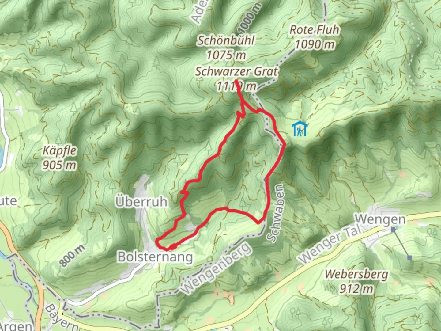
6.4 km
~1 hrs 53 min
364 m
Loop
“Discover the scenic Allgäu region on a 6 km loop featuring lush forests, panoramic views, and rich history.”
Starting near the picturesque town of Ravensburg, Germany, the Schwarzer Grat and Raggenhorn Peak Loop via Adelegg Wandergebiet offers a delightful 6 km (approximately 3.7 miles) journey through the scenic Allgäu region. With an elevation gain of around 300 meters (about 984 feet), this loop trail is rated as medium difficulty, making it suitable for moderately experienced hikers.
Getting There
To reach the trailhead, you can either drive or use public transportation. If you're driving, head towards the Adelegg Wandergebiet area near Ravensburg. For those relying on public transport, take a train to Ravensburg and then a local bus towards the Adelegg region. The nearest significant landmark to the trailhead is the Adelegg Nature Reserve, which is well-signposted and easy to locate.
Trail Highlights
As you embark on this loop, you'll be greeted by lush forests and rolling hills characteristic of the Allgäu region. The trail is well-marked, but it's always a good idea to have a reliable navigation tool like HiiKER to ensure you stay on track.
Schwarzer Grat
Approximately 2 km (1.2 miles) into the hike, you'll reach the Schwarzer Grat, the highest point in the Württemberg region at 1,118 meters (3,668 feet) above sea level. Here, you'll find a wooden observation tower that offers panoramic views of the surrounding landscape, including the distant Alps on a clear day. This spot is perfect for a short break and some memorable photos.
Raggenhorn Peak
Continuing along the loop, you'll soon approach Raggenhorn Peak. This section of the trail is slightly steeper, contributing to the overall elevation gain. The peak itself stands at 1,056 meters (3,465 feet) and provides another excellent vantage point. The area around Raggenhorn is known for its diverse flora and fauna, so keep an eye out for local wildlife such as deer and various bird species.
Historical Significance
The Adelegg region has a rich history dating back to medieval times. The dense forests were once part of the hunting grounds for local nobility. Additionally, the area played a role in the timber industry, with many ancient paths originally used for transporting wood. As you hike, you might notice remnants of old logging routes and historical markers that provide insight into the region's past.
Practical Tips
- Footwear: Given the moderate difficulty and varied terrain, sturdy hiking boots are recommended.
- Weather: The weather can be unpredictable, so bring layers and a waterproof jacket.
- Water and Snacks: There are no facilities along the trail, so carry enough water and snacks to keep you energized.
- Wildlife: Be respectful of the local wildlife and maintain a safe distance.
Navigation
While the trail is well-marked, using HiiKER can provide additional peace of mind. The app offers detailed maps and real-time tracking to help you navigate the loop without any hiccups.
This 6 km loop is a perfect blend of natural beauty, moderate challenge, and historical intrigue, making it a rewarding experience for any hiker.

What to expect?
Activity types
Comments and Reviews
User comments, reviews and discussions about the Schwarzer Grat and Raggenhorn Peak Loop via Adelegg Wandergebiet, Germany.
4.33
average rating out of 5
3 rating(s)