Download
Preview
Add to list
More
11.6 km
~4 hrs 6 min
1079 m
Loop
“Explore the enchanting Allgäu Alps on a captivating hike rich in nature, history, and stunning views.”
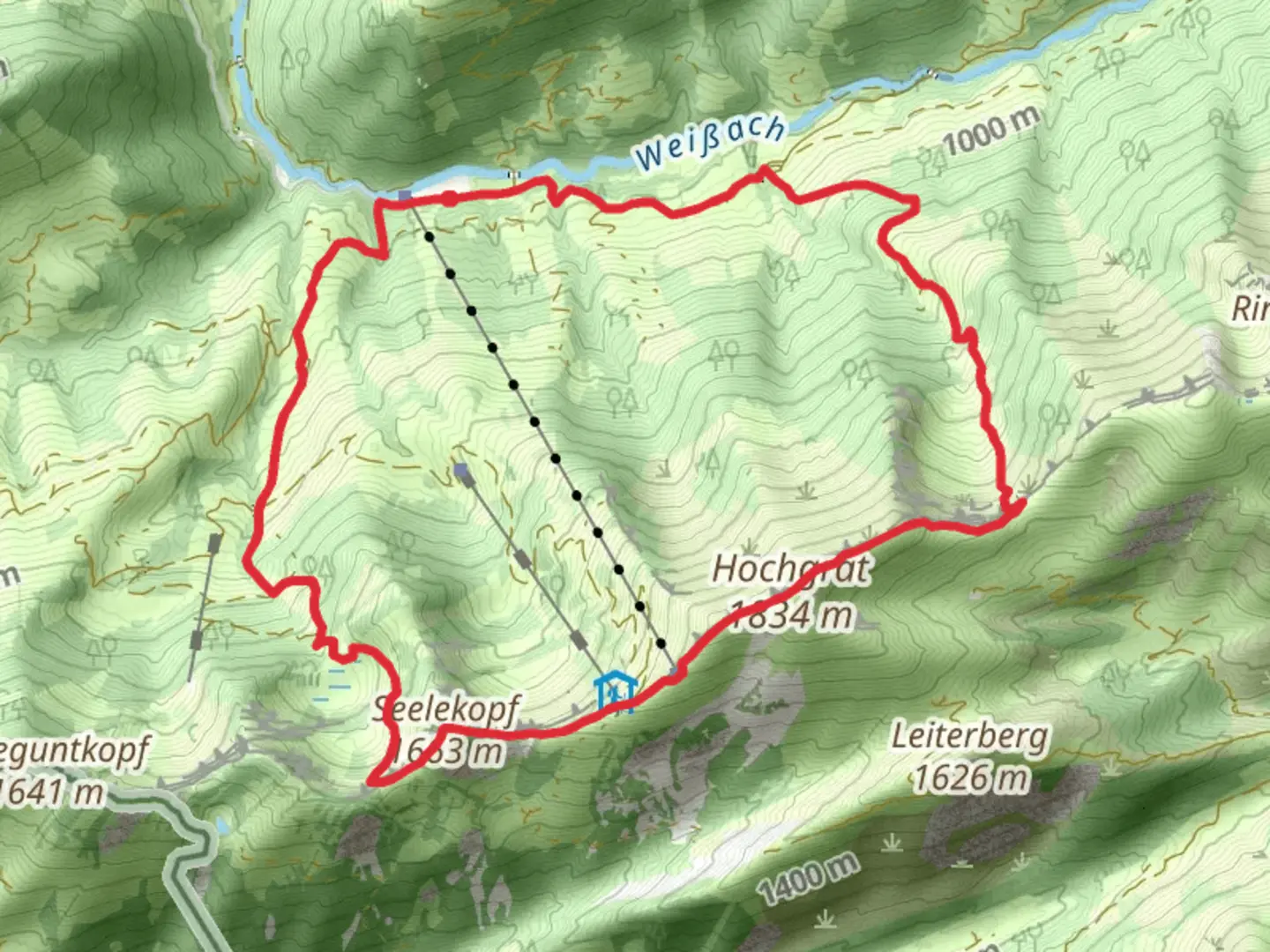
Nestled in the picturesque region of Oberallgäu, Germany, the Hochgrat via Wandergebiet Oberstaufen trail offers a captivating loop hike of approximately 12 kilometers (about 7.5 miles) with an elevation gain of around 1000 meters (approximately 3280 feet). This medium-difficulty trail promises a rewarding adventure through the stunning landscapes of the Allgäu Alps.### Getting ThereTo reach the trailhead, travelers can drive to the vicinity of Oberstaufen, a charming town known for its spa and wellness offerings. For those opting for public transport, Oberstaufen is accessible via train from major German cities like Munich or Stuttgart. From the Oberstaufen train station, local buses or taxis can take you closer to the trailhead, which is conveniently located near the town.### Trail HighlightsThe journey begins with a gentle ascent through lush meadows and dense forests, offering hikers a serene start. As you progress, the trail gradually becomes steeper, leading you to the ridge of the Hochgrat, the highest peak in the Nagelfluhkette Nature Park. This section of the trail provides breathtaking panoramic views of the surrounding alpine landscape, including the distant Lake Constance and the Swiss Alps on clear days.### Flora and FaunaThe trail is a haven for nature enthusiasts, with diverse flora and fauna. In spring and summer, the meadows burst into a vibrant display of wildflowers, including gentians and alpine roses. Birdwatchers may spot golden eagles soaring above, while marmots can often be seen basking on sunlit rocks. The rich biodiversity of the area is a testament to the conservation efforts within the Nagelfluhkette Nature Park.### Historical SignificanceThe region around Oberstaufen has a rich history, with evidence of human settlement dating back to the Bronze Age. The trail itself traverses areas that have been used for centuries by local shepherds and farmers. Along the way, hikers may encounter traditional alpine huts, some of which offer refreshments and a glimpse into the pastoral lifestyle that has shaped the cultural landscape of the Allgäu.### Navigation and SafetyHikers are encouraged to use the HiiKER app for navigation, which provides detailed maps and real-time updates on trail conditions. The trail is well-marked, but weather conditions can change rapidly in the mountains, so it's essential to be prepared with appropriate gear, including sturdy hiking boots, weatherproof clothing, and sufficient water and snacks.The Hochgrat via Wandergebiet Oberstaufen trail is a delightful blend of natural beauty, cultural history, and outdoor adventure, making it a must-visit for hikers seeking to explore the enchanting Allgäu Alps.

Comments and Reviews
User comments, reviews and discussions about the Hochgrat via Wandergebiet Oberstaufen, Germany.
4.5
average rating out of 5
2 rating(s)