Download
Preview
Add to list
More
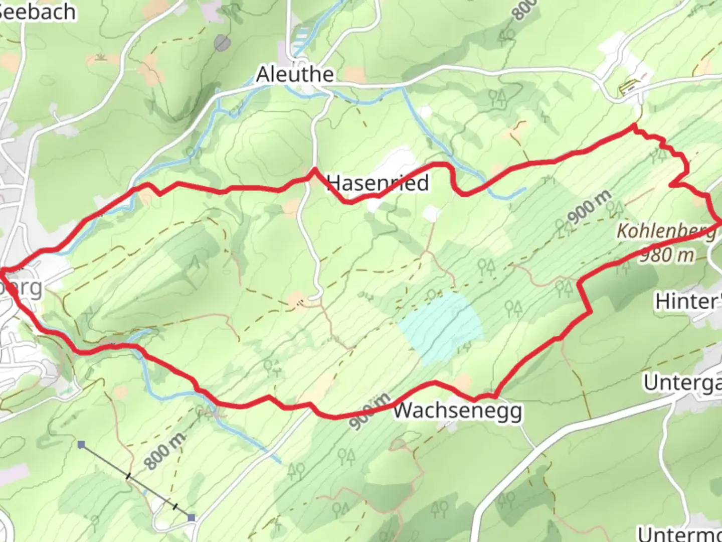
6.6 km
~1 hrs 46 min
276 m
Loop
“Explore the Heinrichweg and Sulzberg Loop for stunning alpine views, historical landmarks, and moderate hiking challenges.”
Starting near Oberallgäu, Germany, the Heinrichweg and Sulzberg Loop is a delightful 7 km (4.35 miles) trail with an elevation gain of approximately 200 meters (656 feet). This loop trail is rated as medium difficulty, making it suitable for moderately experienced hikers.
Getting There
To reach the trailhead, you can either drive or use public transport. If driving, set your GPS to Oberallgäu, Germany, and look for parking near the town center. For those using public transport, take a train to Oberstdorf station, which is the nearest major station. From there, you can catch a local bus to Oberallgäu. The bus ride is scenic and takes you through charming Bavarian landscapes.
Trail Overview
The trail begins near the town center of Oberallgäu, where you will find clear signposts marking the start of the Heinrichweg and Sulzberg Loop. The initial section of the trail is relatively flat, allowing you to ease into the hike. As you proceed, the path gradually ascends, offering panoramic views of the surrounding Allgäu Alps.
Key Landmarks and Nature
Around the 2 km (1.24 miles) mark, you will encounter the first significant landmark: the historic Sulzberg Chapel. This quaint chapel, dating back to the 17th century, is a perfect spot for a short break and some photographs. The trail then continues through dense forests, where you might spot local wildlife such as deer and various bird species.
Midway Point
At approximately 3.5 km (2.17 miles), you will reach the highest point of the trail, offering breathtaking views of the Allgäu region. This is an excellent spot to pause and take in the scenery. The elevation gain here is about 150 meters (492 feet) from the starting point, making it the most challenging part of the hike.
Historical Significance
The region around Oberallgäu has a rich history, with settlements dating back to the Roman era. The trail itself passes through areas that were once ancient trade routes. Keep an eye out for informational plaques along the way that provide insights into the historical significance of the region.
Navigation and Safety
The trail is well-marked, but it's always a good idea to have a reliable navigation tool. I recommend using HiiKER for accurate trail maps and real-time updates. The app can help you stay on track and provide additional information about the trail.
Final Stretch
As you descend back towards Oberallgäu, the trail meanders through picturesque meadows and small streams. The final 2 km (1.24 miles) are relatively easy, allowing you to cool down and enjoy the natural beauty of the area. The loop concludes back at the starting point near the town center, where you can find local cafes and restaurants to relax and refuel.
This trail offers a perfect blend of natural beauty, historical landmarks, and moderate physical challenge, making it a rewarding experience for any hiker.

What to expect?
Activity types
Comments and Reviews
User comments, reviews and discussions about the Heinrichweg and Sulzberg Loop, Germany.
average rating out of 5
0 rating(s)