Download
Preview
Add to list
More
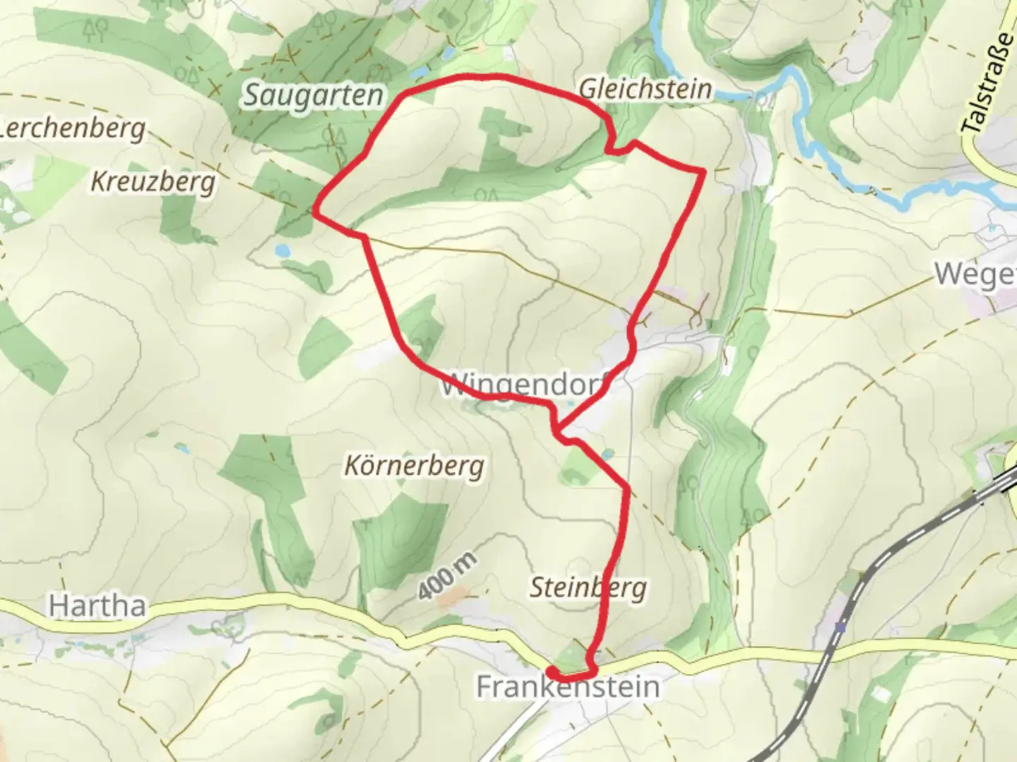
8.8 km
~2 hrs 1 min
158 m
Loop
“The Wingendorf Loop in Germany blends scenic views, historical landmarks, and moderate challenges over a 9 km trail.”
Starting near Mittelsachsen, Germany, the Wingendorf Loop is a delightful 9 km (5.6 miles) trail with an elevation gain of approximately 100 meters (328 feet). This loop trail is rated as medium difficulty, making it suitable for moderately experienced hikers.
Getting There
To reach the trailhead, you can either drive or use public transport. If driving, set your GPS to Wingendorf, Mittelsachsen, Germany. For those using public transport, take a train to the nearest station in Mittweida and then a local bus to Wingendorf. The trailhead is conveniently located near the village, making it easily accessible.
Trail Overview
The Wingendorf Loop offers a mix of forested paths, open meadows, and scenic viewpoints. The trail is well-marked, but it's always a good idea to have a reliable navigation tool like HiiKER to ensure you stay on track.
Key Sections and Landmarks
Forested Path
The initial part of the trail takes you through a dense forest, where you'll be surrounded by towering trees and the sounds of nature. This section is relatively flat, making it a good warm-up for the more challenging parts ahead. Keep an eye out for local wildlife such as deer and various bird species.
Open Meadows
About 3 km (1.9 miles) into the hike, the trail opens up into expansive meadows. This is a great spot to take a break and enjoy the panoramic views of the surrounding countryside. The elevation gain here is minimal, allowing you to catch your breath before the next ascent.
Historical Significance
As you continue, you'll come across several historical landmarks. One notable site is an old stone bridge dating back to the 18th century, located around the 5 km (3.1 miles) mark. This bridge was once a crucial crossing point for local traders and has been well-preserved over the years.
Scenic Viewpoints
Around the 7 km (4.3 miles) point, the trail ascends to a higher elevation, offering stunning views of the Mittelsachsen region. This is the steepest part of the hike, with an elevation gain of about 50 meters (164 feet) over a short distance. The effort is well worth it, as the viewpoint provides a perfect photo opportunity.
Flora and Fauna
The Wingendorf Loop is rich in biodiversity. In the forested sections, you'll find a variety of tree species, including oak, beech, and pine. The meadows are home to wildflowers, especially in the spring and summer months. Wildlife is abundant, so keep your eyes peeled for foxes, rabbits, and a variety of bird species.
Final Stretch
The last 2 km (1.2 miles) of the trail gradually descend back towards Wingendorf. This section is relatively easy, allowing you to cool down as you make your way back to the starting point. The trail loops back to where you began, making it convenient for those who parked their cars or need to catch a bus back to Mittweida.
Preparation Tips
Given the medium difficulty rating, it's advisable to wear sturdy hiking boots and bring plenty of water. The trail can be muddy in sections, especially after rain, so be prepared for varying trail conditions. A map or navigation tool like HiiKER is recommended to ensure you stay on the correct path.
The Wingendorf Loop offers a perfect blend of natural beauty, historical landmarks, and moderate physical challenge, making it a rewarding experience for any hiker.

What to expect?
Activity types
Comments and Reviews
User comments, reviews and discussions about the Wingendorf Loop, Germany.
average rating out of 5
0 rating(s)