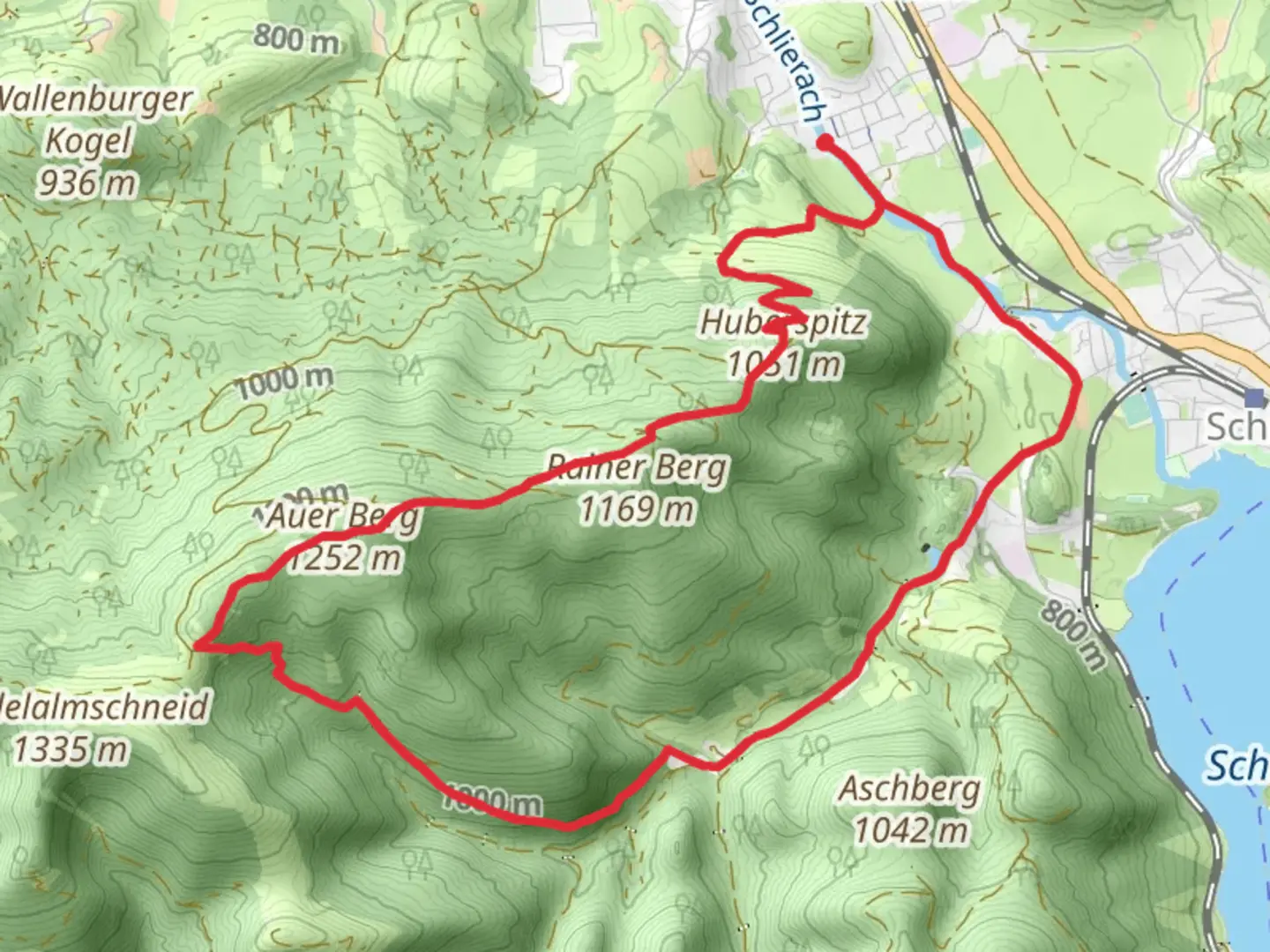
Auer Berg, Huberspitz and Stauweiher via Wanderweg and Maximiliansweg
Download
Preview
Add to list
More
11.8 km
~3 hrs 16 min
553 m
Loop
“Explore Bavarian beauty and history on this 12 km loop trail near Miesbach, Germany.”
Starting your adventure near Miesbach, Germany, this 12 km (7.5 miles) loop trail offers a delightful mix of natural beauty and historical intrigue. With an elevation gain of around 500 meters (1,640 feet), the trail is rated as medium difficulty, making it suitable for moderately experienced hikers.
Getting There To reach the trailhead, you can either drive or use public transport. If driving, set your GPS to Miesbach, a charming town in Bavaria. There are several parking options available near the trailhead. For those using public transport, Miesbach is well-connected by train from Munich. From the Miesbach train station, it's a short walk to the starting point of the trail.
The Hike The trail begins near Miesbach and quickly immerses you in the serene Bavarian countryside. As you start your ascent, you'll be greeted by lush forests and the occasional clearing that offers stunning views of the surrounding landscape.
#### Auer Berg Approximately 3 km (1.9 miles) into the hike, you'll reach Auer Berg. This section involves a steady climb, gaining about 200 meters (656 feet) in elevation. The summit provides panoramic views of the Bavarian Alps and the rolling hills below. It's a perfect spot for a short break and some photography.
#### Huberspitz Continuing on, the trail leads you to Huberspitz, another notable peak. This part of the hike is relatively easier, with gentle slopes and well-marked paths. Huberspitz is around 5 km (3.1 miles) from the start, and the elevation gain here is about 150 meters (492 feet). The area is known for its rich biodiversity, so keep an eye out for local wildlife such as deer and various bird species.
#### Stauweiher The final significant landmark on this trail is Stauweiher, a picturesque reservoir located about 8 km (5 miles) into the hike. The reservoir is surrounded by dense forest, making it a tranquil spot to rest and enjoy a packed lunch. The elevation gain here is minimal, allowing you to relax and soak in the natural beauty.
Historical Significance The region around Miesbach has a rich history, dating back to medieval times. The town itself is known for its traditional Bavarian architecture and has been a center for trade and culture for centuries. As you hike, you'll come across several old farmhouses and possibly even remnants of ancient trade routes that once connected various parts of Bavaria.
Navigation and Safety For navigation, it's highly recommended to use HiiKER, which provides detailed maps and real-time updates. The trail is well-marked, but having a reliable navigation tool will ensure you stay on track. Always carry sufficient water, snacks, and a first-aid kit. Weather in this region can be unpredictable, so check the forecast and dress in layers.
This trail offers a perfect blend of natural beauty, moderate physical challenge, and historical intrigue, making it a rewarding experience for any hiker.

What to expect?
Activity types
Comments and Reviews
User comments, reviews and discussions about the Auer Berg, Huberspitz and Stauweiher via Wanderweg and Maximiliansweg, Germany.
4.44
average rating out of 5
9 rating(s)