Download
Preview
Add to list
More
13.2 km
~3 hrs 25 min
478 m
Point-to-Point
“"Explore the Gladenbach to Rimberg trail: a scenic, moderately challenging 13 km hike rich in history."”
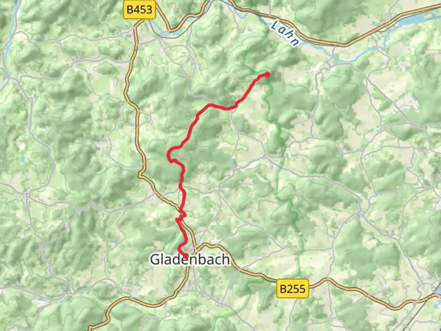
Starting near Marburg-Biedenkopf in Germany, the Gladenbach to Rimberg via Rimbergweg trail offers a delightful 13 km (8 miles) journey with an elevation gain of approximately 400 meters (1,312 feet). This point-to-point trail is rated as medium difficulty, making it suitable for moderately experienced hikers.
Getting There
To reach the trailhead, you can either drive or use public transport. If driving, head towards the town of Gladenbach, which is well-connected by road. For those using public transport, take a train to Marburg and then a bus to Gladenbach. The nearest significant landmark to the trailhead is the Gladenbach town center.
Trail Overview
The trail begins in the charming town of Gladenbach, known for its picturesque half-timbered houses and serene atmosphere. As you set off, you'll quickly find yourself immersed in lush forests and rolling hills. The initial part of the trail is relatively gentle, allowing you to ease into the hike.
Key Landmarks and Nature
Around the 3 km (1.9 miles) mark, you'll encounter the first significant ascent, gaining about 100 meters (328 feet) in elevation. This section offers stunning views of the surrounding countryside, dotted with small villages and expansive meadows. Keep an eye out for local wildlife, including deer and various bird species.
At approximately 6 km (3.7 miles), you'll reach the Rimberg, the highest point of the trail. The Rimberg is not just a natural high point but also a historical site. During medieval times, it served as a lookout point due to its strategic location. The panoramic views from here are breathtaking, offering a 360-degree vista of the Marburg-Biedenkopf region.
Historical Significance
The area around Rimberg has a rich history. In addition to its medieval significance, the region was also a site of various historical events during the Napoleonic Wars. Informational plaques along the trail provide insights into these historical contexts, making your hike both physically and intellectually enriching.
Final Stretch
As you descend from Rimberg, the trail becomes more forested, offering a cool and shaded path. This section is relatively easier, allowing you to enjoy the natural beauty without much exertion. The final 4 km (2.5 miles) lead you through dense woods and open fields, eventually bringing you to the endpoint near the town of Rimberg.
Navigation and Safety
For navigation, it's highly recommended to use the HiiKER app, which provides detailed maps and real-time updates. The trail is well-marked, but having a reliable navigation tool ensures you stay on track. Always carry sufficient water, snacks, and a basic first-aid kit. The weather can be unpredictable, so pack a light rain jacket and wear sturdy hiking boots.
This trail offers a perfect blend of natural beauty, moderate physical challenge, and historical intrigue, making it a rewarding experience for any hiker.

Comments and Reviews
User comments, reviews and discussions about the Gladenbach to Rimberg via Rimbergweg, Germany.
5.0
average rating out of 5
1 rating(s)