Download
Preview
Add to list
More
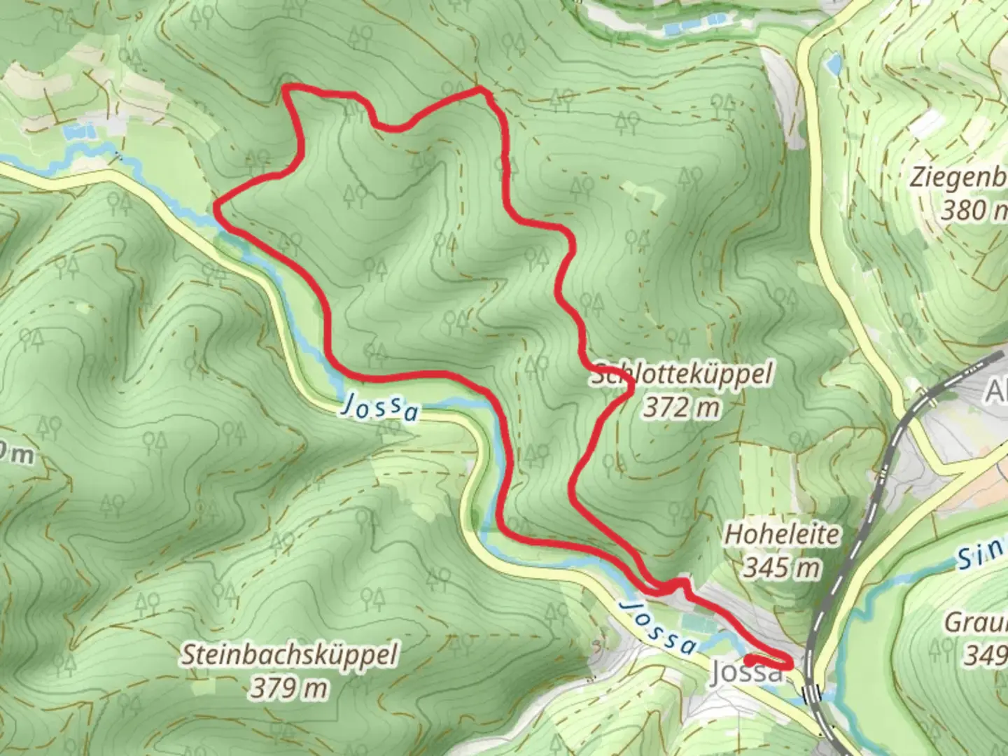
10.6 km
~2 hrs 28 min
210 m
Loop
“Discover the Jossa - Rundwanderweg Geweih: a scenic 11 km trail blending history, nature, and wildlife.”
Starting near Main-Kinzig-Kreis, Germany, the Jossa - Rundwanderweg Geweih is a picturesque loop trail that spans approximately 11 km (6.8 miles) with an elevation gain of around 200 meters (656 feet). This medium-difficulty trail offers a delightful mix of natural beauty, historical landmarks, and opportunities for wildlife observation.### Getting There To reach the trailhead, you can drive or use public transport. If driving, set your GPS to the nearest known address: Jossa, Main-Kinzig-Kreis, Germany. For those using public transport, take a train to the Jossa station, which is well-connected to major cities in the region. From the station, it's a short walk to the trailhead.### Trail Overview The trail begins in the charming village of Jossa, nestled in the heart of the Spessart Nature Park. As you set off, you'll be greeted by a serene landscape of dense forests, rolling hills, and open meadows. The initial section of the trail is relatively flat, making it a gentle start before the gradual ascent begins.### Points of Interest
Historical Landmarks
Around the 3 km (1.86 miles) mark, you'll come across the remnants of an old hunting lodge, a testament to the region's rich history. This area was once a favored hunting ground for local nobility, and the lodge offers a glimpse into the past.#### Natural Beauty As you continue, the trail meanders through lush beech and oak forests. Keep an eye out for the diverse flora and fauna; deer and wild boar are common sightings. Birdwatchers will also appreciate the variety of species that inhabit this area.#### Scenic Vistas At approximately 5 km (3.1 miles), you'll reach a vantage point offering panoramic views of the Spessart hills. This is an excellent spot for a break and some photography. The elevation gain here is about 100 meters (328 feet), providing a moderate challenge but rewarding you with stunning scenery.### Navigation and Safety The trail is well-marked, but it's always wise to have a reliable navigation tool. HiiKER is an excellent app for this purpose, offering detailed maps and real-time tracking to ensure you stay on course. ### Wildlife and Flora The Spessart region is known for its biodiversity. In spring and summer, the meadows are awash with wildflowers, while autumn brings a spectacular display of foliage. The forested sections are home to a variety of wildlife, including red foxes, badgers, and numerous bird species.### Final Stretch The last 3 km (1.86 miles) of the trail descend gently back towards Jossa. This section is particularly scenic, with the path winding through open fields and along the banks of a small stream. The total elevation loss here is around 100 meters (328 feet), making for a pleasant and easy finish.### Practical Information - Best Time to Hike: Spring through autumn for the best weather and scenery. - Facilities: Basic amenities are available in Jossa, including restrooms and a few local eateries. - Gear: Sturdy hiking boots, a map or navigation app like HiiKER, and plenty of water are recommended.This trail offers a perfect blend of natural beauty, historical intrigue, and moderate physical challenge, making it a rewarding experience for hikers of all levels.

Comments and Reviews
User comments, reviews and discussions about the Jossa - Rundwanderweg Geweih, Germany.
4.5
average rating out of 5
4 rating(s)