Download
Preview
Add to list
More
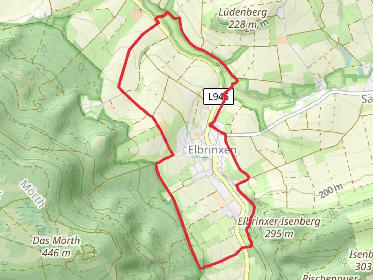
9.0 km
~2 hrs 2 min
147 m
Loop
“Explore the Rundweg um Elbrinxen trail for stunning landscapes, historical intrigue, and a touch of adventure.”
Nestled in the picturesque region of Kreis Lippe, Germany, the Rundweg um Elbrinxen is a delightful loop trail that spans approximately 9 kilometers (about 5.6 miles) with an elevation gain of around 100 meters (328 feet). This medium-difficulty trail offers a perfect blend of natural beauty, historical intrigue, and a touch of adventure for hikers of varying skill levels.
Getting There
To reach the trailhead, you can drive to the vicinity of Kreis Lippe, where parking is generally available near the starting point. For those relying on public transport, the nearest significant town is Lügde, which is well-connected by train. From Lügde, local buses or a short taxi ride can bring you to the trailhead, ensuring a convenient start to your hiking journey.
Trail Highlights
As you embark on the Rundweg um Elbrinxen, you'll be greeted by the serene landscapes typical of the North Rhine-Westphalia region. The trail meanders through lush forests, open meadows, and charming rural settings, offering a diverse array of scenery that changes with the seasons.
#### Nature and Wildlife
The trail is a haven for nature enthusiasts, with opportunities to spot a variety of local wildlife. Keep an eye out for deer grazing in the meadows and listen for the melodic calls of native bird species. The forested sections are rich with flora, including oak and beech trees, which provide a canopy of shade during the warmer months.
#### Historical Significance
The area surrounding Elbrinxen is steeped in history, with roots tracing back to medieval times. As you hike, you'll encounter remnants of historical structures and landmarks that tell the story of the region's past. Notably, the nearby town of Lügde is known for its traditional half-timbered houses and the annual Osterräderlauf, a unique Easter wheel-rolling festival that has been celebrated for centuries.
Navigation and Safety
While the trail is well-marked, it's advisable to use the HiiKER app for navigation to ensure you stay on course and make the most of your hike. The app provides detailed maps and real-time updates, which can be particularly useful in the more remote sections of the trail.
Trail Experience
The Rundweg um Elbrinxen offers a moderate challenge, with gentle inclines and declines that make it accessible to most hikers. The elevation gain is gradual, allowing for a comfortable pace as you take in the surrounding beauty. The loop nature of the trail ensures that you'll return to your starting point, making logistics straightforward.
Whether you're a seasoned hiker or a casual walker, the Rundweg um Elbrinxen promises a rewarding experience filled with natural wonders and historical charm.

What to expect?
Activity types
Comments and Reviews
User comments, reviews and discussions about the Rundweg um Elbrinxen, Germany.
average rating out of 5
0 rating(s)