Download
Preview
Add to list
More
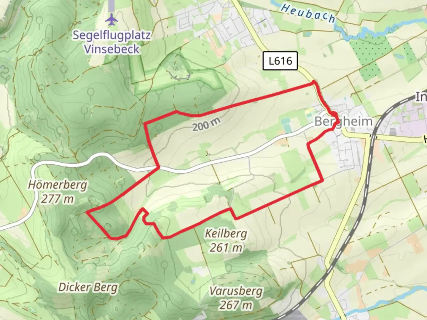
8.4 km
~2 hrs 4 min
240 m
Loop
“Explore the scenic 8 km Rundwanderweg A2 in Höxter, blending nature, history, and moderate adventure.”
Starting near Kreis Höxter, Germany, the Rundwanderweg A2 is an 8 km (approximately 5 miles) loop trail with an elevation gain of around 200 meters (656 feet). This medium-difficulty trail offers a blend of natural beauty, historical landmarks, and a moderate challenge suitable for most hikers.
Getting There
To reach the trailhead, you can either drive or use public transport. If driving, set your GPS to Kreis Höxter, and you will find parking options near the starting point. For those using public transport, take a train or bus to Höxter, and from there, local buses or taxis can take you to the trailhead.
Trail Navigation
For navigation, it's recommended to use the HiiKER app, which provides detailed maps and real-time updates to ensure you stay on track.
Trail Highlights
Nature and Wildlife
The trail meanders through a variety of landscapes, including dense forests, open meadows, and gentle hills. As you hike, keep an eye out for local wildlife such as deer, foxes, and a variety of bird species. The flora is equally diverse, with seasonal wildflowers adding splashes of color to the verdant scenery.
Historical Significance
One of the most notable landmarks along the trail is the Corvey Abbey, a UNESCO World Heritage site located approximately 3 km (1.8 miles) from the trailhead. This former Benedictine monastery dates back to the 9th century and offers a glimpse into the region's rich history. The abbey's architecture and well-preserved artifacts make it a must-see for history enthusiasts.
Trail Sections
Initial Ascent
The trail begins with a gentle ascent through a mixed forest. This section covers about 2 km (1.2 miles) and gains approximately 100 meters (328 feet) in elevation. The path is well-marked and relatively easy to navigate, making it a good warm-up for the more challenging sections ahead.
Mid-Trail Plateau
After the initial climb, the trail levels out onto a plateau, offering panoramic views of the surrounding countryside. This section is about 3 km (1.8 miles) long and is a great spot to take a break and enjoy the scenery. There are several benches and picnic areas where you can rest and refuel.
Descent and Return
The final section of the trail involves a gradual descent back towards the starting point. This 3 km (1.8 miles) stretch takes you through open meadows and along a small stream, providing a peaceful end to your hike. The descent is gentle, making it easy on the knees and a pleasant way to conclude your journey.
Practical Tips
- Footwear: Sturdy hiking boots are recommended due to the varied terrain.
- Weather: Check the weather forecast before heading out, as conditions can change rapidly.
- Water and Snacks: Bring enough water and snacks to keep your energy levels up, especially if you plan to explore the Corvey Abbey.
- Safety: Always let someone know your hiking plans and estimated return time.
By following these guidelines and using the HiiKER app for navigation, you can fully enjoy the Rundwanderweg A2 and all it has to offer.

Comments and Reviews
User comments, reviews and discussions about the Rundwanderweg A2, Germany.
average rating out of 5
0 rating(s)