Download
Preview
Add to list
More
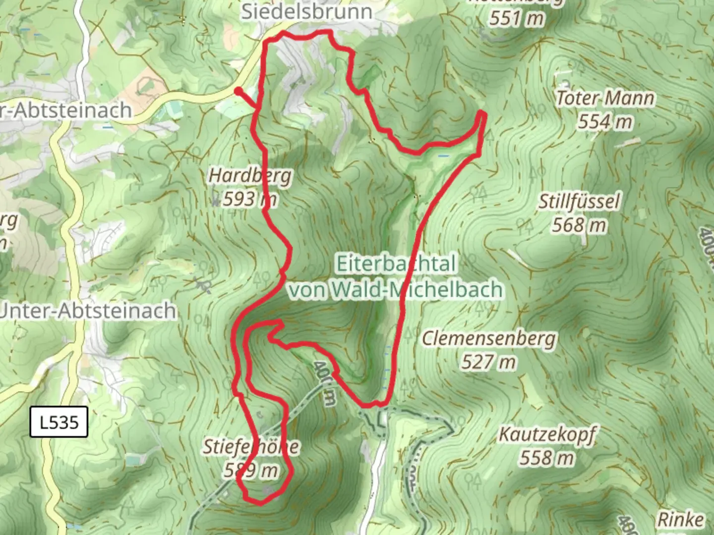
11.8 km
~3 hrs 10 min
492 m
Loop
“Explore the Eiterbachtal Weg and Wallfahrtsweg Lichtenklingen trail for stunning views and historical ruins.”
Starting near Kreis Bergstraße, Germany, the Eiterbachtal Weg and Wallfahrtsweg Lichtenklingen trail offers a scenic 12 km (7.5 miles) loop with an elevation gain of approximately 400 meters (1,312 feet). This medium-difficulty trail is perfect for those looking to explore the natural beauty and historical richness of the region.
Getting There To reach the trailhead, you can either drive or use public transport. If driving, set your GPS to Kreis Bergstraße, and look for parking near the trailhead. For public transport, take a train to the nearest station in Heppenheim (Bergstraße), and from there, you can catch a local bus or taxi to the starting point.
Trail Overview The trail begins with a gentle ascent through lush forests, where you'll be surrounded by a variety of native flora and fauna. Keep an eye out for deer and various bird species that inhabit the area. The first 3 km (1.9 miles) will take you through dense woodland, gradually climbing to an elevation of about 200 meters (656 feet).
Historical Significance Around the 4 km (2.5 miles) mark, you'll come across the ruins of Lichtenklingen Monastery, a significant historical landmark. This monastery dates back to the 12th century and offers a glimpse into the region's medieval past. Take some time to explore the ruins and imagine the lives of the monks who once lived there.
Scenic Views As you continue, the trail opens up to offer stunning views of the surrounding valleys and hills. At approximately 6 km (3.7 miles), you'll reach the highest point of the trail, around 400 meters (1,312 feet) above sea level. This is a great spot to take a break and enjoy the panoramic views.
Navigating the Trail The trail is well-marked, but it's always a good idea to have a reliable navigation tool. Use HiiKER to ensure you stay on the right path and to get real-time updates on your progress. The app will also provide you with information on any upcoming turns or landmarks.
Wildlife and Nature Descending from the highest point, the trail takes you through a mix of open meadows and forested areas. This section is particularly rich in wildlife, so keep your camera ready. You might spot foxes, wild boars, and a variety of bird species. The descent is gradual, making it easier on the knees and allowing you to fully appreciate the natural surroundings.
Final Stretch The last 3 km (1.9 miles) of the trail bring you back through the Eiterbachtal valley, where you'll follow a picturesque stream. This part of the trail is relatively flat and offers a peaceful end to your hike. The sound of the flowing water and the sight of small waterfalls make this section particularly enjoyable.
Practical Tips - Wear sturdy hiking boots, as some sections can be rocky and uneven. - Bring enough water and snacks, especially if you plan to take your time exploring the historical sites. - Check the weather forecast before you go, as the trail can be slippery after rain. - Use HiiKER for navigation and to stay updated on trail conditions.
This trail offers a perfect blend of natural beauty, historical intrigue, and moderate physical challenge, making it a rewarding experience for any hiker.

Comments and Reviews
User comments, reviews and discussions about the Eiterbachtal Weg and Wallfahrtsweg Lichtenklingen, Germany.
4.4
average rating out of 5
5 rating(s)