Download
Preview
Add to list
More
10.7 km
~2 hrs 32 min
247 m
Point-to-Point
“Experience a harmonious blend of scenic beauty and rich history on this moderately challenging Franconian hike.”
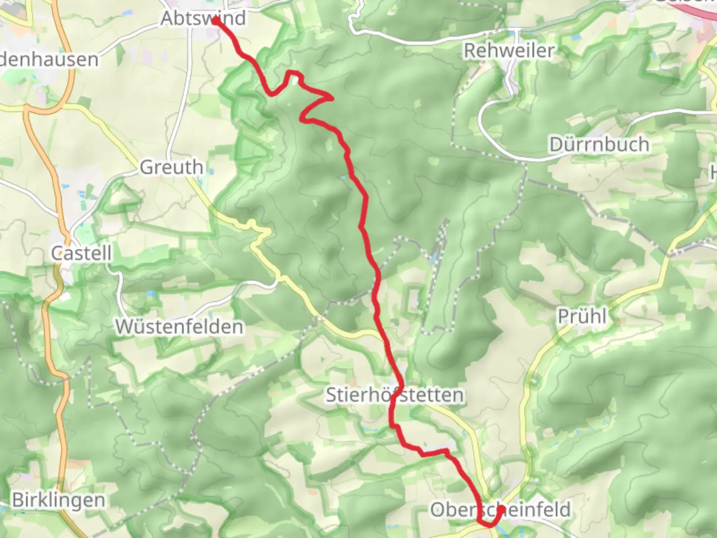
Starting your journey near the charming town of Kitzingen, Germany, the trail from Abtswind to Oberscheinfeld via Hoellbachweg and O2 offers a delightful mix of natural beauty and cultural history. This point-to-point trail stretches approximately 11 kilometers (about 6.8 miles) with an elevation gain of around 200 meters (approximately 656 feet), making it a moderately challenging hike suitable for those with some hiking experience.
Getting There
To reach the trailhead, you can drive to Abtswind, which is conveniently located near Kitzingen. If you're using public transport, take a train to Kitzingen and then a local bus or taxi to Abtswind. The trailhead is easily accessible and well-marked, ensuring a smooth start to your adventure.
Trail Highlights
As you set off from Abtswind, you'll be greeted by the serene landscapes typical of the Franconian region. The trail meanders through lush forests and open fields, offering a peaceful escape from urban life. The initial part of the hike is relatively gentle, allowing you to ease into the journey.
Hoellbachweg
Approximately 3 kilometers (1.9 miles) into the hike, you'll encounter the Hoellbachweg section. This part of the trail is known for its picturesque views of the surrounding countryside. The path follows the gentle curves of the Hoellbach stream, providing a soothing soundtrack of flowing water. Keep an eye out for local wildlife, including deer and various bird species that inhabit the area.
Historical Significance
The region is steeped in history, with several points of interest along the way. As you continue your hike, you'll pass through areas that have been inhabited since ancient times. The trail itself has been used for centuries, serving as a route for traders and travelers. The nearby villages, such as Abtswind and Oberscheinfeld, boast traditional Franconian architecture and are worth exploring if time permits.
Navigation and Safety
The trail is well-marked, but it's always wise to have a reliable navigation tool. HiiKER is an excellent resource for ensuring you stay on track. The app provides detailed maps and real-time updates, making it easier to navigate the trail's twists and turns.
Final Stretch to Oberscheinfeld
As you approach the final stretch towards Oberscheinfeld, the trail begins to ascend slightly, offering panoramic views of the surrounding hills and valleys. This section can be a bit more demanding, but the breathtaking vistas make the effort worthwhile. Upon reaching Oberscheinfeld, you'll find a quaint village with opportunities to relax and enjoy local cuisine.
This hike from Abtswind to Oberscheinfeld via Hoellbachweg and O2 is a rewarding journey through one of Germany's most picturesque regions. Whether you're drawn by the natural beauty, the historical intrigue, or the challenge of the trail itself, this hike promises an unforgettable experience.

Comments and Reviews
User comments, reviews and discussions about the Abtswind to Oberscheinfeld via Hoellbachweg and O2, Germany.
average rating out of 5
0 rating(s)