Download
Preview
Add to list
More
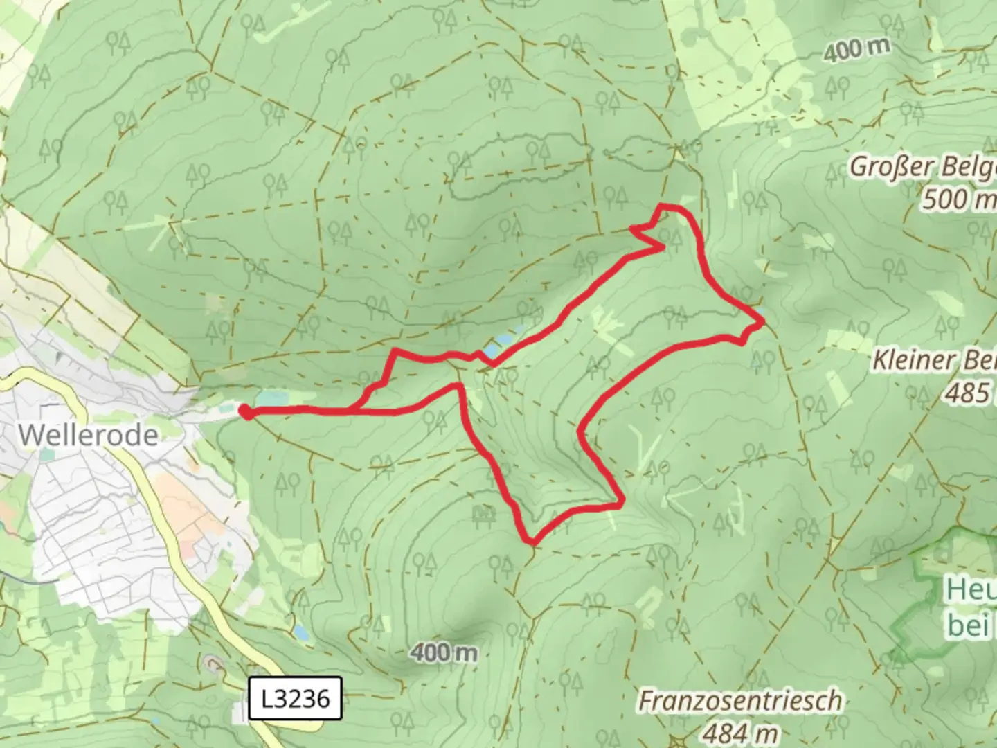
7.6 km
~1 hrs 47 min
165 m
Loop
“Discover the Fulda-Gelster Weg, an 8 km scenic loop offering natural beauty, history, and moderate hiking.”
Starting near Kassel, Germany, the Fulda-Gelster Weg and Soehrewald Wellerode Rundweg is a delightful loop trail that spans approximately 8 km (5 miles) with an elevation gain of around 100 meters (328 feet). This medium-difficulty trail offers a blend of natural beauty, historical landmarks, and a touch of local wildlife, making it a rewarding experience for hikers of all levels.
Getting There
To reach the trailhead, you can either drive or use public transport. If you're driving, set your GPS to Wellerode, a small village near Kassel. There is ample parking available near the village center. For those using public transport, take a train to Kassel-Wilhelmshöhe station and then a bus to Wellerode. The bus ride offers scenic views of the surrounding countryside, setting the mood for your hike.
Trail Overview
The trail begins in Wellerode, a charming village known for its traditional German architecture. As you start your hike, you'll be greeted by well-marked paths that guide you through a mix of dense forests and open meadows. The initial part of the trail is relatively flat, making it an easy start for warming up.
Points of Interest
Wellerode Forest
About 2 km (1.2 miles) into the hike, you'll enter the Wellerode Forest. This section is particularly enchanting, with tall trees forming a natural canopy overhead. Keep an eye out for local wildlife such as deer and various bird species. The forest floor is often carpeted with wildflowers in the spring, adding a splash of color to your hike.
Historical Landmarks
Around the 4 km (2.5 miles) mark, you'll come across the remnants of an old watchtower. This tower dates back to the medieval period and was part of a network of fortifications used to protect the region. It's a great spot to take a break and soak in some history. Information plaques provide details about the tower's significance and the role it played in local defense.
Elevation Gain
As you continue, the trail begins to ascend gradually. The elevation gain is spread out over the next 2 km (1.2 miles), making it manageable even for those who are not seasoned hikers. The highest point of the trail offers panoramic views of the surrounding countryside, including the distant cityscape of Kassel.
Navigation
For navigation, it's highly recommended to use the HiiKER app, which provides detailed maps and real-time updates. The trail is well-marked, but having a reliable navigation tool ensures you stay on track and can explore any interesting detours without getting lost.
Flora and Fauna
The final stretch of the trail takes you through a series of meadows and small streams. This area is rich in biodiversity, with various species of plants and insects. In the summer months, you might even spot butterflies fluttering around the wildflowers. The streams are crystal clear and provide a refreshing spot to cool off before completing your loop.
Returning to Wellerode
The last 2 km (1.2 miles) of the trail are a gentle descent back into Wellerode. As you approach the village, you'll pass by several traditional German houses and gardens, offering a picturesque end to your hike. There are a few local cafes and bakeries where you can grab a bite to eat and relax after your adventure.
This trail offers a perfect blend of natural beauty, historical intrigue, and moderate physical challenge, making it a must-visit for anyone in the Kassel area.

Comments and Reviews
User comments, reviews and discussions about the Fulda-Gelster Weg and Soehrewald Wellerode Rundweg, Germany.
5.0
average rating out of 5
1 rating(s)