Katzenstein, Marchengrund, Ravensberg and Ratsberg Loop via Karlsfelsen
Download
Preview
Add to list
More
8.4 km
~2 hrs 13 min
330 m
Loop
“This 8 km loop near Göttingen blends moderate hikes, stunning nature, and rich history for a rewarding adventure.”
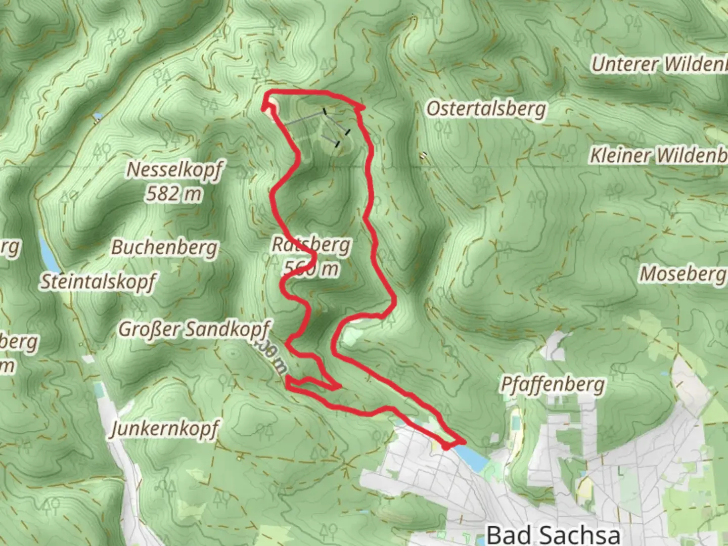
Starting near Göttingen, Germany, the Katzenstein, Marchengrund, Ravensberg, and Ratsberg Loop via Karlsfelsen is an 8 km (approximately 5 miles) loop trail with an elevation gain of around 300 meters (984 feet). This medium-difficulty trail offers a blend of natural beauty, historical landmarks, and diverse wildlife, making it a rewarding experience for hikers.
Getting There
To reach the trailhead, you can either drive or use public transport. If driving, head towards Göttingen and follow signs to the starting point near the Göttingen Forest. For public transport, take a train to Göttingen Hauptbahnhof (main station) and then a local bus towards the Göttingen Forest area. The nearest significant landmark to the trailhead is the Göttingen Forest parking area.
Trail Overview
The trail begins with a gentle ascent through dense forest, providing a serene atmosphere as you make your way towards Katzenstein. This initial section is relatively easy, allowing you to warm up before the more challenging parts of the hike.
Katzenstein
At approximately 2 km (1.2 miles) into the hike, you'll reach Katzenstein, a rocky outcrop offering panoramic views of the surrounding forest and valleys. This is a great spot for a short break and some photography. The elevation gain here is around 100 meters (328 feet), making it a moderate climb.
Marchengrund
Continuing on, the trail leads you to Marchengrund, a mystical area known for its fairy-tale-like scenery. The dense forest and unique rock formations create an enchanting atmosphere. This section is relatively flat, allowing you to enjoy the surroundings without much effort.
Ravensberg
Around the 4 km (2.5 miles) mark, you'll start the ascent to Ravensberg. This is the most challenging part of the hike, with an elevation gain of about 150 meters (492 feet). The climb is steep but manageable, and the effort is well worth it. At the summit, you'll find a lookout tower offering 360-degree views of the region. On clear days, you can see as far as the Harz Mountains.
Ratsberg and Karlsfelsen
Descending from Ravensberg, the trail takes you towards Ratsberg. This section is a mix of gentle slopes and flat terrain, making it a pleasant walk. At around 6 km (3.7 miles), you'll reach Karlsfelsen, another rocky outcrop with impressive views. This is a great spot to rest and take in the scenery before completing the loop.
Wildlife and Flora
The trail is home to a variety of wildlife, including deer, foxes, and numerous bird species. The forest is rich with flora, featuring oak, beech, and pine trees. During spring and summer, the area is adorned with wildflowers, adding a splash of color to the landscape.
Historical Significance
The Göttingen Forest has a rich history, with evidence of human activity dating back to the Bronze Age. The area around Ravensberg was historically significant as a lookout point, and remnants of old fortifications can still be seen. The trail itself has been used for centuries, making it a walk through both natural beauty and historical intrigue.
Navigation
For navigation, it is highly recommended to use the HiiKER app, which provides detailed maps and real-time tracking to ensure you stay on the right path. The trail is well-marked, but having a reliable navigation tool can enhance your hiking experience.
This 8 km loop offers a perfect blend of moderate physical challenge, stunning natural beauty, and historical significance, making it a must-do for any hiking enthusiast visiting the Göttingen area.

What to expect?
Activity types
Comments and Reviews
User comments, reviews and discussions about the Katzenstein, Marchengrund, Ravensberg and Ratsberg Loop via Karlsfelsen, Germany.
4.71
average rating out of 5
7 rating(s)