Download
Preview
Add to list
More
11.6 km
~3 hrs 13 min
552 m
Point-to-Point
“Embark on a picturesque 12 km hike through the Harz Mountains, blending natural beauty and historical significance.”
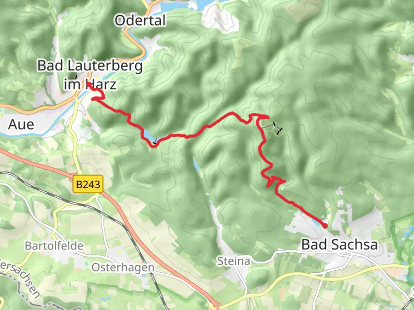
Starting near Göttingen, Germany, the trail from Bad Lauterberg to Bad Sachsa via Wiesenbeker Teich offers a delightful 12 km (7.5 miles) journey through the picturesque Harz Mountains. With an elevation gain of approximately 500 meters (1,640 feet), this point-to-point trail is rated as medium difficulty, making it suitable for moderately experienced hikers.
Getting There
To reach the trailhead, you can take a train to Bad Lauterberg im Harz, which is well-connected via Göttingen. From the train station, it's a short walk to the starting point. If you're driving, parking is available near the trailhead in Bad Lauterberg.
Trail Overview
The trail begins in the charming town of Bad Lauterberg, known for its spa and wellness facilities. As you set off, you'll quickly find yourself immersed in lush forests, with the path winding through dense woodlands and offering occasional clearings that provide stunning views of the surrounding landscape.
Wiesenbeker Teich
Around 3 km (1.9 miles) into the hike, you'll encounter Wiesenbeker Teich, a serene reservoir that dates back to the 18th century. This area is perfect for a short break, allowing you to enjoy the tranquil waters and perhaps spot some local wildlife, such as ducks and herons. The reservoir is part of the Upper Harz Water Regale, a UNESCO World Heritage site, highlighting its historical significance in the region's mining history.
Ascending the Harz Mountains
Continuing on, the trail begins to ascend more steeply, gaining elevation as you move deeper into the Harz Mountains. The climb can be challenging, but the well-maintained path and the occasional switchbacks make it manageable. As you ascend, keep an eye out for the diverse flora, including ancient beech and oak trees, as well as various species of ferns and wildflowers.
Scenic Vistas
Approximately 7 km (4.3 miles) into the hike, you'll reach some of the highest points on the trail, offering panoramic views of the Harz region. These vantage points are perfect for photography and provide a rewarding sense of accomplishment after the climb. On clear days, you can see for miles, with the rolling hills and dense forests stretching out before you.
Descent to Bad Sachsa
The final stretch of the trail involves a gradual descent into the town of Bad Sachsa. As you make your way down, the path becomes less steep, allowing for a more leisurely pace. The descent offers a mix of forested areas and open meadows, with the occasional stream crossing adding to the trail's charm.
Arrival in Bad Sachsa
Upon reaching Bad Sachsa, you'll find a welcoming town with plenty of amenities, including cafes, restaurants, and shops. The town is also known for its spa facilities, making it an ideal place to relax and rejuvenate after your hike.
Navigation and Safety
For navigation, it's recommended to use the HiiKER app, which provides detailed maps and real-time updates to ensure you stay on track. Always carry sufficient water, snacks, and appropriate clothing, as weather conditions can change rapidly in the mountains.
This trail offers a blend of natural beauty, historical significance, and moderate physical challenge, making it a rewarding experience for those looking to explore the Harz Mountains.

What to expect?
Activity types
Comments and Reviews
User comments, reviews and discussions about the Bad Lauterberg to Bad Sachsa Walk via Wiesenbeker Teich, Germany.
average rating out of 5
0 rating(s)