Download
Preview
Add to list
More
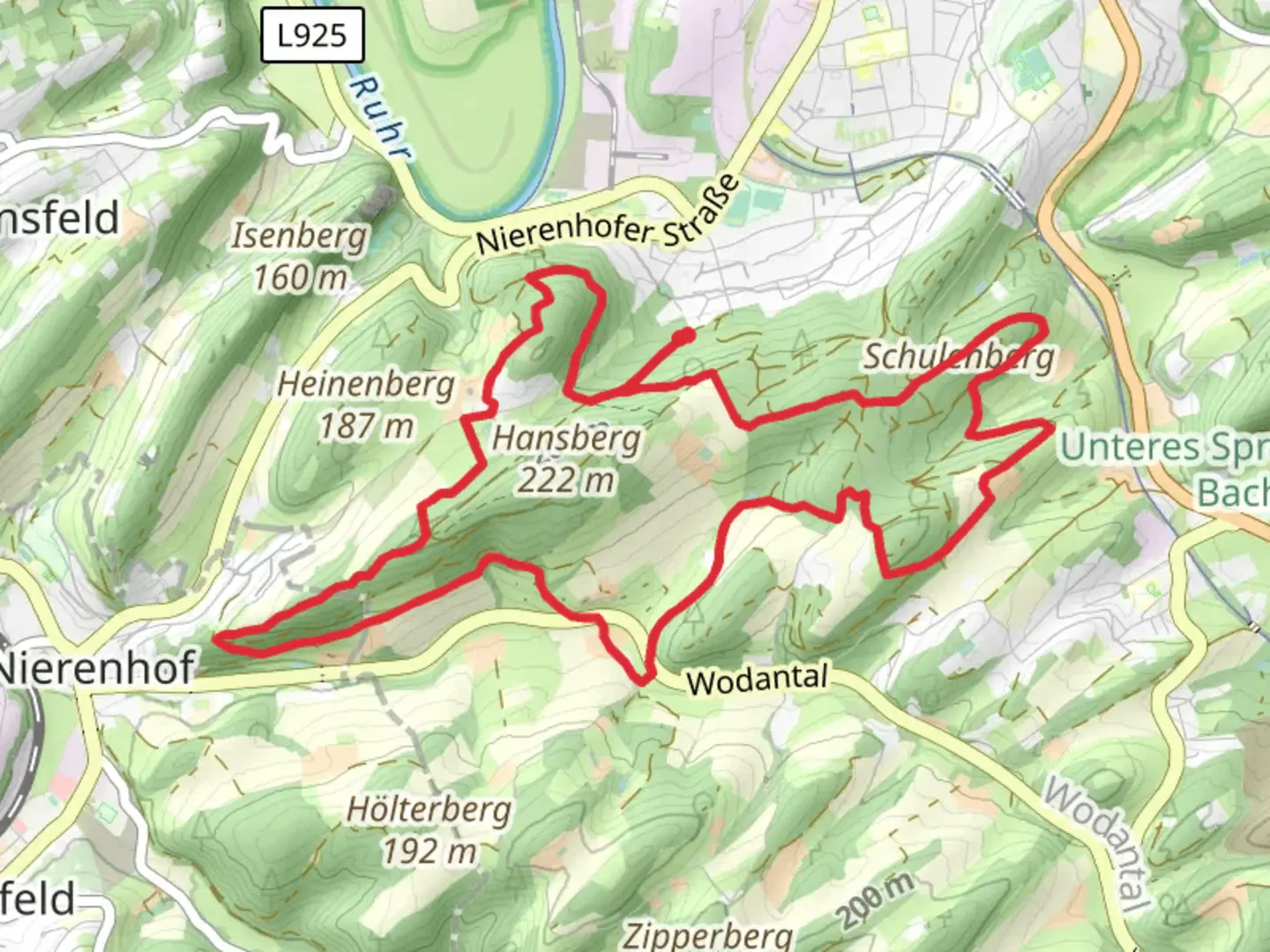
11.5 km
~2 hrs 49 min
310 m
Loop
“Discover the GeoRoute Ruhr, a captivating blend of nature, history, and challenging terrains for seasoned hikers.”
Nestled in the picturesque Ennepe-Ruhr-Kreis region of Germany, the GeoRoute Ruhr and Rund um Hattingen trail offers a challenging yet rewarding hiking experience. This 12 km (approximately 7.5 miles) loop trail boasts an elevation gain of around 300 meters (about 984 feet), making it a demanding trek suitable for experienced hikers. The trailhead is conveniently located near the charming town of Hattingen, which is easily accessible by both public transport and car.
Getting There
For those traveling by public transport, Hattingen is well-connected via regional trains and buses. The nearest major train station is Hattingen (Ruhr) Mitte, from where local buses can take you closer to the trailhead. If you prefer to drive, Hattingen is accessible via the A43 and A44 motorways, with ample parking available in the town.
Trail Highlights
The GeoRoute Ruhr and Rund um Hattingen trail is renowned for its diverse landscapes and rich historical significance. As you embark on this loop, you'll traverse through dense forests, open meadows, and along the scenic Ruhr River. The trail is well-marked, but it's advisable to use the HiiKER app for navigation to ensure you stay on course.
#### Historical Significance
Hattingen is steeped in history, and this trail offers glimpses into its industrial past. As you hike, you'll encounter remnants of the region's coal mining heritage, including old mining structures and informative plaques detailing the area's significance during the industrial revolution. The trail also passes by the Henrichshütte Ironworks, a testament to the region's metallurgical history, now transformed into an engaging museum.
#### Natural Beauty and Wildlife
The trail's natural beauty is equally captivating. The Ruhr Valley is home to a variety of flora and fauna, and hikers may spot deer, foxes, and a plethora of bird species. The lush forests provide a serene backdrop, especially during the spring and autumn months when the foliage is particularly vibrant.
Trail Challenges
Given its difficulty rating, hikers should be prepared for steep ascents and descents, particularly in the sections where the trail winds through hilly terrain. Proper hiking boots and poles are recommended to navigate these challenging parts safely. The trail can be muddy and slippery after rain, so checking weather conditions before setting out is advisable.
Points of Interest
Around the halfway mark, the trail offers panoramic views of the Ruhr Valley, a perfect spot for a rest and some photography. Additionally, the historic town of Hattingen itself is worth exploring either before or after your hike. Its well-preserved medieval architecture, including the St. George's Church and the picturesque old town, provides a charming contrast to the natural landscapes of the trail.
Embarking on the GeoRoute Ruhr and Rund um Hattingen trail promises a blend of natural beauty, historical intrigue, and physical challenge, making it a must-visit for avid hikers seeking an enriching outdoor adventure in Germany.

Comments and Reviews
User comments, reviews and discussions about the GeoRoute Ruhr and Rund um Hattingen, Germany.
4.5
average rating out of 5
2 rating(s)