Download
Preview
Add to list
More
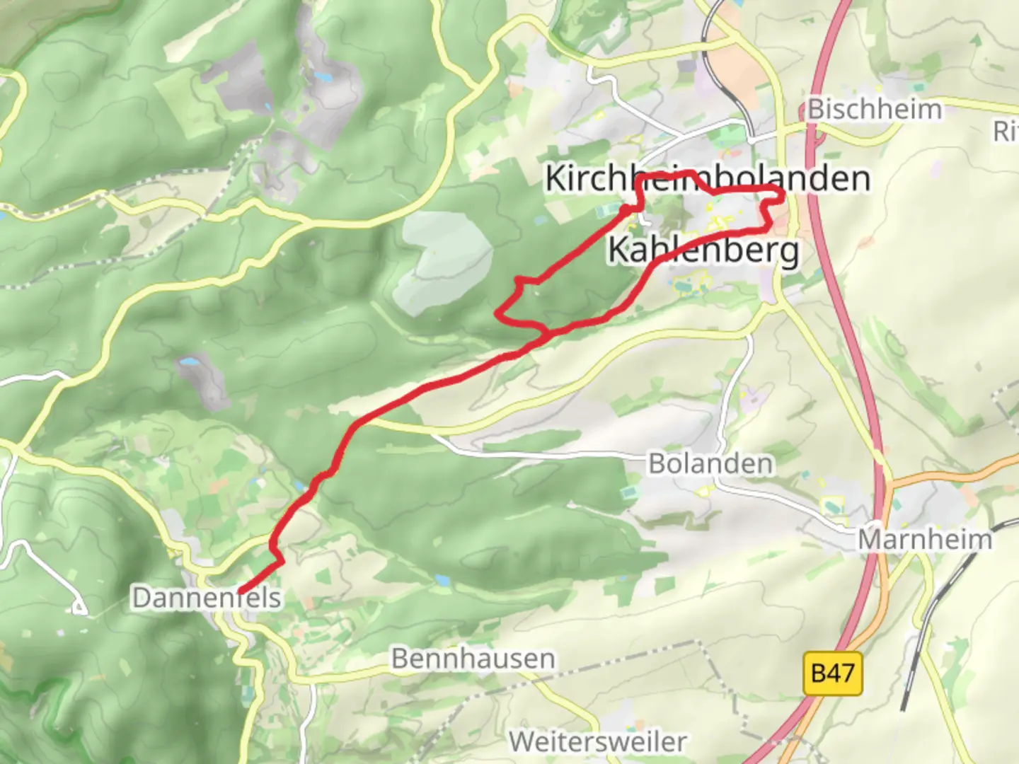
16.2 km
~3 hrs 52 min
386 m
Loop
“Explore lush landscapes and historical ruins on the serene Kirchheimbolanden Loop hike in Germany.”
Nestled in the picturesque region of Donnersbergkreis, Germany, the Kirchheimbolanden Loop offers a delightful hiking experience that spans approximately 16 kilometers (about 10 miles) with an elevation gain of around 300 meters (approximately 984 feet). This easy-rated loop trail is perfect for hikers of all levels, providing a serene escape into nature with a touch of historical intrigue.
Getting There
To reach the trailhead, which is conveniently located near the town of Kirchheimbolanden, you have several options. If you're traveling by car, you can easily access the area via the A63 motorway, taking the Kirchheimbolanden exit. For those relying on public transport, the nearest train station is Kirchheimbolanden Bahnhof. From there, local buses or a short taxi ride can bring you to the trailhead.
Trail Highlights
Scenic Landscapes and Natural Beauty
As you embark on the Kirchheimbolanden Loop, you'll be greeted by the rolling hills and lush forests characteristic of the Rhineland-Palatinate region. The trail meanders through a variety of landscapes, including open meadows and dense woodlands, offering a diverse array of flora and fauna. Keep an eye out for native wildlife such as deer and various bird species that inhabit the area.
Historical Significance
The region around Donnersbergkreis is steeped in history, and this trail provides glimpses into its past. One notable landmark is the ruins of the medieval castle, Burg Stauf, located near the trail. This castle, once a formidable fortress, now stands as a testament to the area's rich history. As you hike, you'll also encounter remnants of ancient settlements and historical markers that tell the story of the people who once inhabited this land.
Navigating the Trail
The Kirchheimbolanden Loop is well-marked, making navigation straightforward. However, for those who prefer digital assistance, the HiiKER app is an excellent tool to ensure you stay on track and make the most of your hiking experience. The app provides detailed maps and real-time navigation, allowing you to explore with confidence.
Points of Interest
Donnersberg Mountain
While the trail itself does not ascend Donnersberg, the highest peak in the Palatinate region, it offers stunning views of this majestic mountain. Standing at 687 meters (2,254 feet), Donnersberg is a prominent feature of the landscape and adds to the scenic allure of the hike.
Local Flora and Fauna
Throughout the hike, you'll encounter a rich tapestry of plant life, from vibrant wildflowers in the spring to the golden hues of autumn leaves. The diverse ecosystem supports a variety of wildlife, making it a haven for nature enthusiasts and photographers alike.
Practical Tips
Given the trail's easy difficulty rating, it is suitable for families and casual hikers. However, it's always wise to wear sturdy footwear and bring sufficient water, especially during warmer months. The loop nature of the trail ensures that you'll return to your starting point, making logistics simple and convenient.
Whether you're drawn by the natural beauty, the historical landmarks, or the peaceful ambiance, the Kirchheimbolanden Loop promises a rewarding hiking experience in the heart of Germany's enchanting countryside.

Comments and Reviews
User comments, reviews and discussions about the Kirchheimbolanden Loop, Germany.
average rating out of 5
0 rating(s)