Download
Preview
Add to list
More
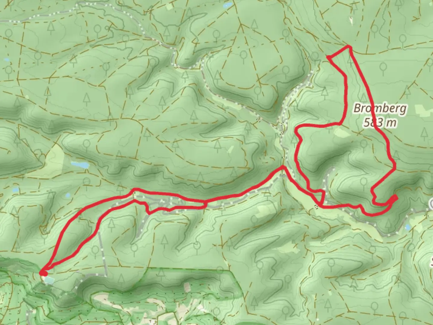
14.7 km
~3 hrs 30 min
341 m
Loop
“Explore Böblingen's scenic loop trail, where diverse landscapes and panoramic views promise a captivating adventure.”
Nestled near the charming town of Böblingen, Germany, the Bromberg and Falkenkopf Loop offers a delightful hiking experience through the picturesque landscapes of the Swabian region. This 15 km (approximately 9.3 miles) loop trail presents a moderate challenge with an elevation gain of around 300 meters (about 984 feet), making it suitable for hikers with some experience.
Getting There
To reach the trailhead, you can easily access Böblingen by public transport or car. If you're traveling by train, Böblingen is well-connected via the S-Bahn network from Stuttgart, with frequent services making it a convenient option. From the Böblingen train station, local buses or a short taxi ride can take you to the trailhead. For those driving, Böblingen is accessible via the A81 motorway, with ample parking options available near the starting point.
Trail Highlights
The loop begins near Böblingen and quickly immerses you in the serene beauty of the surrounding forests. As you embark on the trail, you'll traverse a variety of landscapes, from dense woodlands to open meadows, offering a diverse range of flora and fauna. Keep an eye out for native wildlife, including deer and a variety of bird species, which are often spotted along the route.
#### Bromberg Section
The initial part of the hike takes you through the Bromberg area, where you'll encounter gently rolling hills and lush greenery. This section is particularly known for its vibrant wildflowers during the spring and summer months, painting the landscape with a stunning array of colors. The trail here is well-marked, but it's advisable to use the HiiKER app for navigation to ensure you stay on track.
#### Falkenkopf Ascent
As you progress, the trail leads you to the Falkenkopf, the highest point of the loop. This ascent is the most challenging part of the hike, with a steady climb that rewards you with panoramic views of the surrounding countryside. The elevation gain here is approximately 150 meters (492 feet), providing a satisfying workout for those seeking a bit of a challenge. On a clear day, the vistas from the top are truly breathtaking, offering a perfect spot for a rest and a picnic.
Historical Significance
The region around Böblingen is steeped in history, with several points of interest along the trail. The area was historically significant during the Thirty Years' War, and remnants of old fortifications can still be found in the vicinity. Additionally, the nearby town of Böblingen itself has a rich history, with its origins dating back to the 13th century. Consider taking some time to explore the town either before or after your hike to appreciate its historical architecture and local culture.
Practical Information
The Bromberg and Falkenkopf Loop is best enjoyed during the spring and autumn months when the weather is mild, and the natural beauty of the area is at its peak. Be sure to wear sturdy hiking boots, as some sections of the trail can be uneven and muddy, especially after rain. Carry sufficient water and snacks, as there are limited facilities along the route. Always check the weather forecast before setting out, and consider downloading the HiiKER app for offline navigation to enhance your hiking experience.

Comments and Reviews
User comments, reviews and discussions about the Bromberg and Falkenkopf Loop, Germany.
average rating out of 5
0 rating(s)