Download
Preview
Add to list
More
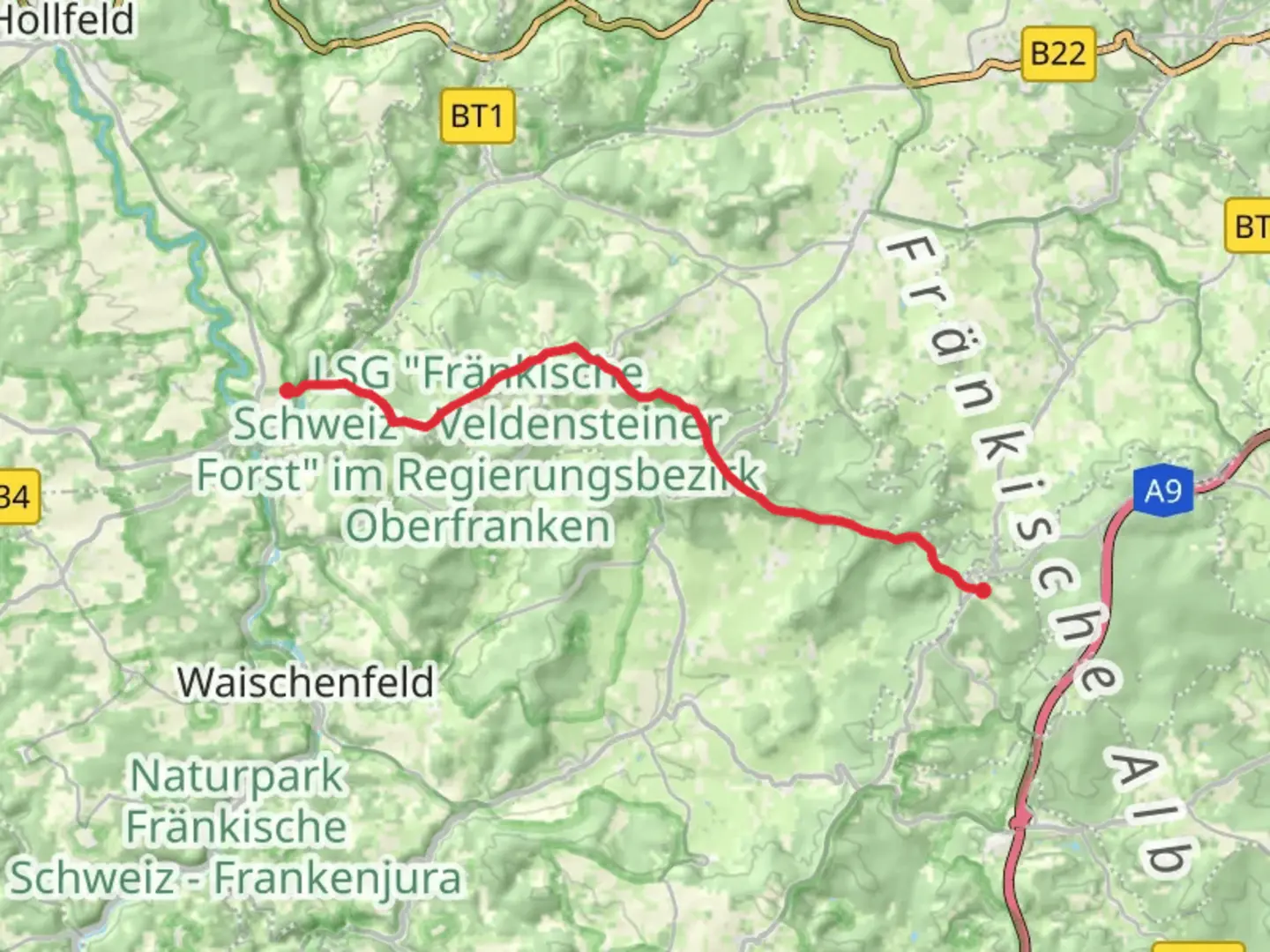
13.9 km
~3 hrs 35 min
490 m
Point-to-Point
“Explore Franconian Switzerland's enchanting landscapes and history on a captivating trail from Plankenfels to Muthmannsreuth.”
Nestled in the picturesque region near Bayreuth, Germany, the trail from Plankenfels to Muthmannsreuth via the Fraenkischer Gebirgsweg offers a captivating journey through the heart of Franconian Switzerland. Spanning approximately 14 kilometers (about 8.7 miles) with an elevation gain of around 400 meters (approximately 1,312 feet), this point-to-point trail is rated as medium in difficulty, making it suitable for hikers with some experience.
Getting There
To reach the trailhead near Plankenfels, travelers can opt for public transport or drive. If you're using public transport, Bayreuth serves as a convenient hub. From Bayreuth, take a regional bus towards Plankenfels, which is well-connected and offers a scenic introduction to the region. For those driving, Bayreuth is accessible via the A9 motorway, and from there, follow the signs to Plankenfels. Parking is available near the trailhead, allowing for a seamless start to your hike.
Trail Highlights
As you embark on this journey, the trail meanders through the enchanting landscapes of Franconian Switzerland, renowned for its rugged rock formations, dense forests, and charming villages. The Fraenkischer Gebirgsweg is part of a larger network of trails, celebrated for its natural beauty and cultural heritage.
#### Nature and Wildlife
The trail offers a diverse array of flora and fauna. Hikers can expect to encounter lush deciduous forests, interspersed with patches of coniferous trees. In spring and summer, the path is adorned with wildflowers, providing a vibrant backdrop to your hike. Wildlife enthusiasts may spot deer, foxes, and a variety of bird species, including woodpeckers and songbirds.
#### Historical Significance
This region is steeped in history, with evidence of human settlement dating back to prehistoric times. As you traverse the trail, you'll pass through areas that have been inhabited for centuries, with remnants of medieval castles and fortifications dotting the landscape. These historical sites offer a glimpse into the past, providing context to the cultural evolution of the area.
Navigation and Safety
The trail is well-marked, but it's advisable to use a reliable navigation tool like HiiKER to ensure you stay on course. The path includes some steep sections and uneven terrain, so sturdy hiking boots are recommended. Weather conditions can change rapidly, so be prepared with appropriate clothing and gear.
Points of Interest
Approximately halfway through the hike, you'll reach the village of Aufseß, known for its traditional Franconian architecture and local breweries. It's an ideal spot to take a break and enjoy some regional delicacies. Continuing on, the trail offers panoramic views of the surrounding valleys and hills, particularly as you approach Muthmannsreuth.
This hike is a delightful blend of natural beauty, historical intrigue, and cultural richness, making it a rewarding experience for those who venture along its path.

What to expect?
Activity types
Comments and Reviews
User comments, reviews and discussions about the Plankenfels to Muthmannsreuth via Fraenkischer Gebirgsweg, Germany.
average rating out of 5
0 rating(s)