Download
Preview
Add to list
More
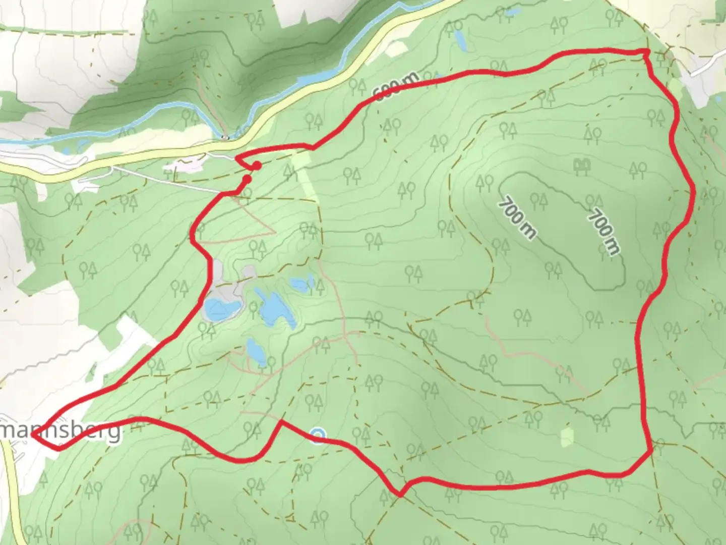
6.7 km
~1 hrs 43 min
229 m
Loop
“The Gefrees Rundwanderweg offers a scenic 7 km hike blending nature, history, and local wildlife.”
Nestled near Bayreuth, Germany, the Gefrees Rundwanderweg is a delightful loop trail that spans approximately 7 km (4.3 miles) with an elevation gain of around 200 meters (656 feet). This medium-difficulty trail offers a blend of natural beauty, historical landmarks, and a touch of local wildlife, making it a rewarding experience for hikers.### Getting ThereTo reach the trailhead, you can either drive or use public transport. If you're driving, head towards Gefrees, a small town near Bayreuth. The nearest significant landmark to the trailhead is the Gefrees Town Hall (Rathaus Gefrees), located at Marktplatz 1, 95482 Gefrees, Germany. There is ample parking available nearby.For those using public transport, take a train to Bayreuth Hauptbahnhof (Bayreuth Main Station). From there, you can catch a regional bus to Gefrees. The bus stop closest to the trailhead is Gefrees Marktplatz, just a short walk from the starting point.### Trail Highlights#### Nature and WildlifeThe trail meanders through a mix of dense forests and open meadows, offering a variety of flora and fauna. In the spring and summer months, you'll encounter vibrant wildflowers and lush greenery. Keep an eye out for local wildlife such as deer, foxes, and a variety of bird species. The forested sections provide a cool, shaded respite, while the open meadows offer panoramic views of the surrounding countryside.#### Historical SignificanceAs you hike, you'll come across several points of historical interest. One notable landmark is the ruins of an old watchtower, dating back to the medieval period. This tower once served as a lookout point to protect the region from invaders. The ruins are located approximately 3 km (1.9 miles) into the hike, and the slight detour to explore them is well worth it.Another significant site is the Gefrees War Memorial, situated about 5 km (3.1 miles) along the trail. This memorial honors the soldiers from the region who fought in various conflicts. It's a poignant reminder of the area's history and offers a moment of reflection amidst your hike.### Navigation and SafetyThe trail is well-marked with signs and markers, but it's always a good idea to have a reliable navigation tool. The HiiKER app is highly recommended for this purpose, as it provides detailed maps and real-time GPS tracking to ensure you stay on course.While the trail is rated as medium difficulty, there are a few steep sections, particularly in the first half of the hike. These sections can be challenging, especially after rain, so sturdy hiking boots with good grip are essential. Trekking poles can also be helpful for added stability.### Points of Interest- Gefrees Town Hall (Rathaus Gefrees): Starting point with parking facilities. - Medieval Watchtower Ruins: Located 3 km (1.9 miles) into the hike. - Gefrees War Memorial: Found at the 5 km (3.1 miles) mark.### Final Tips- Weather: Check the weather forecast before you set out. The trail can become slippery in wet conditions. - Water and Snacks: Carry enough water and some snacks, as there are no facilities along the trail. - Clothing: Dress in layers, as the weather can change quickly, especially in the forested areas.By preparing adequately and using the HiiKER app for navigation, you'll be well-equipped to enjoy the scenic and historical wonders of the Gefrees Rundwanderweg.

Comments and Reviews
User comments, reviews and discussions about the Gefrees Rundwanderweg, Germany.
4.67
average rating out of 5
3 rating(s)