Download
Preview
Add to list
More
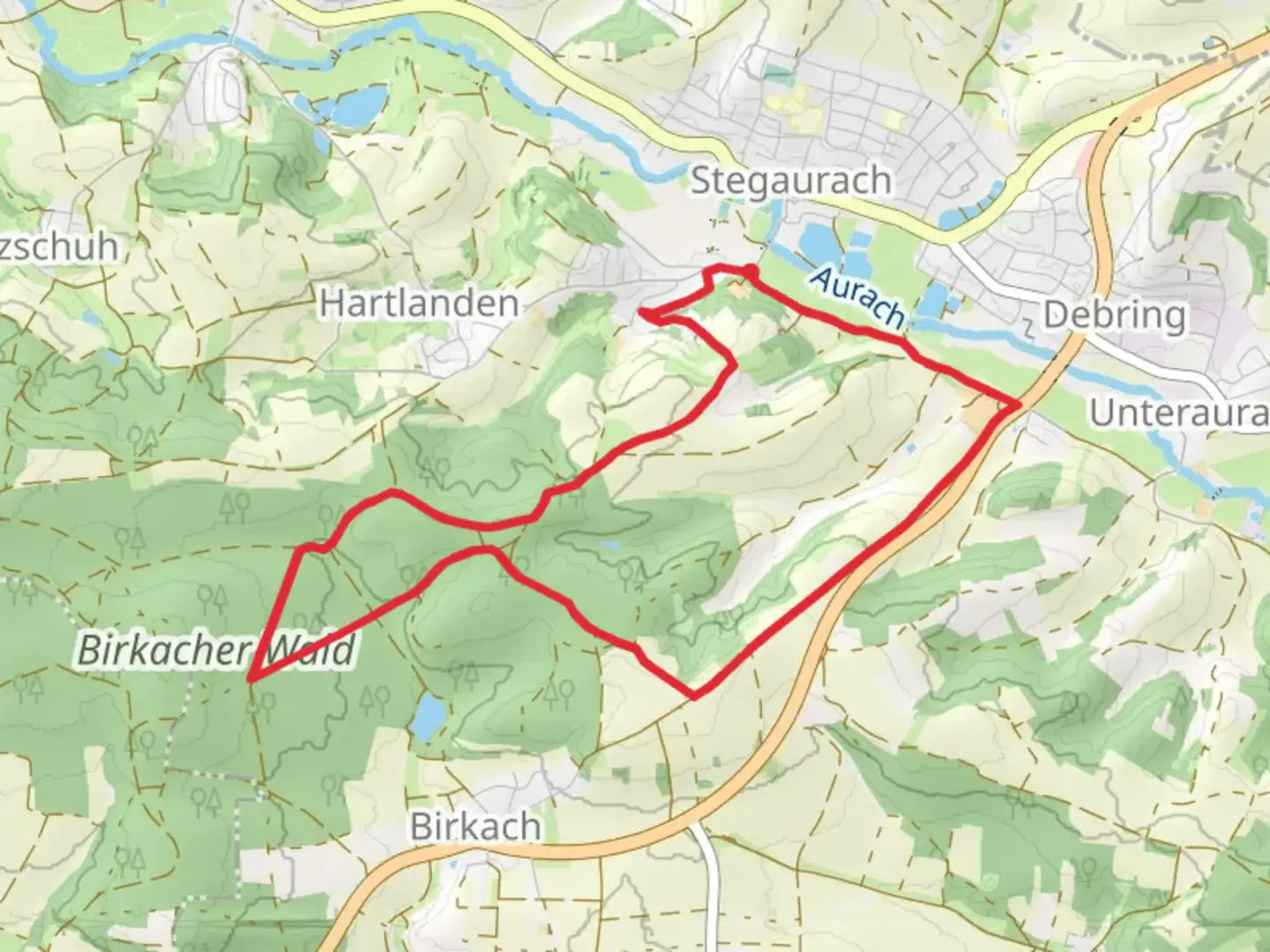
8.6 km
~1 hrs 55 min
126 m
Loop
“The Rundweg Stegaurach is a scenic 9 km loop near Bamberg, blending natural beauty and historical charm.”
Starting near the charming town of Bamberg, Germany, the Rundweg Stegaurach is a delightful loop trail that spans approximately 9 km (5.6 miles) with an elevation gain of around 100 meters (328 feet). This trail offers a moderate challenge, making it suitable for hikers with some experience.
Getting There To reach the trailhead, you can either drive or use public transport. If you're driving, head towards Stegaurach, a small town just southwest of Bamberg. Parking is available near the trailhead. For those using public transport, take a bus from Bamberg to Stegaurach; the journey is short and convenient.
Trail Navigation For navigation, it's highly recommended to use the HiiKER app, which provides detailed maps and real-time updates to ensure you stay on track.
Trail Highlights As you embark on the Rundweg Stegaurach, you'll find yourself immersed in a landscape rich with natural beauty and historical significance. The trail meanders through lush forests, open meadows, and quaint villages, offering a diverse range of scenery.
#### Nature and Wildlife The trail is home to a variety of flora and fauna. In the spring and summer months, you'll encounter vibrant wildflowers and dense greenery. Keep an eye out for local wildlife such as deer, foxes, and a variety of bird species. The forested sections provide a cool, shaded respite, especially during warmer days.
#### Historical Significance The region around Bamberg is steeped in history. As you hike, you'll come across several landmarks that hint at the area's rich past. One notable site is the St. Marien Church in Stegaurach, a beautiful example of local architecture. The church dates back several centuries and offers a glimpse into the region's religious and cultural heritage.
Key Sections of the Trail - **First 3 km (1.9 miles):** The initial part of the trail takes you through dense forest, with a gentle ascent that gradually increases in elevation. This section is particularly serene, with the sounds of rustling leaves and chirping birds accompanying your hike. - **Midpoint (4.5 km / 2.8 miles):** Around the halfway mark, you'll reach an open meadow that offers panoramic views of the surrounding countryside. This is an excellent spot for a short break and some photography. - **Final 2 km (1.2 miles):** The last stretch of the trail loops back towards Stegaurach, passing through a mix of forest and farmland. The descent is gradual, making for a pleasant end to your hike.
Practical Tips - **Footwear:** Given the mixed terrain, sturdy hiking boots are recommended. - **Weather:** Check the weather forecast before you set out, as conditions can change rapidly. - **Supplies:** Carry enough water and snacks, especially if you plan to take breaks along the way. - **Safety:** Always let someone know your hiking plans and estimated return time.
The Rundweg Stegaurach offers a perfect blend of natural beauty and historical intrigue, making it a rewarding experience for any hiker.

Comments and Reviews
User comments, reviews and discussions about the Rundweg Stegaurach, Germany.
average rating out of 5
0 rating(s)