Walchensee and Aussischtsplatz Schluchtenblick Scenic Walk
Download
Preview
Add to list
More
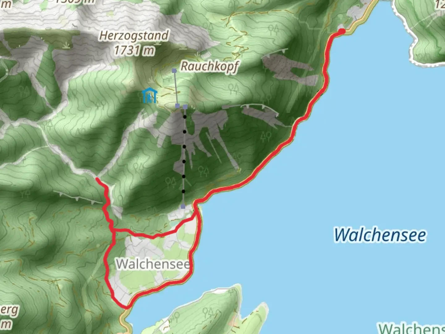
11.4 km
~2 hrs 58 min
417 m
Loop
“Explore lush forests, historic landmarks, and alpine vistas on this rewarding 11-kilometer loop near Walchensee.”
Starting near Bad Tölz-Wolfratshausen in Germany, this scenic loop trail spans approximately 11 kilometers (around 6.8 miles) with an elevation gain of about 400 meters (1,312 feet). The trailhead is easily accessible by car or public transport. If you're driving, you can park near the Walchensee, a picturesque lake that serves as a perfect starting point. For those using public transport, take a train to Kochel am See and then a bus to Walchensee.
Trail Overview
The trail begins with a gentle ascent through lush forests, offering a serene start to your hike. As you climb, you'll encounter a variety of flora, including dense pine and beech trees. The first significant landmark is the Aussichtspunkt Schluchtenblick, a viewpoint that offers breathtaking views of the surrounding valleys and the Walchensee below. This viewpoint is roughly 3 kilometers (1.86 miles) into the hike and sits at an elevation of about 1,000 meters (3,280 feet).
Historical Significance
The region around Walchensee has a rich history. During World War II, the area was used for military training, and remnants of old bunkers can still be found along the trail. Additionally, the Walchensee Power Plant, one of the oldest high-pressure storage power plants in the world, is located nearby. Built in 1924, it’s an engineering marvel worth noting as you hike.
Wildlife and Nature
As you continue, the trail meanders through alpine meadows where you might spot local wildlife such as deer, foxes, and a variety of bird species. The area is also known for its diverse plant life, including rare alpine flowers that bloom in the spring and summer months.
Midway Point
Around the 6-kilometer (3.7 miles) mark, you'll reach the highest point of the trail at approximately 1,200 meters (3,937 feet). Here, the trail opens up to panoramic views of the Bavarian Alps. This is an excellent spot to take a break and enjoy a packed lunch while soaking in the scenery.
Descent and Return
The descent begins gradually, leading you through more forested areas and eventually back towards the lake. The final stretch of the trail runs parallel to the shoreline of Walchensee, offering stunning water views and the opportunity to dip your feet in the lake to cool off.
Navigation and Safety
For navigation, it's highly recommended to use the HiiKER app, which provides detailed maps and real-time updates. The trail is well-marked, but having a reliable navigation tool can enhance your hiking experience and ensure you stay on track.
Getting There
To reach the trailhead, if you're driving, set your GPS to Walchensee, Germany. For public transport users, take a train to Kochel am See and then a bus to Walchensee. The trailhead is a short walk from the bus stop.
This medium-difficulty trail offers a mix of natural beauty, historical landmarks, and opportunities for wildlife spotting, making it a rewarding experience for hikers of all levels.

What to expect?
Activity types
Comments and Reviews
User comments, reviews and discussions about the Walchensee and Aussischtsplatz Schluchtenblick Scenic Walk, Germany.
4.4
average rating out of 5
5 rating(s)