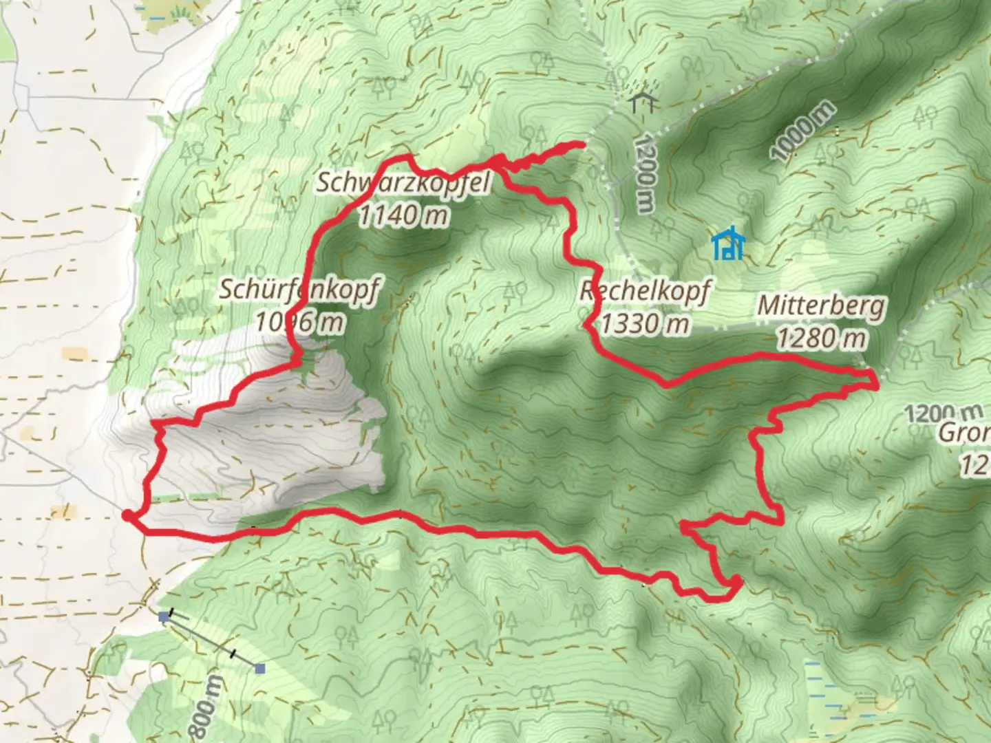
Schürfenkopf and Sulzkopf Peak Loop via Sonntratnsteig
Download
Preview
Add to list
More
14.2 km
~4 hrs 11 min
805 m
Loop
“Embark on a challenging alpine journey through stunning landscapes and historical echoes in the Bavarian Alps.”
Nestled in the picturesque Bavarian Alps, the Schürfenkopf and Sulzkopf Peak Loop via Sonntratnsteig offers a challenging yet rewarding adventure for seasoned hikers. This 14 km (approximately 8.7 miles) loop trail boasts an elevation gain of around 800 meters (about 2,625 feet), making it a demanding trek that promises breathtaking views and a rich tapestry of natural and historical wonders.
Getting There
The trailhead is conveniently located near Bad Tölz-Wolfratshausen, Germany. For those traveling by car, the area is accessible via the A95 motorway, with ample parking available near the trailhead. If you prefer public transport, take a train to Bad Tölz station, followed by a local bus or taxi to the starting point. The region is well-connected, ensuring a smooth journey to the beginning of your hiking adventure.
Trail Highlights
Ascending Schürfenkopf
The journey begins with a steady ascent towards Schürfenkopf, where hikers will traverse through dense forests and lush meadows. The initial 5 km (3.1 miles) of the trail are characterized by a gradual climb, offering glimpses of the surrounding alpine landscape. As you gain elevation, the forest canopy opens up, revealing panoramic views of the Bavarian Alps. Keep an eye out for local wildlife, including deer and various bird species that inhabit this serene environment.
Reaching Sulzkopf Peak
Continuing along the trail, the path becomes steeper as you approach Sulzkopf Peak. This section, approximately 4 km (2.5 miles) from Schürfenkopf, is the most challenging part of the hike, with rocky terrain and narrow paths. Hikers should be prepared for a rigorous climb, but the effort is well worth it. Upon reaching the summit, you'll be rewarded with sweeping vistas of the surrounding peaks and valleys, a perfect spot for a well-deserved rest and photo opportunity.
Navigational Tips
Given the trail's difficulty, it's crucial to be well-prepared with navigation tools. The HiiKER app is an excellent resource for real-time trail maps and updates, ensuring you stay on course throughout your journey. The trail is well-marked, but weather conditions can change rapidly, so always check forecasts and be prepared for sudden shifts.
Historical Significance
The region around Bad Tölz-Wolfratshausen is steeped in history, with roots tracing back to medieval times. The area was once a significant trade route, and remnants of ancient paths can still be found along the trail. As you hike, imagine the footsteps of traders and travelers who once traversed these same routes, contributing to the rich cultural tapestry of the Bavarian Alps.
Descending Back
The descent from Sulzkopf Peak leads you through a series of switchbacks, gradually easing back into the forested areas. This final stretch of the loop, approximately 5 km (3.1 miles), offers a more relaxed pace, allowing hikers to soak in the tranquil beauty of the alpine flora and fauna. As you make your way back to the trailhead, take a moment to reflect on the diverse landscapes and historical echoes that define this remarkable trail.

What to expect?
Activity types
Comments and Reviews
User comments, reviews and discussions about the Schürfenkopf and Sulzkopf Peak Loop via Sonntratnsteig, Germany.
average rating out of 5
0 rating(s)