Download
Preview
Add to list
More
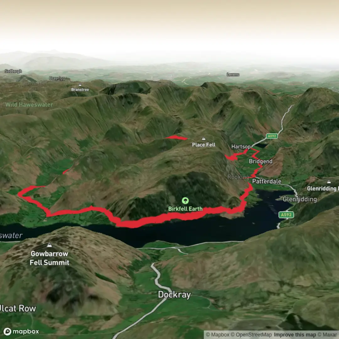
19.4 km
~4 hrs 58 min
661 m
Loop
“From lakeside meadows to airy ridges, this loop dazzles with sweeping views, wildlife, and centuries-old stories.”
Starting from the picturesque village of Glenridding, nestled on the southern shore of Ullswater in the Lake District, this loop hike covers approximately 19 km (about 12 miles) with a total elevation gain of around 700 metres (2,300 feet). Glenridding is easily accessible by car via the A592, with parking available in the village. For those using public transport, regular buses connect Penrith railway station to Glenridding, making it a convenient starting point for visitors arriving by train.
Initial Ascent and Ullswater Views
The route begins with a gentle climb out of Glenridding, quickly offering sweeping views over Ullswater, the second largest lake in the Lake District. Early on, the path skirts the lower slopes of Birkhouse Moor, where the landscape is dotted with ancient dry stone walls and grazing Herdwick sheep, a breed native to the region. The trail soon ascends more steeply, passing through bracken and heather, with occasional glimpses of red squirrels darting through the trees.
Hen How and Dale Head Ridge
After about 6 km (3.7 miles), the trail reaches the Hen How area, a lesser-known but striking upland section. Here, the terrain becomes rockier, and the path undulates along the ridge, offering panoramic views of the Helvellyn range to the west and the rolling fells to the east. The air is often filled with the calls of skylarks and, in spring and summer, the slopes are alive with wildflowers such as bluebells and foxgloves.
Continuing north, the route approaches Dale Head—not to be confused with the more famous Dale Head near Honister Pass. This Dale Head is a prominent local high point, providing a perfect spot for a rest and a chance to take in the dramatic scenery. The summit area is marked by a cairn, and on clear days, the views extend across the Eden Valley and towards the Pennines.
Descent and Historical Features
The descent from Dale Head leads through a landscape shaped by centuries of farming and mining. Old mine workings and spoil heaps are visible in places, remnants of the area’s lead mining heritage dating back to the 18th and 19th centuries. The path winds past tumbling becks and through mixed woodland, where roe deer are sometimes seen at dawn or dusk.
Return to Glenridding
The final section of the loop follows the valley floor, tracing the course of Glenridding Beck. This stretch is relatively flat and easy-going, passing through lush meadows and alongside drystone walls. The route returns to Glenridding, where hikers can enjoy refreshments at one of the village’s cafes or pubs.
Navigation is straightforward for most of the route, but the upland sections can be exposed in poor weather, so carrying a map and compass is recommended. For digital navigation, the entire loop is available on HiiKER, which provides detailed mapping and offline access.
Wildlife enthusiasts should keep an eye out for peregrine falcons and buzzards soaring overhead, while botanists will appreciate the diverse flora, especially in the spring and summer months. The area’s rich history, combined with its natural beauty, makes this loop a rewarding choice for hikers seeking a classic Lake District experience with a mix of lakeside, ridge, and valley walking.

Surfaces
Unknown
Gravel
Asphalt
Ground
Comments and Reviews
User comments, reviews and discussions about the Ullswater, Hen How and Dale Head Loop, England.
average rating out of 5
0 rating(s)