Download
Preview
Add to list
More
15.3 km
~4 hrs 24 min
806 m
Loop
“Embark on a captivating 15 km loop from Cockley Beck, blending historical landmarks, stunning vistas, and moderate challenges.”
Starting your adventure near Westmorland and Furness, England, the Three Shire Stone, Cold Pike, and Long Top Loop - Cockley Beck is a captivating 15 km (approximately 9.3 miles) loop trail with an elevation gain of around 800 meters (about 2,625 feet). This trail offers a medium difficulty rating, making it suitable for moderately experienced hikers.
Getting There
To reach the trailhead, you can drive or use public transport. If driving, head towards Cockley Beck, which is accessible via the A593 from Ambleside or the A595 from the west. For those using public transport, the nearest significant landmark is the town of Ambleside. From Ambleside, you can take a local bus service to the vicinity of Cockley Beck, though services may be infrequent, so planning ahead is essential.
Trail Highlights and Navigation
Starting at the trailhead near Cockley Beck, the initial section of the trail takes you through a picturesque valley, gradually ascending towards the Three Shire Stone. This stone marks the historic meeting point of the old counties of Cumberland, Westmorland, and Lancashire. It's a significant landmark, offering a glimpse into the region's historical boundaries.
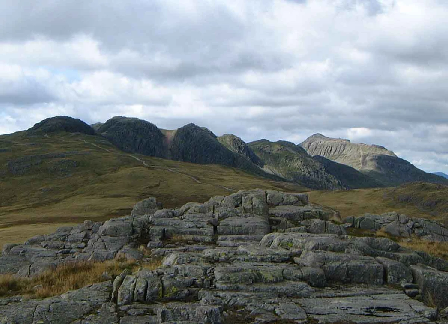
As you continue, the trail ascends towards Cold Pike. This section is characterized by rocky terrain and offers panoramic views of the surrounding fells. The climb to Cold Pike is steady but manageable, with an elevation gain of approximately 400 meters (1,312 feet) over the first 5 km (3.1 miles). Keep an eye out for native wildlife such as red deer and various bird species, including peregrine falcons.
Reaching Long Top
From Cold Pike, the trail leads you towards Long Top, the highest point of the hike. This section involves a more challenging ascent, with rocky outcrops and steeper inclines. The elevation gain from Cold Pike to Long Top is around 200 meters (656 feet) over 3 km (1.9 miles). The summit of Long Top offers breathtaking views of the Lake District, including Scafell Pike and the Langdale Pikes.
Descent and Return
The descent from Long Top back towards Cockley Beck is gradual, allowing you to enjoy the serene landscape. This part of the trail is less strenuous, with a gentle decline over the remaining 7 km (4.3 miles). The path meanders through lush meadows and alongside babbling brooks, providing a peaceful end to your hike.
Historical Significance
The Three Shire Stone is not just a geographical marker but a symbol of the historical division of the counties. This area has been a significant point of interest for centuries, marking the boundaries of ancient lands. The stone itself is a popular spot for history enthusiasts and offers a tangible connection to the past.
Navigation Tools
For navigation, it's highly recommended to use HiiKER, which provides detailed maps and real-time updates to ensure you stay on track. The app is particularly useful in this region, where weather conditions can change rapidly, and clear paths may not always be visible.
Preparation Tips
Given the medium difficulty rating, ensure you are well-prepared with appropriate hiking gear, including sturdy boots, weather-appropriate clothing, and sufficient water and snacks. The trail can be rocky and uneven in places, so trekking poles may be beneficial. Always check the weather forecast before setting out, as conditions in the Lake District can be unpredictable.
This trail offers a blend of historical intrigue, natural beauty, and moderate physical challenge, making it a rewarding experience for those who undertake it.

What to expect?
Activity types
Comments and Reviews
User comments, reviews and discussions about the Three Shire Stone, Cold Pike and Long Top Loop - Cockley Beck, England.
4.57
average rating out of 5
7 rating(s)