Download
Preview
Add to list
More
8.3 km
~2 hrs 13 min
348 m
Loop
“Experience serene riverside paths and invigorating climbs on an 8 km loop through England's Lake District.”
Starting your adventure near Westmorland and Furness, England, the River Rothay and Helm Crag trail is a delightful loop that spans approximately 8 km (5 miles) with an elevation gain of around 300 meters (984 feet). This medium-difficulty hike offers a mix of serene riverside paths and invigorating climbs, making it a perfect choice for those looking to experience the natural beauty and historical richness of the Lake District.
Getting There To reach the trailhead, you can drive or use public transport. If driving, head towards Grasmere, a charming village in the Lake District, where you can find parking options. For those using public transport, the nearest significant landmark is Grasmere, which is well-connected by bus services from nearby towns such as Ambleside and Keswick. The bus stop in Grasmere is just a short walk from the trailhead.
The Trail The journey begins near the River Rothay, where you will follow a picturesque path along the riverbank. This section is relatively flat and offers a gentle start to your hike. As you walk, keep an eye out for local wildlife, including various bird species and perhaps even an otter if you're lucky.
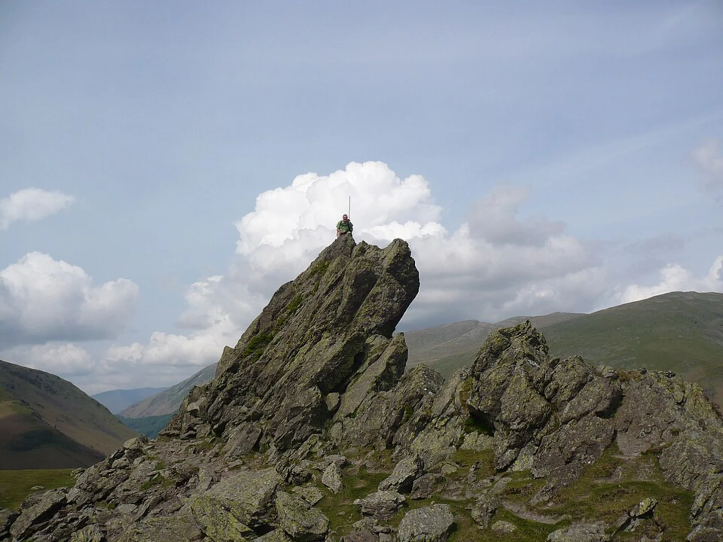
#### Riverside Path to Helm Crag After approximately 2 km (1.2 miles) along the river, the trail starts to ascend towards Helm Crag. This is where the elevation gain becomes more noticeable. The climb is steady but manageable, and the path is well-marked. As you ascend, you'll be treated to stunning views of the surrounding fells and valleys. Helm Crag itself is a notable landmark, often referred to as the "Lion and the Lamb" due to the distinctive rock formations at its summit.
#### Historical Significance Helm Crag holds historical significance, as it has been a source of inspiration for many poets and writers, including William Wordsworth, who lived in the nearby Dove Cottage. The area is steeped in literary history, and you can almost feel the presence of these great minds as you take in the breathtaking scenery.
Summit and Descent Reaching the summit of Helm Crag, you'll find yourself at an elevation of about 405 meters (1,329 feet). The panoramic views from the top are truly spectacular, offering a 360-degree vista of the Lake District's rugged landscape. Take a moment to enjoy the scenery before beginning your descent.
The descent from Helm Crag is a bit steep in places, so take care and watch your footing. The path eventually levels out as you make your way back towards Grasmere. This section of the trail offers a different perspective of the landscape, with lush greenery and the occasional glimpse of local wildlife.
Navigation and Safety For navigation, it's highly recommended to use HiiKER, which provides detailed maps and real-time updates to ensure you stay on track. The trail is generally well-marked, but having a reliable navigation tool can enhance your hiking experience and provide peace of mind.
Final Stretch As you approach the final stretch of the loop, you'll find yourself back near the River Rothay. The gentle riverside path leads you back to the starting point, completing your 8 km (5 miles) journey. This trail offers a perfect blend of natural beauty, historical significance, and a moderate challenge, making it a must-do for any hiking enthusiast visiting the Lake District.

What to expect?
Activity types
Comments and Reviews
User comments, reviews and discussions about the River Rothay and Helm Crag, England.
4.67
average rating out of 5
3 rating(s)